Tula Oblast
Tula Oblast (Russian: Ту́льская о́бласть, Tulskaya oblast) is a federal subject (an oblast) of Russia. It is geographically in the European Russia region of the country and is part of the Central Federal District, covering an area of 25,700 square kilometers (9,900 sq mi) and a population of 1,553,925 (2010).[9][5]
Tula Oblast | |
|---|---|
| Тульская область | |
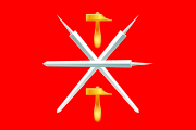 Flag  Coat of arms | |
 | |
| Coordinates: 53°55′N 37°35′E | |
| Country | Russia |
| Federal district | Central[1] |
| Economic region | Central[2] |
| Established | 26 September 1937 |
| Administrative center | Tula |
| Government | |
| • Body | Oblast Duma |
| • Governor | Alexey Dyumin[3] |
| Area | |
| • Total | 25,700 km2 (9,900 sq mi) |
| Area rank | 69th |
| Population (2010 Census)[5] | |
| • Total | 1,553,925 |
| • Estimate (2018)[6] | 1,491,855 (-4%) |
| • Rank | 27th |
| • Density | 60/km2 (160/sq mi) |
| • Urban | 79.4% |
| • Rural | 20.6% |
| Time zone | UTC+3 (MSK |
| ISO 3166 code | RU-TUL |
| License plates | 71 |
| OKTMO ID | 70000000 |
| Official languages | Russian[8] |
| Website | http://www.admportal.tula.ru/ |
Tula is the largest city and the capital of Tula Oblast.
Tula Oblast borders Moscow Oblast in the north, Ryazan Oblast in the east, Lipetsk Oblast in the southeast, Oryol Oblast in the southwest, and Kaluga Oblast in the west. Tula Oblast is one of the most developed and urbanized territories in Russia, and the majority of the territory forms the Tula-Novomoskovsk Agglomeration, an urban area with a population of over 1 million.
History
The Tula Oblast area has been inhabited since the Stone Age, as shown by discoveries of burial mounds (kurgans) and old settlements.[10] By the Eighth Century, these lands were occupied by the Vyatichi, an East Slavic tribe who cultivated the land, traded, and worked at crafts, confirmed by records in property registers which mention an "ancient settlement" located at the confluence of the Upa River and Tulitsa River. The first mention of the city of Tula in 1146 is found in the Nikon Chronicle, in reference to the campaign of Prince Svyatoslav Olgovich of Chernigov. At the time the lands belonged to the Ryazan Principality, and Prince Sviatoslav passed through a number of settlements, including Tula, while heading for Ryazan.[11]
Geography
Tula Oblast is located in Russia's Central Federal District and borders Moscow, Ryazan, Lipetsk, Oryol, and Kaluga Oblasts.
Rivers
Tula Oblast contains more than 1,600 rivers and streams. Major rivers include:
- Don River
- Oka River
- Upa River
Natural resources
The oblast is rich in iron ore, clay, limestone, and deposits of lignite (coal).[12] The lignite deposit is part of the Moscow coal basin.
Climate
Tula Oblast has a moderate continental climate, with warm summers and cold winters. Average January temperature is −10 °C (14 °F) in north and −9 °C (16 °F) in south. Average July temperature is about +19 °C (66 °F) to +20 °C (68 °F). Annual precipitation is 470 millimetres (19 in) in southeast and 575 millimetres (22.6 in) in northwest.
Politics

During the Soviet period, the high authority in the oblast was shared between three persons: The first secretary of the Tula CPSU Committee (who in reality had the biggest authority), the chairman of the oblast Soviet (legislative power), and the Chairman of the oblast Executive Committee (executive power). Since 1991, CPSU lost all the power, and the head of the Oblast administration, and eventually the governor was appointed/elected alongside elected regional parliament.
The Charter of Tula Oblast is the fundamental law of the region. The Tula Oblast Duma is the province's standing legislative (representative) body. The Oblast Duma exercises its authority by passing laws, resolutions, and other legal acts and by supervising the implementation and observance of the laws and other legal acts passed by it. The highest executive body is the Oblast Government, which includes territorial executive bodies such as district administrations, committees, and commissions that facilitate development and run the day to day matters of the province. The Oblast administration supports the activities of the Governor who is the highest official and acts as guarantor of the observance of the oblast Charter in accordance with the Constitution of Russia.
Administrative divisions
Demographics
Population: 1,553,925 (2010 Census);[5] 1,675,758 (2002 Census);[13] 1,867,013 (1989 Census).[14]
Settlements
Ethnic composition (2010):[5]
- Russians - 95.3%
- Ukrainians - 1%
- Armenians - 0.6%
- Tatars - 0.5%
- Azeris - 0.4%
- Romani people - 0.3%
- Belarusians - 0.2%
- Germans - 0.2%
- Others - 1.5%
- 19,778 people were registered from administrative databases, and could not declare an ethnicity. It is estimated that the proportion of ethnicities in this group is the same as that of the declared group.[15]
- 2002 Census population:
- Urban: 1,366,818 (81.6%)
- Rural: 308,940 (18.4%)
- Males: 755,057 (45.1%)
- Females: 920,701 (54.9%)
- Females per 1000 Males: 1219
- Average age : 41.7 years
- Urban : 41.5 years
- Rural : 42.8 years
- Male : 37.8 years
- Female : 44.9 years
- 2012
2009 - 1.31 | 2010 - 1.31 | 2011 - 1.32 | 2012 - 1.43 | 2013 - 1.42 | 2014 - 1.47 | 2015 - 1.57 | 2016 - 1.56(e)
Religion
According to a 2012 survey[18] 62% of the population of Tula Oblast adheres to the Russian Orthodox Church, 2% are unaffiliated generic Christians, 1% are Muslims. In addition, 19% of the population declares to be "spiritual but not religious", 13% is atheist, and 3% follows other religions or did not give an answer to the question.[18]
Economy
Tula Oblast is part of the Central economic region. It is a prominent industrial center with metalworking, engineering, coalmining, and chemical industries.[20] Major industrial cities include Novomoskovsk and Aleksin. Historical industries, such as firearm, samovar, and accordion manufacturing, still play an important role in the region.
The oblast also has a developed agricultural sector, which ranks 33rd in Russia in agricultural production.[11] The sector includes farming grain (wheat and rye), potatoes, sugar beets, and vegetable growing, livestock raising, and dairying.
Culture
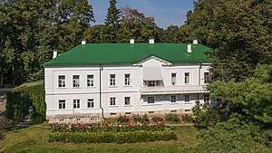
Tula Oblast has as many as 32 museums. Several are located in the administrative center of the oblast, the city of Tula, notably the Tula State Arms Museum, the Tula Kremlin, and the Tula Samovar Museum . Another important cultural tourist attractions is the home and country estate of Leo Tolstoy, Yasnaya Polyana, located 12 km outside of the city of Tula.
The oblast also has four professional theaters, a philharmonic orchestra, and a circus.
Notes and references
- Президент Российской Федерации. Указ №849 от 13 мая 2000 г. «О полномочном представителе Президента Российской Федерации в федеральном округе». Вступил в силу 13 мая 2000 г. Опубликован: "Собрание законодательства РФ", No. 20, ст. 2112, 15 мая 2000 г. (President of the Russian Federation. Decree #849 of May 13, 2000 On the Plenipotentiary Representative of the President of the Russian Federation in a Federal District. Effective as of May 13, 2000.).
- Госстандарт Российской Федерации. №ОК 024-95 27 декабря 1995 г. «Общероссийский классификатор экономических регионов. 2. Экономические районы», в ред. Изменения №5/2001 ОКЭР. (Gosstandart of the Russian Federation. #OK 024-95 December 27, 1995 Russian Classification of Economic Regions. 2. Economic Regions, as amended by the Amendment #5/2001 OKER. ).
- "Путин принял отставку губернатора Тульской области Груздева". Lenta.ru. 2 February 2016.
- Федеральная служба государственной статистики (Federal State Statistics Service) (21 May 2004). "Территория, число районов, населённых пунктов и сельских администраций по субъектам Российской Федерации (Territory, Number of Districts, Inhabited Localities, and Rural Administration by Federal Subjects of the Russian Federation)". Всероссийская перепись населения 2002 года (All-Russia Population Census of 2002) (in Russian). Federal State Statistics Service. Retrieved 1 November 2011.
- Russian Federal State Statistics Service (2011). "Всероссийская перепись населения 2010 года. Том 1" [2010 All-Russian Population Census, vol. 1]. Всероссийская перепись населения 2010 года [2010 All-Russia Population Census] (in Russian). Federal State Statistics Service.
- "26. Численность постоянного населения Российской Федерации по муниципальным образованиям на 1 января 2018 года". Federal State Statistics Service. Retrieved 23 January 2019.
- "Об исчислении времени". Официальный интернет-портал правовой информации (in Russian). 3 June 2011. Retrieved 19 January 2019.
- Official throughout the Russian Federation according to Article 68.1 of the Constitution of Russia.
- http://www.gks.ru/bgd/regl/b11_14t/IssWWW.exe/Stg/centr/tula.htm
- For example, at the Satinskoye settlement site. Yushkova, Maria A. (2012). "Northwestern Russia at the periphery of the north European and Volga-Uralic Bronze Age". In Anfinset, Nils; Wrigglesworth, Melanie (eds.). Local Societies in Bronze Age Northern Europe. London: Equinox (Acumen). pp. 129–147. ISBN 978-1-84553-742-5.
- "Tula Region". Kommersant Moscow. 8 March 2004. Archived from the original on 30 September 2007.
- "Tula Oblast". Merriam-Webster's Geographical Dictionary (2001). Retrieved 31 October 2006.
- Russian Federal State Statistics Service (21 May 2004). "Численность населения России, субъектов Российской Федерации в составе федеральных округов, районов, городских поселений, сельских населённых пунктов – районных центров и сельских населённых пунктов с населением 3 тысячи и более человек" [Population of Russia, Its Federal Districts, Federal Subjects, Districts, Urban Localities, Rural Localities—Administrative Centers, and Rural Localities with Population of Over 3,000] (XLS). Всероссийская перепись населения 2002 года [All-Russia Population Census of 2002] (in Russian).
- "Всесоюзная перепись населения 1989 г. Численность наличного населения союзных и автономных республик, автономных областей и округов, краёв, областей, районов, городских поселений и сёл-райцентров" [All Union Population Census of 1989: Present Population of Union and Autonomous Republics, Autonomous Oblasts and Okrugs, Krais, Oblasts, Districts, Urban Settlements, and Villages Serving as District Administrative Centers]. Всесоюзная перепись населения 1989 года [All-Union Population Census of 1989] (in Russian). Институт демографии Национального исследовательского университета: Высшая школа экономики [Institute of Demography at the National Research University: Higher School of Economics]. 1989 – via Demoscope Weekly.
- http://www.perepis-2010.ru/news/detail.php?ID=6936
- "Том 1. Численность и размещение населения: Итоги ВПН-2010" [Volume 1. Population and population distribution: Results of VPN-2010].
- http://www.gks.ru/wps/wcm/connect/rosstat_main/rosstat/ru/statistics/publications/catalog/doc_1137674209312
- "Arena: Atlas of Religions and Nationalities in Russia". Sreda, 2012.
- 2012 Arena Atlas Religion Maps. "Ogonek", № 34 (5243), 27/08/2012. Retrieved 21/04/2017. Archived.
- "Tula". Encyclopædia Britannica Online. Retrieved 31 October 2006.
External links
| Wikimedia Commons has media related to Tula Oblast. |
Administrative center: Tula • Rural localities | |||
| Administrative districts | |||
| Cities and towns | |||
| Urban-type settlements | |||
| Authority control |
|---|