The Fortress (Alberta)
The Fortress (3,000 m (9,843 ft)) is a mountain located in the Kananaskis River Valley of Kananaskis Park of the Canadian Rockies. When viewed from Highway 40, the north face presents a fortress like appearance. The Fortress should not be confused with nearby Fortress Mountain.
| The Fortress | |
|---|---|
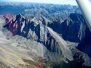 The Fortress (upper center), Mount Chester (right) and Gusty Peak (left and ridge foreground) | |
| Highest point | |
| Elevation | 3,000 m (9,800 ft) [1] |
| Prominence | 287 m (942 ft) [2] |
| Coordinates | 50°49′40″N 115°14′20″W [1] |
| Geography | |
| Parent range | Kananaskis Range Canadian Rockies |
| Topo map | NTS 82J/14 |
| Climbing | |
| Easiest route | Scramble on southwest ridge |


The mountain was originally named Tower Mountain but was changed in 1957 to its current name so as not to be confused with Tower Mountain.[2]
Climbing routes
The southwestern slopes can be scrambled from either the Chester Lake side or Headwall Lakes side. Both routes join at the Chester-Fortress col. From the col, a steep path ascends the remaining 325 m (1,066 ft) to the summit. Only the final section of the summit block requires any real hands on scrambling. The Headwall Lakes approach takes longer but the scree slopes leading to the col are not as loose as the Chester Lake side, which serves as a better descent route.
Climate
Based on the Köppen climate classification, The Fortress is located in a subarctic climate with cold, snowy winters, and mild summers.[3] Temperatures can drop below −20 C with wind chill factors below −30 C.
Photo gallery
 Chester Lake with The Fortress behind
 The Fortress and Gusty Peak
.jpg) The Fortress
The Fortress
References
- "The Fortress". PeakFinder. Retrieved 2005-11-20.
- "The Fortress". Bivouac.com. Retrieved 2009-01-01.
- Peel, M. C.; Finlayson, B. L. & McMahon, T. A. (2007). "Updated world map of the Köppen−Geiger climate classification". Hydrol. Earth Syst. Sci. 11: 1633–1644. ISSN 1027-5606.
External links
- The Fortress weather site: Mountain Forecast