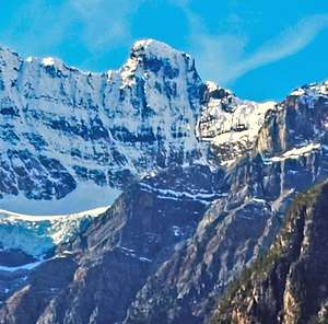
Stairway Peak
Stairway Peak is a 3,006 metres (9,862 ft) mountain summit located on the Continental Divide, on the shared border of Alberta and British Columbia in the Canadian Rockies. It is also on the shared border between Banff National Park and Yoho National Park, and can be seen from the Icefields Parkway. It was named in 1918 by Arthur O. Wheeler.[1][2]
| Stairway Peak | |
|---|---|
 | |
| Highest point | |
| Elevation | 3,006 m (9,862 ft) [1] |
| Prominence | 105 m (344 ft) |
| Coordinates | 51°47′36″N 116°39′22″W |
| Geography | |
 Stairway Peak Location in Alberta and British Columbia  Stairway Peak Stairway Peak (Canada) | |
| Location | Alberta British Columbia |
| Topo map | NTS 82N/15 |
| Climbing | |
| First ascent | 1944 Mr. and Mrs. D.W. Measuroll, J. Monroe Thorington, Edward Feuz jr. |
Geology
Stairway Peak is composed of sedimentary rock laid down during the Precambrian to Jurassic periods. Formed in shallow seas, this sedimentary rock was pushed east and over the top of younger rock during the Laramide orogeny.[3]
Climate
Based on the Köppen climate classification, Stairway Peak is located in a subarctic climate with cold, snowy winters, and mild summers.[4] Temperatures can drop below −20 °C with wind chill factors below −30 °C. Precipitation runoff from the peak drains east to the Mistaya River, or west into tributaries of the Blaeberry River.
See also
- List of peaks on the British Columbia-Alberta border
- Mountains of Alberta
- Mountains of British Columbia
References
- "Stairway Peak". PeakFinder.com. Retrieved 2019-08-20.
- "Stairway Peak". Bivouac.com.
- Gadd, Ben (2008). "Geology of the Rocky Mountains and Columbias". Cite journal requires
|journal=(help) - Peel, M. C.; Finlayson, B. L. & McMahon, T. A. (2007). "Updated world map of the Köppen−Geiger climate classification". Hydrol. Earth Syst. Sci. 11: 1633–1644. ISSN 1027-5606.