Sivrice, Elazığ
Sivrice (Kurdish: Xox),[3] is a town and district of Elazığ Province of Turkey. Sivrice is on the shore of Lake Hazar.
Sivrice | |
|---|---|
 Sivrice in the evening | |
 Sivrice | |
| Coordinates: 38°26′48″N 39°18′42″E | |
| Country | Turkey |
| Province | Elazığ |
| Government | |
| • Mayor | Ebubekir Irmak (AKP) |
| • Kaymakam | Sultan Doğru |
| Area | |
| • District | 647.88 km2 (250.15 sq mi) |
| Elevation | 1,266 m (4,154 ft) |
| Population (2012)[2] | |
| • Urban | 3,961 |
| • District | 8,485 |
| • District density | 13/km2 (34/sq mi) |
| Post code | 23900 |
| Climate | Csa |
| Website | www.sivrice.bel.tr/index.html |
History
Sivrice was attacked numerous times by the Arab armies during the Byzantine era and changed hands a number of times until the Seljuks took the area in 1071. The district came under the control of the İlhanites in 1243, the Mamelukes from 1366, the Akkoyunlu in 1465, and the Safavids from 1507.
The area came under the Ottoman Empire in 1514. The modern town dates only from the early 20th century, when Turkish immigrants from Romania, Yugoslavia and Russia were settled on the Euphrates flood plain between 1933 and 1940.
On 24 January 2020 the town was impacted by a magnitude 6.7 earthquake.[4][5]
Brick, fertilizer and pottery manufacturing are significant parts of the local economy, and beekeeping is common. In 2014 the population was 8857.
Composition
Sivrice district comprises the town of Sivrice and 50 villages; 29 Kurdish or Zaza villages and 21 Turkish villages.[6]
| Settlement[6] | Composition |
|---|---|
| Sivrice town | Kurdish, Muhacir Turkish |
| Akbuğday | Kurdish/Zaza |
| Akseki | Turkish |
| Alaattin | Kurdish/Zaza |
| Alıncık | Turkish |
| Aşağıçanakçı | Kurdish/Zaza |
| Başkaynak | Kurdish/Zaza |
| Bekçitepe | Kurdish/Zaza |
| Canuşağı | Kurdish/Zaza |
| Çatakkaya | Turkish |
| Çevrimtaş | Turkish |
| Çortunlu | Kurdish/Zaza |
| Dedeyolu | Turkish |
| Dereboynu | Kurdish/Zaza |
| Dikmen | Turkish |
| Doğanbağı | Turkish |
| Dörtbölük | Kurdish/Zaza |
| Duygulu | Turkish |
| Elmasuyu | Kurdish/Zaza |
| Gelindere | Kurdish/Zaza |
| Görgülü | Kurdish/Zaza |
| Gözeli | Kurdish/Zaza |
| Günay | Kurdish/Zaza |
| Günbalı | Kurdish/Zaza |
| Hacılar | Turkish |
| Haftasar | Kurdish/Zaza |
| Ilıncak | Turkish |
| Kalaba | Turkish |
| Kamışlık | Kurdish/Zaza |
| Kavak | Kurdish/Zaza |
| Kavallı | Turkish |
| Kayabağları | Turkish |
| Kayapınar | Turkish |
| Kılıçkaya | Turkish |
| Kösebayır | Kurdish/Zaza |
| Kürk | Turkish |
| Mollaali | Kurdish/Zaza |
| Nergize | Kurdish/Zaza |
| Soğukpınar | Kurdish/Zaza |
| Sürek | Kurdish/Zaza |
| Tarlatepe | Kurdish/Zaza |
| Taşlıyayla | Turkish |
| Topaluşağı | Kurdish/Zaza |
| Uslu | Turkish |
| Üçlerce | Kurdish/Zaza |
| Üğrük | Turkish |
| Yaruşağı | Kurdish/Zaza |
| Yedikardeş | Kurdish/Zaza |
| Yedipınar | Kurdish/Zaza |
| Yukarıçanakçı | Kurdish/Zaza |
| Yürekkaya | Turkish |
References
- "Area of regions (including lakes), km²". Regional Statistics Database. Turkish Statistical Institute. 2002. Retrieved 2013-03-05.
- "Population of province/district centers and towns/villages by districts - 2012". Address Based Population Registration System (ABPRS) Database. Turkish Statistical Institute. Retrieved 2013-02-27.
- adem Avcıkıran (2009). Kürtçe Anamnez Anamneza bi Kurmancî (PDF) (in Turkish and Kurdish). p. 56. Retrieved 17 December 2019.
- 6.7 magnitude earthquake 5 km from Doğanyol, Malatya, Turkey.
- Recent Earthquakes Near Doğanyol, Malatya, Turkey .
- Ahmet Buran; Muhammet Kaymaz (1996). "Sivrice yöresi ağızları (İnceleme-metin-sözlük)" (PDF) (in Turkish). Firat University: 13. Retrieved 19 March 2020. Cite journal requires
|journal=(help)
Sivrice, Elazığ in Elâzığ Province of Turkey | |||||||||||||||||||||||||||
|---|---|---|---|---|---|---|---|---|---|---|---|---|---|---|---|---|---|---|---|---|---|---|---|---|---|---|---|
| Districts | 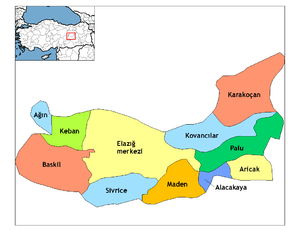 Districts of Elâzığ | ||||||||||||||||||||||||||
| |||||||||||||||||||||||||||
Metropolitan municipalities are bolded. | |||||||||||||||||||||||||||