Si Narong District
Si Narong District (Thai: ศรีณรงค์, pronounced [sǐː nā.rōŋ]) is a district (amphoe) of Surin Province, northeastern Thailand.
Si Narong ศรีณรงค์ | |
|---|---|
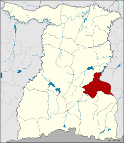 District location in Surin Province | |
| Coordinates: 14°46′1″N 103°52′29″E | |
| Country | Thailand |
| Province | Surin |
| Seat | Narong |
| Area | |
| • Total | 410.0 km2 (158.3 sq mi) |
| Population (2005) | |
| • Total | 46,029 |
| • Density | 112.3/km2 (291/sq mi) |
| Time zone | UTC+7 (ICT) |
| Postal code | 32150 |
| Geocode | 3215 |
History
The minor district (king amphoe) was established on 1 April 1995 with five tambons split from Sangkha District.[1]
On 15 May 2007, all 81 minor districts were upgraded to full districts.[2] On 24 August the upgrade became official.[3]
Geography
Neighboring districts are (from the south clockwise): Sangkha, Lamduan and Sikhoraphum of Surin Province, Prang Ku and Khukhan of Sisaket Province.
Administration
The district is divided into five sub-districts (tambons), which are further subdivided into 62 villages (mubans). There are no municipal (thesaban) areas. There are five tambon administrative organizations (TAO).
| No. | Name | Thai name | Villages | Pop. | |
|---|---|---|---|---|---|
| 1. | Narong | ณรงค์ | 13 | 9,523 | |
| 2. | Chaenwaen | แจนแวน | 11 | 8,952 | |
| 3. | Truat | ตรวจ | 15 | 12,457 | |
| 4. | Nong Waeng | หนองแวง | 11 | 5,795 | |
| 5. | Si Suk | ศรีสุข | 12 | 9,302 |
References
- ประกาศกระทรวงมหาดไทย เรื่อง แบ่งเขตท้องที่อำเภอสังขะ จังหวัดสุรินทร์ ตั้งเป็นกิ่งอำเภอศรีณรงค์ (PDF). Royal Gazette (in Thai). 112 (Special 9 ง): 63. March 22, 1995.
- แถลงผลการประชุม ครม. ประจำวันที่ 15 พ.ค. 2550 (in Thai). Manager Online.
- พระราชกฤษฎีกาตั้งอำเภอฆ้องชัย...และอำเภอเหล่าเสือโก้ก พ.ศ. ๒๕๕๐ (PDF). Royal Gazette (in Thai). 124 (46 ก): 14–21. August 24, 2007.
This article is issued from Wikipedia. The text is licensed under Creative Commons - Attribution - Sharealike. Additional terms may apply for the media files.