Sanom District
Sanom District (Thai: สนม, pronounced [sā.nǒm]) is a district (amphoe) in the northern part of Surin Province, northeastern Thailand.
Sanom สนม | |
|---|---|
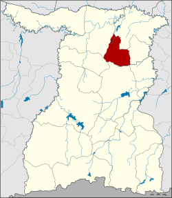 District location in Surin Province | |
| Coordinates: 15°11′56″N 103°45′42″E | |
| Country | Thailand |
| Province | Surin |
| Seat | Sanom |
| Area | |
| • Total | 203.0 km2 (78.4 sq mi) |
| Population (2005) | |
| • Total | 45,268 |
| • Density | 223.0/km2 (578/sq mi) |
| Time zone | UTC+7 (ICT) |
| Postal code | 32160 |
| Geocode | 3208 |
History
The original name of the main town was Ban Nong Sanom (บ้านหนองสนม), which was a village under Mueang Surin. In 1893 it was reassigned to Mueang Rattanaburi, the present-day Rattanaburi District.
The minor district (king amphoe) Sanom was established on 1 July 1971, when the five tambons Sanom, Khaen, Na Nuan, Nong Rakhang, and Phon Ko were split off from Rattanaburi District.[1] It was upgraded to a full district on 12 April 1977.[2]
Geography
Neighboring districts are (from the north clockwise): Rattanaburi, Non Narai, Samrong Thap, Sikhoraphum, Chom Phra and Tha Tum.
Administration
The district is divided into seven sub-districts (tambons), which are further subdivided into 78 villages (mubans). Sanom is a township (thesaban tambon) which covers parts of tambon Sanom. There are a further seven tambon administrative organizations (TAO).
| No. | Name | Thai name | Villages | Pop. | |
|---|---|---|---|---|---|
| 1. | Sanom | สนม | 12 | 9,272 | |
| 2. | Phon Ko | โพนโก | 12 | 7,341 | |
| 3. | Nong Rakhang | หนองระฆัง | 8 | 4,489 | |
| 4. | Na Nuan | นานวน | 13 | 5,989 | |
| 5. | Khaen | แคน | 14 | 9,063 | |
| 6. | Hua Ngua | หัวงัว | 8 | 4,365 | |
| 7. | Nong I Yo | หนองอียอ | 11 | 4,749 |
References
- ประกาศกระทรวงมหาดไทย เรื่อง แบ่งท้องที่อำเภอรัตนบุรี ตั้งเป็นกิ่งอำเภอสนม จังหวัดสุรินทร์ (PDF). Royal Gazette (in Thai). 88 (69 ง): 1864. June 29, 1971.
- พระราชกฤษฎีกาตั้งอำเภอปลายพระยา อำเภอห้วยเม็ก อำเภอละแม อำเภอแม่จริม อำเภอหนองกี่ อำเภอโคกปีบ อำเภอเกาะพะงัน อำเภอสนม อำเภอโซ่พิสัย อำเภอโนนสะอาด และอำเภอนาจะหลวย พ.ศ. ๒๕๒๐ (PDF). Royal Gazette (in Thai). 94 (31 ก): 326–330. April 12, 1977.