Phanom Dong Rak District
Phanom Dong Rak District (Thai: พนมดงรัก, pronounced [pʰā.nōm dōŋ rák]) is the southwesternmost district (amphoe) of Surin Province, northeastern Thailand.
Phanom Dong Rak พนมดงรัก | |
|---|---|
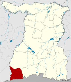 District location in Surin Province | |
| Coordinates: 14°26′44″N 103°18′16″E | |
| Country | Thailand |
| Province | Surin |
| Seat | Bakdai |
| Area | |
| • Total | 318.0 km2 (122.8 sq mi) |
| Population (2005) | |
| • Total | 35,968 |
| • Density | 107.4/km2 (278/sq mi) |
| Time zone | UTC+7 (ICT) |
| Postal code | 32140 |
| Geocode | 3214 |
History
The area was separated from Kap Choeng District and made a minor district (king amphoe) on 1 April 1995.[1]
On 15 May 2007, all 81 minor districts were upgraded to full districts.[2] On 24 August the upgrade became official.[3]
Geography
Neighboring districts are (from the west clockwise): Ban Kruat of Buriram Province; Prasat, Kap Choeng of Surin Province; and Oddar Meancheay of Cambodia.
The district is in the Phanom Dong Rak Range, the hills that form a boundary between Thailand and Cambodia. The name of the district translates as 'Dongrak Mountains'.
Administration
The district is divided into four sub-districts (tambons), which are further subdivided into 55 villages (mubans). There are no municipal (thesaban) areas. There are four tambon administrative organizations (TAO).
| No. | Name | Thai name | Villages | Pop. | |
|---|---|---|---|---|---|
| 1. | Bakdai | บักได | 20 | 11,432 | |
| 2. | Khok Klang | โคกกลาง | 11 | 6,826 | |
| 3. | Chik Daek | จีกแดก | 12 | 7,668 | |
| 4. | Ta Miang | ตาเมียง | 12 | 10,042 |
References
- ประกาศกระทรวงมหาดไทย เรื่อง แบ่งเขตท้องที่อำเภอกาบเชิง จังหวัดสุรินทร์ ตั้งเป็นกิ่งอำเภอพนมดงรัก (PDF). Royal Gazette (in Thai). 112 (Special 9 ง): 55. March 22, 1995.
- แถลงผลการประชุม ครม. ประจำวันที่ 15 พ.ค. 2550 (in Thai). Manager Online.
- พระราชกฤษฎีกาตั้งอำเภอฆ้องชัย...และอำเภอเหล่าเสือโก้ก พ.ศ. ๒๕๕๐ (PDF). Royal Gazette (in Thai). 124 (46 ก): 14–21. August 24, 2007.