Lamduan District
Lamduan District (Thai: ลำดวน, pronounced [lām.dūa̯n]) is a district (amphoe) in the central part of Surin Province, northeastern Thailand.
Lamduan ลำดวน | |
|---|---|
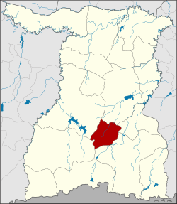 District location in Surin Province | |
| Coordinates: 14°43′38″N 103°40′33″E | |
| Country | Thailand |
| Province | Surin |
| Seat | Lamduan |
| Area | |
| • Total | 301.0 km2 (116.2 sq mi) |
| Population (2005) | |
| • Total | 30,059 |
| • Density | 99.9/km2 (259/sq mi) |
| Time zone | UTC+7 (ICT) |
| Postal code | 32220 |
| Geocode | 3211 |
History
The district dates back to the Mueang Suraphinthanikhom (สุรพินทนิคม), which was established in 1871. In 1896 it was converted into the district Lamduan, which was later dissolved.
On 3 January 1977 it was reestablished as a minor district (king amphoe) by splitting off the two tambons, Lamduan and Chok Nuea, from Sangkha District.[1] It was upgraded to a full district on 19 July 1991.[2]
Geography
Neighboring districts are (from the north clockwise): Sikhoraphum, Si Narong, Sangkha, Prasat and Mueang Surin.
Administration
The district is divided into five sub-districts (tambons), which are further subdivided into 51 villages (mubans). Lamduan Sunphin is a township (thesaban tambon) which covers parts of tambon Lamduan. There are a further five tambon administrative organizations (TAO).
| No. | Name | Thai name | Villages | Pop. | |
|---|---|---|---|---|---|
| 1. | Lamduan | ลำดวน | 11 | 7,791 | |
| 2. | Chok Nuea | โชคเหนือ | 9 | 4,665 | |
| 3. | U Lok | อู่โลก | 11 | 5,386 | |
| 4. | Tram Dom | ตรำดม | 10 | 5,719 | |
| 5. | Tapiang Tia | ตระเปียงเตีย | 10 | 6,498 |
References
- ประกาศกระทรวงมหาดไทย เรื่อง แบ่งท้องที่อำเภอสังขะ จังหวัดสุรินทร์ ตั้งเป็นกิ่งอำเภอลำดวน (PDF). Royal Gazette (in Thai). 94 (6 ง): 190–191. January 18, 1977.
- พระราชกฤษฎีกาตั้งอำเภอทุ่งตะโก อำเภอพะโต๊ะ อำเภอเขาค้อ อำเภอน้ำหนาว อำเภอวังจันทร์ อำเภอนาด้วง อำเภอเต่างอย อำเภอสิงหนคร อำเภอพระสมุทรเจดีย์ และอำเภอลำดวน พ.ศ. ๒๕๓๔ (PDF). Royal Gazette (in Thai). 108 (107 ก Special): 29–33. June 19, 1991.