Sandstone Valley, Calgary
Sandstone Valley is a suburban neighbourhood in northwest Calgary, Alberta, Canada. Located northwest of the community of Beddington Heights, this primarily low-density residential community is bounded by Country Hills Boulevard to the north, Beddington Trail to the east, Berkshire Boulevard to the south and 14th Street W to the west. The Nose Hill Park is located southwest from the community.
Sandstone Valley | |
|---|---|
Neighbourhood | |
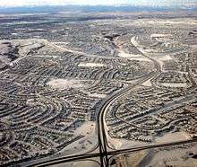
 Sandstone Valley and Nose Hill Park | |
 Sandstone Valley Location of Sandstone Valley in Calgary | |
| Coordinates: 51°08′22″N 114°05′48″W | |
| Country | |
| Province | |
| City | |
| Quadrant | NW |
| Ward | 4 |
| Established | 1982 |
| Government | |
| • Mayor | Naheed Nenshi |
| • Administrative body | Calgary City Council |
| • Councillor | Sean Chu |
| Area | |
| • Total | 1.8 km2 (0.7 sq mi) |
| Elevation | 1,130 m (3,710 ft) |
| Population (2006)[2] | |
| • Total | 6,628 |
| • Average Income | $75,002 |
| Website | Sandstone Valley Community Association |
It is represented in the Calgary City Council by the Ward 4 councillor.
Development of this community began in 1982, and was recently completed.
Demographics
In the City of Calgary's 2012 municipal census, Sandstone Valley had a population of 6,253 living in 2,120 dwellings, a 1.8% increase from its 2011 population of 6,142.[3] With a land area of 1.8 km2 (0.69 sq mi), it had a population density of 3,470/km2 (9,000/sq mi) in 2012.[3][4]
Residents in this community had a median household income of $75,002 in 2000, and there were 13% low income residents living in the neighbourhood.[5] As of 2000, 36.2% of the residents were immigrants. A proportion of 1% of the buildings were condominiums or apartments, and 8.6% of the housing was used for renting.[2]
Education
In 2006, there were two schools in the district:
- Monsignor N. Anderson Elementary - Separate
- Simons Valley Elementary School - Public
See also
References
- "Calgary Elections". City of Calgary. 2017. Retrieved November 12, 2017.
- City of Calgary (2006). "Sandstone Valley Community Statistics" (PDF). Archived from the original (PDF) on 2008-04-11. Retrieved 2007-05-09.
- "2012 Civic Census Results" (PDF). City of Calgary. 2012. Retrieved February 4, 2013.
- "Community Boundaries" (Esri shapefile). City of Calgary. Retrieved February 5, 2013.
- City of Calgary (2004). "Ward 4 Profile" (PDF). Archived from the original (PDF) on 2008-04-11. Retrieved 2007-05-09.
External links
- Calgary Area - Sandstone/MacEwan Community Info
Places adjacent to Sandstone Valley, Calgary | ||||||||||
|---|---|---|---|---|---|---|---|---|---|---|
| ||||||||||