Crescent Heights, Calgary
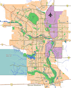
Crescent Heights is an affluent neighbourhood (formerly its own village) spanning the boundary between the northwest and northeast quadrants of Calgary, Alberta. It is located in the inner city, immediately north from Downtown. It is bounded to the north by the Trans-Canada Highway, on the east by Edmonton Trail, on the west by 4th Street NW, and to the south by Memorial Drive and the Bow River.
Crescent Heights | |
|---|---|
Neighbourhood | |
 Crescent Heights Location of Crescent Heights in Calgary | |
| Coordinates: 51°03′48″N 114°03′45″W | |
| Country | |
| Province | |
| City | |
| Quadrant | NE, NW |
| Ward | 7 |
| Established | 1914 |
| Annexed | 1911 |
| Government | |
| • Mayor | Naheed Nenshi |
| • Administrative body | Calgary City Council |
| • Councillor | Druh Farrell |
| Area | |
| • Total | 1.63 km2 (0.63 sq mi) |
| Elevation | 1,080 m (3,540 ft) |
| Population (2006)[3] | |
| • Total | 6,082 |
| • Density | 3,731.3/km2 (9,664/sq mi) |
| • Average Income | $43,123 |
| Website | Crescent Heights Community Association |
Crescent Heights was originally incorporated as a village on May 1, 1908. It was subsequently annexed by the City of Calgary in 1911 and established as a neighbourhood in 1914.
Crescent Heights is represented in the Calgary City Council by the Ward 7 councillor.[1] The community has an area redevelopment plan in place.[4]
The community will be linked to the city’s CTrain rapid-transit system at 9 Avenue North Station once construction of the Green Line is complete in 2026.[5]
History
Crescent Heights was founded in 1895 by Archibald J. McArthur.[6]
Demographics
In the City of Calgary's 2012 municipal census, Crescent Heights had a population of 6,271 living in 3,614 dwellings, a 6.4% increase from its 2011 population of 5,895.[7] With a land area of 1.6 km2 (0.62 sq mi), it had a population density of 3,920/km2 (10,200/sq mi) in 2012.[8][7]
Residents in this community had a median household income of $43,123, and there were 19.7% low income residents living in the neighbourhood.[3] As of 2000, 18.7% of the residents were immigrants. A proportion of 9.5% of the buildings were condominiums or apartments, and 6.8% of the housing was used for renting.
Education
The community (and others) is served by Crescent Heights Senior High public school. Due to a shortage of high schools in northeast Calgary, Crescent Heights had a proportion of students bused in from Abbeydale, Marlborough, Marlborough Park and surrounding areas in the 1980s and 1990s.
References
- "Calgary Elections". City of Calgary. 2017. Retrieved November 12, 2017.
- City of Calgary. "Calgary Snapshots 2011" (PDF). Retrieved 2012-05-02.
- City of Calgary (2006). "Crescent Heights - Community Social Statistics" (PDF). Archived from the original (PDF) on 2008-04-11. Retrieved 2007-05-06.
- City of Calgary Planning (2005). "Crescent Heights Area Redevelopment Plan" (PDF). Archived from the original (PDF) on 2006-10-04. Retrieved 2007-05-11.
- Communications, Customer Service &. "Green Line - Segment 2 :: Green Line Stage One". Engage. Retrieved 2020-05-24.
- "Archibald J. McArthur pioneer profile". Southern Alberta Pioneer. Retrieved 2007-08-01.
- "2012 Civic Census Results" (PDF). City of Calgary. 2012. Retrieved February 4, 2013.
- "Community Boundaries" (Esri shapefile). City of Calgary. Retrieved February 5, 2013.