MacEwan Glen
MacEwan Glen (commonly known as MacEwan) is a suburban neighbourhood in northwest Calgary, Alberta, Canada. The primarily low-density residential community is located directly north of Nose Hill Park and is bounded by Country Hills Boulevard to the north, 14 Street W to the east, Shaganappi Trail to the west, and Nose Hill to the south.
MacEwan Glen | |
|---|---|
Neighbourhood | |
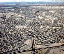 Aerial view of MacEwan Glen and Sandstone Valley in winter | |
 Location of MacEwan Glen in Calgary | |
| Coordinates: 51°08′13″N 114°06′50″W | |
| Country | |
| Province | |
| City | |
| Quarant | NW |
| Ward | 4 |
| Established | 1982 |
| Government | |
| • Mayor | Naheed Nenshi |
| • Administrative body | Calgary City Council |
| • Councillor | Sean Chu |
| Elevation | 1,150 m (3,770 ft) |
| Population (2006)[2] | |
| • Total | 5,372 |
| • Average Income | $74,045 |
| Website | MacEwan Community Association |
Development of the community began in 1982, and was recently completed. It was named for John Walter Grant MacEwan, Calgary mayor and Lieutenant Governor of Alberta. It is represented in the Calgary City Council by the Ward 4 councillor.
Demographics
In the City of Calgary's 2012 municipal census, MacEwan Glen had a population of 5,100 living in 1,781 dwellings, a -0.7% increase from its 2011 population of 5,138.[3] With a land area of 1.4 km2 (0.54 sq mi), it had a population density of 3,640/km2 (9,400/sq mi) in 2012.[3][4]
Residents in this community had a median household income of $74,045 in 2000, and there were 9.7% low income residents living in the neighbourhood.[5] As of 2000, 20.5% of the residents were immigrants. 9.1% of the housing was used for renting.[2]
Education
The community is served by Monsignor N. Anderson Elementary (Catholic) and Simons Valley Elementary public school.
See also
References
- "Calgary Elections". City of Calgary. 2017. Retrieved November 12, 2017.
- City of Calgary (2006). "Macewan Glen Community Statistics" (PDF). Archived from the original (PDF) on 2008-04-11. Retrieved 2007-05-14.
- "2012 Civic Census Results" (PDF). City of Calgary. 2012. Retrieved February 4, 2013.
- "Community Boundaries" (Esri shapefile). City of Calgary. Retrieved February 5, 2013.
- City of Calgary (2004). "Ward 4 Profile" (PDF). Archived from the original (PDF) on 2008-04-11. Retrieved 2007-05-14.
External links
- Sandstone-MacEwan Community News
- Sandstone-MacEwan Community Association
- Calgary Area - Sandstone/MacEwan Community Info
Places adjacent to MacEwan Glen | |
|---|---|