Saint-Aubin-en-Charollais
Saint-Aubin-en-Charollais is a commune in the Saône-et-Loire department in the region of Bourgogne in eastern France.
Saint-Aubin-en-Charollais | |
|---|---|
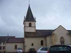 The church in Saint-Aubin-en-Charollais | |
Location of Saint-Aubin-en-Charollais 
| |
 Saint-Aubin-en-Charollais  Saint-Aubin-en-Charollais | |
| Coordinates: 46°29′47″N 4°13′01″E | |
| Country | France |
| Region | Bourgogne-Franche-Comté |
| Department | Saône-et-Loire |
| Arrondissement | Charolles |
| Canton | Charolles |
| Area 1 | 19.61 km2 (7.57 sq mi) |
| Population (2017-01-01)[1] | 472 |
| • Density | 24/km2 (62/sq mi) |
| Time zone | UTC+01:00 (CET) |
| • Summer (DST) | UTC+02:00 (CEST) |
| INSEE/Postal code | 71388 /71430 |
| Elevation | 248–312 m (814–1,024 ft) (avg. 270 m or 890 ft) |
| 1 French Land Register data, which excludes lakes, ponds, glaciers > 1 km2 (0.386 sq mi or 247 acres) and river estuaries. | |
Geography
The Bourbince forms most of the commune's western border.
References
- "Populations légales 2017". INSEE. Retrieved 6 January 2020.
| Wikimedia Commons has media related to Saint-Aubin-en-Charollais. |
| Authority control |
|
|---|
This article is issued from Wikipedia. The text is licensed under Creative Commons - Attribution - Sharealike. Additional terms may apply for the media files.