Bantanges
Bantanges is a commune in the Saône-et-Loire department in the region of Bourgogne in eastern France.
Bantanges | |
|---|---|
 The town hall in Bantanges | |
Location of Bantanges 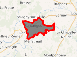
| |
 Bantanges  Bantanges | |
| Coordinates: 46°36′37″N 5°06′45″E | |
| Country | France |
| Region | Bourgogne-Franche-Comté |
| Department | Saône-et-Loire |
| Arrondissement | Louhans |
| Canton | Cuiseaux |
| Intercommunality | Canton of Montpont-en-Bresse |
| Government | |
| • Mayor (2014&2020) | Jean-Michel Reboulet |
| Area 1 | 10.73 km2 (4.14 sq mi) |
| Population (2017-01-01)[1] | 549 |
| • Density | 51/km2 (130/sq mi) |
| Time zone | UTC+01:00 (CET) |
| • Summer (DST) | UTC+02:00 (CEST) |
| INSEE/Postal code | 71018 /71500 |
| Elevation | 175–201 m (574–659 ft) (avg. 200 m or 660 ft) |
| 1 French Land Register data, which excludes lakes, ponds, glaciers > 1 km2 (0.386 sq mi or 247 acres) and river estuaries. | |
Geography
The Seille forms the commune's northwestern border.
The Sâne Morte forms most of the commune's southeastern border.
Population
| Historical population | ||
|---|---|---|
| Year | Pop. | ±% |
| 1793 | 580 | — |
| 1806 | 659 | +13.6% |
| 1821 | 668 | +1.4% |
| 1831 | 700 | +4.8% |
| 1841 | 792 | +13.1% |
| 1851 | 846 | +6.8% |
| 1861 | 857 | +1.3% |
| 1872 | 878 | +2.5% |
| 1881 | 917 | +4.4% |
| 1891 | 981 | +7.0% |
| 1901 | 968 | −1.3% |
| 1911 | 910 | −6.0% |
| 1921 | 832 | −8.6% |
| 1931 | 783 | −5.9% |
| 1946 | 685 | −12.5% |
| 1954 | 670 | −2.2% |
| 1962 | 675 | +0.7% |
| 1968 | 647 | −4.1% |
| 1975 | 574 | −11.3% |
| 1982 | 552 | −3.8% |
| 1990 | 477 | −13.6% |
| 1999 | 446 | −6.5% |
| 2006 | 547 | +22.6% |
| 2012 | 555 | +1.5% |
References
- "Populations légales 2017". INSEE. Retrieved 6 January 2020.
| Wikimedia Commons has media related to Bantanges. |
| Authority control |
|
|---|
This article is issued from Wikipedia. The text is licensed under Creative Commons - Attribution - Sharealike. Additional terms may apply for the media files.