La Chapelle-Saint-Sauveur, Saône-et-Loire
La Chapelle-Saint-Sauveur is a commune in the Saône-et-Loire department in the region of Bourgogne in eastern France. The town is located in the township of Pierre-de-Bresse part of the district of Louhans.[2]
La Chapelle-Saint-Sauveur | |
|---|---|
 The church in La Chapelle-Saint-Sauveur | |
Location of La Chapelle-Saint-Sauveur 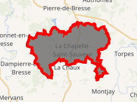
| |
 La Chapelle-Saint-Sauveur  La Chapelle-Saint-Sauveur | |
| Coordinates: 46°50′40″N 5°16′09″E | |
| Country | France |
| Region | Bourgogne-Franche-Comté |
| Department | Saône-et-Loire |
| Arrondissement | Louhans |
| Canton | Pierre-de-Bresse |
| Intercommunality | Pierre-de-Bresse |
| Area 1 | 27.36 km2 (10.56 sq mi) |
| Population (2017-01-01)[1] | 681 |
| • Density | 25/km2 (64/sq mi) |
| Time zone | UTC+01:00 (CET) |
| • Summer (DST) | UTC+02:00 (CEST) |
| INSEE/Postal code | 71093 /71310 |
| Elevation | 184–215 m (604–705 ft) (avg. 215 m or 705 ft) |
| 1 French Land Register data, which excludes lakes, ponds, glaciers > 1 km2 (0.386 sq mi or 247 acres) and river estuaries. | |
References
- "Populations légales 2017". INSEE. Retrieved 6 January 2020.
- "Town of La Chapelle-Saint-Sauveur". mapfrance.com. Retrieved May 14, 2018.
| Wikimedia Commons has media related to La Chapelle-Saint-Sauveur (Saône-et-Loire). |
| Authority control |
|
|---|
This article is issued from Wikipedia. The text is licensed under Creative Commons - Attribution - Sharealike. Additional terms may apply for the media files.