Ribbon Peak
Ribbon Peak is a 2,880-metre (9,450-foot) summit located in Kananaskis Country in the Canadian Rockies of Alberta, Canada. Ribbon's nearest higher peak is Mount Bogart, 1.0 km (0.62 mi) to the southwest.[1] Ribbon Peak is situated four kilometres northwest of Mount Kidd, and both can be seen from Highway 40 near the Kananaskis Village junction along Highway 40.
| Ribbon Peak | |
|---|---|
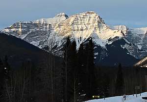
.jpg) Ribbon Peak seen with summit of Mount Bogart directly behind | |
| Highest point | |
| Elevation | 2,880 m (9,450 ft) [1] |
| Prominence | 228 m (748 ft) [1] |
| Parent peak | Mount Bogart (3144 m)[1] |
| Listing | Mountains of Alberta |
| Coordinates | 50°55′09″N 115°13′32″W [1] |
| Geography | |
 Ribbon Peak Location of Ribbon Peak in Alberta  Ribbon Peak Ribbon Peak (Canada) | |
| Location | Alberta, Canada |
| Parent range | Kananaskis Range Canadian Rockies |
| Topo map | NTS 82J/14 |
| Geology | |
| Age of rock | Cambrian |
| Type of rock | Sedimentary |
| Climbing | |
| First ascent | 1957 Crickard, Higgins, Gmoser[1] |
| Easiest route | Scrambling with exposure via south ridge[2] |
History
The first ascent of the peak was made in 1957 by F.W. Crickard, R. Higgins, and Hans Gmoser (guide).[3]
In June 1986, the vicinity was the scene of the first of three related airplane crashes known as the Rescue 807 Crashes. Three lakes on the north aspect of Ribbon Peak were named Memorial Lakes in remembrance of the crash victims.[4]
Geology
Ribbon Peak is composed of sedimentary rock laid down during the Precambrian to Jurassic periods. Formed in shallow seas, this sedimentary rock was pushed east and over the top of younger rock during the Laramide orogeny.[5]
Climate
Based on the Köppen climate classification, Ribbon Peak is located in a subarctic climate with cold, snowy winters, and mild summers.[6] Temperatures can drop below −20 °C with wind chill factors below −30 °C.
The months July through October offer the most favorable weather for viewing or climbing Ribbon Peak.
Precipitation runoff from the mountain drains into Ribbon Creek, thence into the Kananaskis River.
References
- "Ribbon Peak". Bivouac.com. Retrieved 2018-11-26.
- More Scrambles in the Canadian Rockies, 2nd edition, Andrew Nugara, page 293, Rocky Mountain Books, 2014
- Ribbon PeakPeakFinder
- Memorial LakesExplor8ion
- Gadd, Ben (2008). "Geology of the Rocky Mountains and Columbias". Cite journal requires
|journal=(help) - Peel, M. C.; Finlayson, B. L. & McMahon, T. A. (2007). "Updated world map of the Köppen−Geiger climate classification". Hydrol. Earth Syst. Sci. 11: 1633–1644. ISSN 1027-5606.
See also
- Mountains of Alberta
- Geography of Alberta