Red Oak, Texas
Red Oak is a city in Ellis County, Texas, United States. It is part of the Dallas–Fort Worth metroplex. The population was 10,769 at the 2010 census,[3] up from 4,301 at the 2000 census. The North Central Texas Council of Governments projects that number to grow to 63,329 by the year 2030,[4] as it is on the verge of explosive suburban growth. Red Oak was the exterior location for filming True Stories, directed by David Byrne of Talking Heads and released in 1986.
Red Oak, Texas | |
|---|---|
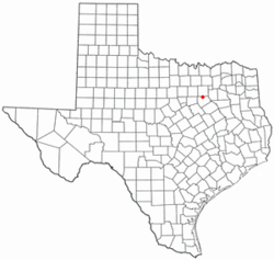 Location in the state of Texas | |
 | |
| Coordinates: 32°31′32″N 96°48′22″W | |
| Country | |
| State | |
| County | Ellis |
| Government | |
| • Type | Council-Manager |
| • City Council | Mayor Dr. Mark Stanfill Scott Lindsey Vacant Vacant Tim Lightfoot Ralph Madden |
| • City Manager Todd Fuller | Albert Lawrence |
| Area | |
| • Total | 15.0 sq mi (38.8 km2) |
| • Land | 15.0 sq mi (38.8 km2) |
| • Water | 0 sq mi (0 km2) |
| Elevation | 607 ft (185 m) |
| Population (2010) | |
| • Total | 10,769 |
| • Density | 719/sq mi (277.8/km2) |
| Time zone | UTC-6 (Central) |
| • Summer (DST) | UTC-5 (Central) |
| ZIP code | 75154 |
| Area code(s) | 972 |
| FIPS code | 48-61196[1] |
| GNIS feature ID | 1344940[2] |
| Website | www |
History
One of the first settlers to this area was James E. Patton and his family in 1844.[5] They settled in what is now known as Ovilla, Texas, located about two miles from Red Oak.[5] Before Red Oak was given its name in 1849, it was known as Possum Trot due to the animal that lived there.[5] The Missouri, Kansas and Texas Railroad began near the Red Oak area in 1884 and was completed in 1890.[5] This railroad allowed people to travel to Dallas and Waco.[5] In 1949, Red Oak became an incorporated town of Ellis, County.[5]
Geography
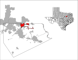
Red Oak is located along the northern edge of Ellis County at 32°31′32″N 96°48′22″W.[6] Adjacent cities are Glenn Heights to the northwest, Lancaster to the north, Ferris to the east, Pecan Hill to the southeast, Waxahachie to the south, and Oak Leaf to the west. It is 18 miles (29 km) south of downtown Dallas via Interstate 35E, which has two exits in Red Oak.
According to the United States Census Bureau, Red Oak has a total area of 15.0 square miles (38.8 km2), all of it land.[3]
Climate
The climate in this area is characterized by hot, humid summers and generally mild to cool winters. According to the Köppen Climate Classification system, Red Oak has a humid subtropical climate, abbreviated "Cfa" on climate maps.[7]

| City Department | Director |
|---|---|
| City Manager | Todd Fuller |
| Community Development | Dean Kennedy |
| City Secretary | Dana Argumaniz, T.R.M.C. |
| Human Resources Director | Rhonda Lawson |
| Fire Chief | Eric Thompson |
| Police Chief | Garland Wolf |
| Court Administrator | Peggy Collins |
| Agriculture Director | Bobby Joe Adamcik |
| Tourism Coordinator | Hank Wright |
Demographics
| Historical population | |||
|---|---|---|---|
| Census | Pop. | %± | |
| 1960 | 415 | — | |
| 1970 | 767 | 84.8% | |
| 1980 | 1,882 | 145.4% | |
| 1990 | 3,124 | 66.0% | |
| 2000 | 4,301 | 37.7% | |
| 2010 | 10,769 | 150.4% | |
| Est. 2019 | 13,464 | [8] | 25.0% |
| U.S. Decennial Census[9] | |||
As of the census[1] of 2000, there were 4,301 people, 1,570 households, and 1,238 families residing in the city. The population density was 550.0 people per square mile (212.4/km2). There were 1,625 housing units at an average density of 207.8 per square mile (80.2/km2). The racial makeup of the city was 85.98% White, 5.42% African American, 0.53% Native American, 0.88% Asian, 4.65% from other races, and 2.53% from two or more races. Hispanic or Latino of any race were 11.69% of the population.
There were 1,570 households out of which 43.9% had children under the age of 18 living with them, 58.5% were married couples living together, 16.6% had a female householder with no husband present, and 21.1% were non-families. 19.0% of all households were made up of individuals and 6.2% had someone living alone who was 65 years of age or older. The average household size was 2.74 and the average family size was 3.10.
In the city, the population was spread out with 30.6% under the age of 18, 8.2% from 18 to 24, 31.4% from 25 to 44, 22.6% from 45 to 64, and 7.3% who were 65 years of age or older. The median age was 33 years. For every 100 females, there were 89.9 males. For every 100 females age 18 and over, there were 87.2 males.
The median income for a household in the city was $48,583, and the median income for a family was $61,250. Males had a median income of $38,227 versus $26,276 for females. The per capita income for the city was $20,049. About 6.3% of families and 6.2% of the population were below the poverty line, including 9.1% of those under age 18 and 5.5% of those age 65 or over.
Education

The city of Red Oak is served by the Red Oak Independent School District: Shields Elementary, Eastridge Elementary, Red Oak Elementary, Wooden Elementary, Russell P Schupmann Elementary, Red Oak Junior High, and Red Oak High School.
In addition Life School, a public charter school, operates the K-12 Red Oak campus.[10]
Texas State Technical College operates a branch campus in Red Oak.
Transportation
Major highways
Air
The city of Red Oak jointly owns the Ferris Red Oak Muni Heliport together with the city of Ferris.[11]
Notable residents
- Pinky Higgins, Major League Baseball player and manager, born in Red Oak
- Louise Ritter, gold medal winner in the women's high jump at the 1988 Summer Olympics, graduated from Red Oak High School[12]
- Michelle Carter, gold medal winner in the women's shot put at the 2016 Summer Olympics in Rio de Janeiro.
- Nikki Stringfield, guitarist for American heavy metal band The Iron Maidens
Geographic location
Places adjacent to Red Oak, Texas | |
|---|---|
References
- "U.S. Census website". United States Census Bureau. Retrieved 2008-01-31.
- "US Board on Geographic Names". United States Geological Survey. 2007-10-25. Retrieved 2008-01-31.
- "Geographic Identifiers: 2010 Census Summary File 1 (G001): Red Oak city, Texas". American Factfinder. U.S. Census Bureau. Archived from the original on February 13, 2020. Retrieved March 25, 2016.
- NCTCOG - Research & Information Services - 2030 Demographic Forecast: Red Oak. (NCTCOG). Retrieved 22 March 2006.
- BROWN, SCOTT (2010-06-15). "RED OAK, TX". tshaonline.org. Retrieved 2019-11-30.
- "US Gazetteer files: 2010, 2000, and 1990". United States Census Bureau. 2011-02-12. Retrieved 2011-04-23.
- Climate Summary for Red Oak, Texas
- "Population and Housing Unit Estimates". Retrieved May 21, 2020.
- "Census of Population and Housing". Census.gov. Retrieved June 4, 2015.
- "Contact Us Archived 2011-09-03 at the Wayback Machine." Life School. Retrieved on September 2, 2011. "950 South I-35E Lancaster, TX 75146"
- FAA Airport Master Record for 12T (Form 5010 PDF). Federal Aviation Administration. Effective 26 April 2018.
- "THE SEOUL OLYMPICS; Last Jump Goes Ritter's Way".
External links
- Red Oak official website
- Red Oak ISD
- Red Oak ISD Education Foundation
- Red Oak ISD Bands
- Handbook of Texas Online - Red Oak, TX
Municipalities and communities of Ellis County, Texas, United States | ||
|---|---|---|
| Cities | 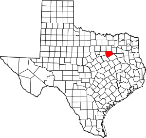 Ellis County map | |
| Towns | ||
| CDP | ||
| Other unincorporated communities | ||
| Footnotes | ‡This populated place also has portions in an adjacent county or counties | |
| Authority control |
|---|