Italy, Texas
Italy (/ˈɪtli/ IT-lee, unlike the country Italy) is a town in Ellis County, Texas, United States. As of the 2010 census, the town had a total population of 1,863,[3] down from 1,993 at the 2000 census.
Italy, Texas | |
|---|---|
.jpg) Downtown Italy, Texas | |
| Motto(s): "The biggest little town in Texas" | |
 Location of Italy, Texas | |
| Coordinates: 32°10′58″N 96°53′6″W | |
| Country | United States |
| State | Texas |
| County | Ellis |
| Area | |
| • Total | 1.8 sq mi (4.7 km2) |
| • Land | 1.8 sq mi (4.7 km2) |
| • Water | 0.0 sq mi (0.0 km2) |
| Elevation | 571 ft (174 m) |
| Population (2010) | |
| • Total | 1,863 |
| • Density | 1,032/sq mi (398.5/km2) |
| Time zone | UTC-6 (Central (CST)) |
| • Summer (DST) | UTC-5 (CDT) |
| ZIP code | 76651 |
| Area code(s) | 214, 469, 972 |
| FIPS code | 48-37072[1] |
| GNIS feature ID | 1338518[2] |
| Website | www |
The community was named after Italy by a settler who had visited the European country.[4]
History
Italy was founded in 1879 by settlers who found the surrounding land suitable for growing cotton, corn, sweet potatoes, and wheat. The Missouri–Kansas–Texas Railroad reached Italy in 1890, with the railroad stop making the town an important market center. The population grew steadily, from 1,061 in 1900 to 1,500 in 1925, until the Great Depression sparked a decline lasting over three decades. The town began to see economic and population growth again in the 1970s, with the population rising to nearly 2,000 residents by the year 2000.[5]
Geography
Italy is located in southwestern Ellis County at 32°10′58″N 96°53′06″W (32.182705, -96.884967).[6] Interstate 35E crosses the northwest corner of the town at Exit 386; it leads north 15 miles (24 km) to Waxahachie, the county seat, north 44 miles (71 km) to downtown Dallas, and southwest 15 miles (24 km) to its junction with I-35W near Hillsboro. U.S. Route 77 passes through the center of Italy and parallels I-35E. Texas State Highway 34 leads northeast from the center of Italy 20 miles (32 km) to Ennis.
According to the United States Census Bureau, Italy has a total area of 1.8 square miles (4.7 km2), all of it land.[3]
Demographics
| Historical population | |||
|---|---|---|---|
| Census | Pop. | %± | |
| 1890 | 370 | — | |
| 1900 | 1,061 | 186.8% | |
| 1910 | 1,149 | 8.3% | |
| 1920 | 1,350 | 17.5% | |
| 1930 | 1,230 | −8.9% | |
| 1940 | 1,224 | −0.5% | |
| 1950 | 1,185 | −3.2% | |
| 1960 | 1,183 | −0.2% | |
| 1970 | 1,309 | 10.7% | |
| 1980 | 1,306 | −0.2% | |
| 1990 | 1,699 | 30.1% | |
| 2000 | 1,993 | 17.3% | |
| 2010 | 1,863 | −6.5% | |
| Est. 2018 | 1,937 | [7] | 4.0% |
| U.S. Decennial Census[8] | |||
As of the census[1] of 2000, there were 1,993 people, 656 households, and 501 families residing in the town. The population density was 1,111.2 people per square mile (429.9/km2). There were 731 housing units at an average density of 407.6 per square mile (157.7/km2). The racial makeup of the town was 74.26% White, 19.72% African American, 0.85% Native American, 0.15% Asian, 3.46% from other races, and 1.56% from two or more races, Hispanic or Latino of any race were 12.64% of the population.
There were 656 households out of which 42.2% had children under the age of 18 living with them, 55.3% were married couples living together, 16.0% had a female householder with no husband present, and 23.5% were non-families. 21.2% of all households were made up of individuals and 11.4% had someone living alone who was 65 years of age or older. The average household size was 2.97 and the average family size was 3.41.
In the town, the population was spread out with 31.8% under the age of 18, 9.7% from 18 to 24, 27.3% from 25 to 44, 18.7% from 45 to 64, and 12.5% who were 65 years of age or older. The median age was 32 years. For every 100 females, there were 89.8 males. For every 100 females age 18 and over, there were 86.6 males.
The median income for a household in the town was $41,853, and the median income for a family was $47,788. Males had a median income of $33,182 versus $24,600 for females. The per capita income for the town was $15,335. About 7.2% of families and 8.9% of the population were below the poverty line, including 10.7% of those under age 18 and 15.6% of those age 65 or over.
Notable people
- Dennis Ransom, former tight end for the NFL Washington Redskins Super Bowl XXVI champions[9]
- Keith Davis, former safety for the Dallas Cowboys
- Dale Evans, actress, wife of Roy Rogers
- Jack Hyles, pastor of First Baptist Church of Hammond, Indiana, 1959-2001, founder of Hyles-Anderson College
- J. B. Milam, Cherokee Nation of Oklahoma
- Art Shires, former first baseman for the Chicago White Sox
Education
The town is served by the Italy Independent School District, which includes Italy High School (Grades 7-12) and Stafford Elementary (Grades PK-6), and the S.M. Dunlap Memorial Library.[10]
In 2009, the school district was rated "academically acceptable" by the Texas Education Agency.[11]
Climate
The climate in this area is characterized by hot, humid summers and generally mild to cool winters. According to the Köppen Climate Classification system, Italy has a humid subtropical climate, abbreviated "Cfa" on climate maps.[12]
References
- "U.S. Census website". United States Census Bureau. Retrieved January 31, 2008.
- "US Board on Geographic Names". United States Geological Survey. October 25, 2007. Retrieved January 31, 2008.
- "Geographic Identifiers: 2010 Census Summary File 1 (G001): Italy town, Texas". American Factfinder. U.S. Census Bureau. Archived from the original on February 13, 2020. Retrieved March 25, 2016.
- Moyer, Armond; Moyer, Winifred (1958). The origins of unusual place-names. Keystone Pub. Associates. p. 70.
- Robert J. Haaser: Italy, TX from the Handbook of Texas Online. Retrieved December 12, 2015.
- "US Gazetteer files: 2010, 2000, and 1990". United States Census Bureau. February 12, 2011. Retrieved April 23, 2011.
- "Population and Housing Unit Estimates". Retrieved May 30, 2019.
- "Census of Population and Housing". Census.gov. Retrieved June 4, 2015.
- Information, Texas A&M Sports. "Texas A&M Connections at the Super Bowl". Retrieved January 22, 2018.
- "Library". The City of Italy, Texas. Retrieved March 4, 2013.
- "2009 Accountability Rating System". Texas Education Agency. Archived from the original on October 25, 2015.
- "Italy, Texas Köppen Climate Classification (Weatherbase)". Weatherbase. Retrieved January 22, 2018.
External links

- City of Italy official website
Municipalities and communities of Ellis County, Texas, United States | ||
|---|---|---|
| Cities | 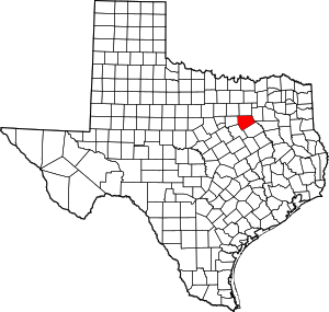 Ellis County map | |
| Towns | ||
| CDP | ||
| Other unincorporated communities | ||
| Footnotes | ‡This populated place also has portions in an adjacent county or counties | |