Qikiqtaryuaq
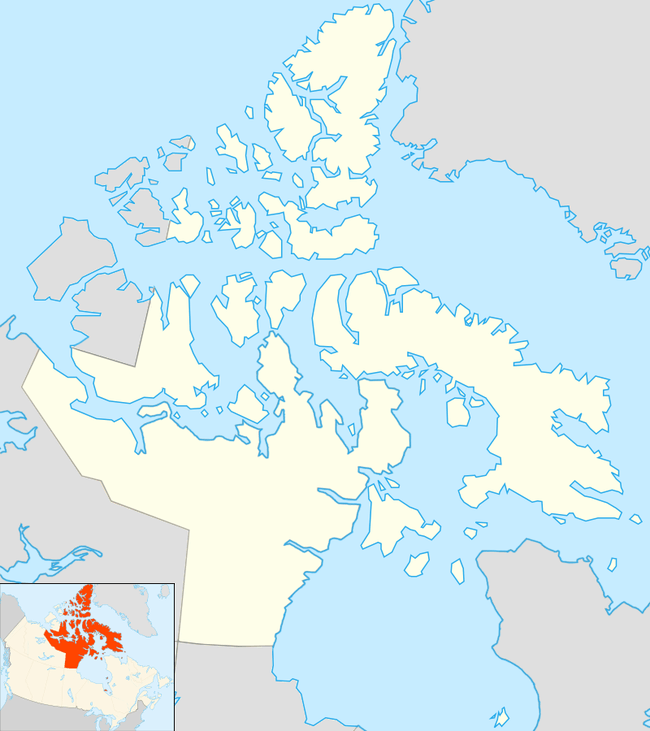
Qikiqtaryuaq formerly Jenny Lind Island,[1] for the Swedish born opera singer, Jenny Lind, is a small island 420 km2 (160 sq mi) in the Kitikmeot Region of Nunavut, Canada. The island is located in the Queen Maud Gulf, about 120 km (75 mi) southeast of Cambridge Bay.
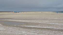 Adventure Canada tourists exploring Jenny Lind Island, 2019 | |
 Qikiqtaryuaq | |
| Geography | |
|---|---|
| Location | Queen Maud Gulf |
| Coordinates | 68°43′17″N 102°02′12″W |
| Archipelago | Arctic Archipelago |
| Area | 420 km2 (160 sq mi) |
| Highest elevation | 80 m (260 ft) |
| Administration | |
Canada | |
| Nunavut | Nunavut |
| Region | Kitikmeot |
| Demographics | |
| Population | Uninhabited |
The island is the site of CAM-1A (Jenny Lind Island), a former Distant Early Warning Line site and home to the unmanned North Warning System site.
Geography
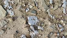
Characteristics of the terrain include rocky ridges, low-lying wetlands, sedge meadows, and a sandy shoreline.
Fauna

Qikiqtaryuaq is a Canadian Important Bird Area (#NU088), and a Key Migratory Terrestrial Bird Site. Notable bird species include Canada goose, lesser snow goose, and Ross's goose.[2]
Muskoxen are found in the south east section of the island.
Climate
| Climate data for Jenny Lind Island Airport (1961-1990) | |||||||||||||
|---|---|---|---|---|---|---|---|---|---|---|---|---|---|
| Month | Jan | Feb | Mar | Apr | May | Jun | Jul | Aug | Sep | Oct | Nov | Dec | Year |
| Record high °C (°F) | −5.1 (22.8) |
−8.8 (16.2) |
−7.8 (18.0) |
2.8 (37.0) |
6.1 (43.0) |
18.3 (64.9) |
22.8 (73.0) |
20.6 (69.1) |
15.0 (59.0) |
6.0 (42.8) |
0.6 (33.1) |
−2.8 (27.0) |
22.8 (73.0) |
| Average high °C (°F) | — | — | −26.1 (−15.0) |
−17.3 (0.9) |
−5.8 (21.6) |
3.2 (37.8) |
9.6 (49.3) |
7.2 (45.0) |
1.0 (33.8) |
−7.5 (18.5) |
−19.2 (−2.6) |
−25.1 (−13.2) |
— |
| Daily mean °C (°F) | — | — | −29.9 (−21.8) |
−21.6 (−6.9) |
−9.3 (15.3) |
0.7 (33.3) |
6.1 (43.0) |
4.5 (40.1) |
−0.9 (30.4) |
−10.4 (13.3) |
−22.7 (−8.9) |
−28.6 (−19.5) |
— |
| Average low °C (°F) | −37.2 (−35.0) |
−37.4 (−35.3) |
−34.6 (−30.3) |
−26.1 (−15.0) |
−13.0 (8.6) |
−1.9 (28.6) |
2.6 (36.7) |
1.7 (35.1) |
−3.0 (26.6) |
−13.6 (7.5) |
−26.7 (−16.1) |
−33.2 (−27.8) |
−18.5 (−1.3) |
| Record low °C (°F) | −51.2 (−60.2) |
−51.2 (−60.2) |
−50.0 (−58.0) |
−43.3 (−45.9) |
−30.6 (−23.1) |
−17.2 (1.0) |
−2.8 (27.0) |
−7.8 (18.0) |
−16.7 (1.9) |
−33.2 (−27.8) |
−42.8 (−45.0) |
−47.2 (−53.0) |
−51.2 (−60.2) |
| Average precipitation mm (inches) | 2.2 (0.09) |
2.4 (0.09) |
2.7 (0.11) |
3.9 (0.15) |
5.9 (0.23) |
10.6 (0.42) |
19.6 (0.77) |
25.9 (1.02) |
18.6 (0.73) |
14.0 (0.55) |
5.5 (0.22) |
3.0 (0.12) |
114.3 (4.50) |
| Source: 1961-1990 Environment Canada [3] | |||||||||||||
History
The island is uninhabited but still has an active North Warning System. Originally part of the Distant Early Warning Line, the site is known as CAM-1.
References
| Wikimedia Commons has media related to Jenny Lind Island. |
- Qikiqtaryuaq (Formerly Jenny Lind Island / Lind Island)
- "Jenny Lind Island". Important Bird and Biodiversity Areas in Canada. Retrieved 2014-01-05.
- Environment Canada—Canadian Climate Normals 1961–1990. Retrieved 22 June 2011.