Oescus
Oescus, Palatiolon[1] or Palatiolum[2] (Bulgarian: Улпия Ескус, pronounced [oɫˈpiɐ ˈɛskos]) was an ancient town along the Danube river, in Moesia, northwest of the modern Bulgarian city of Pleven, near the village of Gigen. It is a Daco-Moesian toponym. Ptolemy calls it a Triballian town, but it later became Roman. For a short time, it was linked by a bridge with the ancient city of Sucidava (modern-day Corabia - Romania).[3] The city seems to have at one point reached a size of 280,000 m²[4] and a population of 100,000.[5]
| Colonia Ulpia Oescensium | |
|---|---|
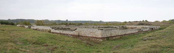
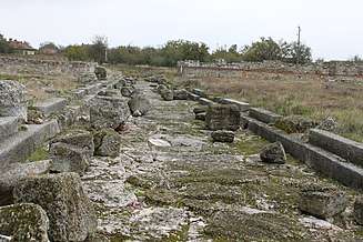
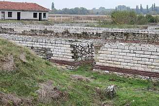 Section of legionary fortress wall, Oescus | |
 | |
| Known also as | Oescus |
| Founded during the reign of | Trajan |
| Founded | 102 |
| Abandoned | 586 |
| Place in the Roman world | |
| Province | Mesia superiore |
| Limes | Danube |
| Stationed military units | |
| — Legions — | |
| Legio V Macedonica da Augusto a Traiano | |
| Location | |
| Coordinates | 43°42′N 24°29′E |
| Town | Gigen |
| County | Gulyantsi Municipality |
| State | Pleven District |
| Country | Bulgaria |

Ancient sources
Ptolemy's Geographia
The Greek geographer Claudius Ptolemy (ca. 90-168 AD) described Ulpia Oescus as a city of the Triballi, an independent Ancient Thracian tribe which inhabited today’s Northwest Bulgaria.[5]
Tabula Peutingeriana
Etymology
The name of the Roman town comes from the river Oescus (today Iskar). It probably meant "water" in the local Thracian dialect.
History
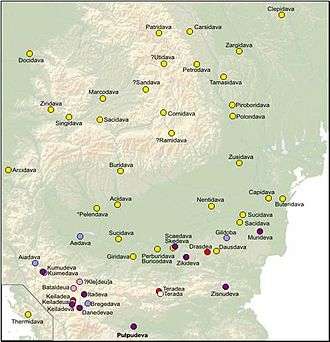
Dacian town
Roman times
Under Roman rule, Oescus was an important settlement and military post, protecting the Danubian Limes road to Trimontium, modern-day Plovdiv.[4] The city was connected to the rest of the Roman empire by three roads:
- Via Egnatia-Danube: Heraclea Lyncestis – Ceramiae – Stobi – Astibos – Tranupara – Pautalia – Aelea – Serdica – Oescus.[6]
- Philippopolis – Oescus: Philippopolis ‐ Viamata (Voynyagovo‐"Gorni Stenici") – Sub Radice (Hristo Danovo) – Montemno (Beklemeto‐"Karcovija Buk") – Ad Radices (Beli Osăm/Kamen Most) – Sostra (Lomec) – Melta (Loveč) – Doriones – Storgosia (Pleven) – Ad Putea (Riben) – Oescus[6]
- The Danube road: Singidunum (Belgrade) – Viminacium (Costolac) – Ratiaria – Oescus – Novae (Steklen by Svistov) – Durostorum (Silistra) – mouth of the Danube River.[7]
The Roman Fifth Macedonian Legion maintained its permanent military encampment at this site from 10 - 101 AD. Remains of the camp's defensive wall are still visible and areas to the east-northeast (Pyasutsite and Prez Livada) show signs of the presence of a necropolis from this period, containing epigraphic monuments of veterans.[4] When the Danube defences were strengthened a second legion Legio IV Scythica was also stationed here until 101 AD.
In 102 Trajan granted the site the status of a colonia.[4] The actual founding occurred in 106 by the settlement of veterans of the VI Macedonica and the Legio I Italica Legions,[7] and the earliest remains of Roman buildings have been dated to this period (106–109 CE).[4] The city was built on top of the legionary fortress. The site received a new name, Colonia Ulpia Oescensium ("Ulpia" after Trajan's middle name, Ulpius).[4]
In 167 Oescus received the unique additional privilege of being granted all Roman rights.
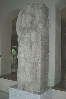
In 190–191 the city dedicated a pagan temple to the goddess Fortuna, who was designated as protector of the city. There also existed a temple of the Capitoline Triad (Jupiter, Juno and Minerva).[4]
The city's economy included manufacturing of jewellery, bronze statuettes bronze brooches and other metal objects and vessels, glass, ceramics (terra sigillata, red slip pottery and other), metal and bone articles. It was also home to one of the largest sculpture workshops in the region.[7]
After 271, the Legio V Macedonica returned, and built a second fortress (Oescus II). An aqueduct was built to deliver fresh water from springs 20 kilometers away, and a stone wall was constructed to protect the site from invaders and from the Danube floods.[4]
On 5 July 328 Emperor Constantine I personally opened and consecrated the Constantines's Bridge,[4] the biggest and most famous stone bridge on the Danube. The crossing linked Oescus with Sucidava to the north and, measuring 2.5 km long (1.3 km over the river) by 5.7 meters wide, was the largest river bridge in ancient times.[5] However, the span was only used for about 27 years; it was destroyed during a barbarian invasion in 355.[5]
In 411, the Huns destroyed Oescus, and in 444 an attempt was made to resettle it as a Hun settlement, named Hunion. Emperor Justinian I rebuilt the city's fortress wall, in an attempt to re-establish Oescus as the stronghold of the Danube defense system, but all the efforts were stopped in late 585 and early 586 by the invasion of the Avars.[5]
Middle Ages
A Bulgarian village existed on the site during the 10th–14th centuries.
Archaeology
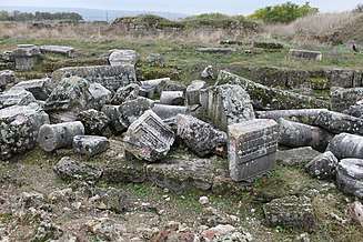
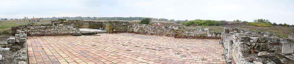
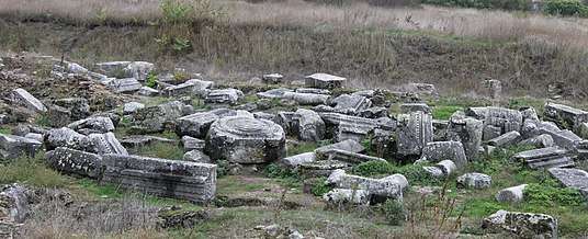
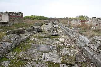
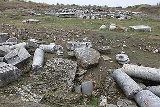
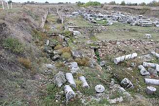
Oescus is one of the biggest and most continuously studied ancient cities of the Lower Danube.[7] Archaeological excavations began at the site in 1904, carried out by Vaclav Dobruski. The fortified city has the shape of an irregular pentagon, with an initial area of 18 hectares; after 271 CE it was extended easterly with a 10 hectare addition.[7] There exists a plan to fully excavate and reconstruct the site, with the goal of providing a complete impression of an ancient Roman commercial, cultural and military center.[4]
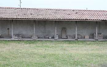
In 1948, the mosaic known popularly as "The Achaeans" (3rd century AD) was discovered. It is currently on display, along with many other of the site's artifacts,[7] at the Pleven Regional Historical Museum.[4] Other artifacts from the site, such as a statue of the goddess Fortuna, are on view at the National Archaeological Museum in Sofia.[4][7]
Archaeological surveys of the eastern extension of Oescus II indicate houses from the Principate period, some of which were quite massive and were decorated with mosaics that could be dated to the time of Septimius Severus.[4]
The ruins indicate the wealth of the Antonine and Severan dynasties.[4] There are a main gate, administrative buildings, a civil basilica, three public baths (thermae), wells, a perfectly preserved road, pagan temples, a necropolis, defensive walls, workshops, and a forum. There also exist ruins of Constantines's Bridge, but they can be seen only from the northern bank of the Danube.[4]
Honours
- Oescus Island in Antarctica is named after Oescus.
Images


References
- Olga Karagiorgou egg.mnir.ro/pdf/Karagiorgou_Container.PDF
- Procopius of Cesarea, De aedificiis: IV, 5, 6; FHDR: II, 463.
- "Constantine's Bridge at Celei". International Database of Structures. Structurae. Retrieved 8 October 2015.
- "Ulpia Oescus Site". panacomp.net. Archived from the original on 23 June 2015. Retrieved 8 October 2015.
- Dikov, Ivan (7 June 2015). "Ancient Thracian and Roman City Ulpia Oescus in Bulgaria's Gigen Deserves Greater Publicity, Archaeologist Says". archaeologyinbulgaria.com. Retrieved 8 October 2015.
- Băjenaru. "Fortificații Minore În Spațiul Balcano‐Dunărean De La Diocletian La Iustinian" (PDF) (in Romanian). Bucharest: Universitatea din București. Archived from the original (PDF) on 5 March 2009.
- Kabakchieva, Gergana. "Cities in the Provinces Moesia Superior and Moesia Inferior". rgzm.de. Römisch-Germanisches Zentralmuseum Archaeological research institute. Archived from the original on 14 February 2016. Retrieved 8 October 2015.
Ancient
- Notitia Dignitatum cca 395-413
- Anonymous (1-4th century AD). Tabula Peutingeriana (in Latin). Check date values in:
|year=(help) - Ptolemy, Claudius (ca. 140 AD). Geographia [Geography] (in Ancient Greek). Sumptibus et typis Caroli Tauchnitii. Check date values in:
|year=(help)
Modern
- Olteanu, Sorin. "Linguae Thraco-Daco-Moesorum - Toponyms Section". Linguae Thraco-Daco-Moesorum (in Romanian and English). Archived from the original on 3 January 2011. Retrieved 3 January 2010.
Further reading
- Brezeanu, Stelian (2004). Dż˝erban Marin, Rudolf Dinu, Ion Bulei and Cristian Luca (eds.). "The Lower Danube Frontier During the 4th-7th Centuries. A Notionďż˝s Ambiguity". Annuario. Bucharest: Istituto Romeno di cultura e ricerca umanistica. 5. Archived from the original on 27 October 2009. Retrieved 8 October 2015.CS1 maint: uses editors parameter (link)
External links
| Wikimedia Commons has media related to Dacia and Dacians. |
| Wikimedia Commons has media related to Colonia Ulpia Oescus. |
Dacia topics | |||||||||||||||||
|---|---|---|---|---|---|---|---|---|---|---|---|---|---|---|---|---|---|
| Tribes | |||||||||||||||||
| Kings | |||||||||||||||||
| |||||||||||||||||
Wars with the Roman Empire |
| ||||||||||||||||
| Roman Dacia |
| ||||||||||||||||
| Research |
| ||||||||||||||||
| |||||||||||||||||