Scythia Minor
Scythia Minor or Lesser Scythia (Greek: Μικρά Σκυθία, romanized: Mikra Skythia) was in ancient times the region surrounded by the Danube at the north and west and the Black Sea at the east, roughly corresponding to today's Dobruja, with a part in Romania, and a part in Bulgaria.
| Provincia Scythia Minor Μικρά Σκυθία | |||||||||
|---|---|---|---|---|---|---|---|---|---|
| Province of Diocese of Thrace, the Byzantine Empire | |||||||||
| c. 293–7th century | |||||||||
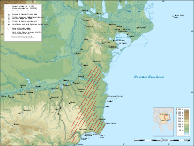 Major towns and colonies in Scythia Minor. Shoreline ca. 1 CE | |||||||||
| Capital | Tomis | ||||||||
| Historical era | Late Antiquity | ||||||||
• division by emperor Diocletian | c. 293 | ||||||||
• fall of the Danubian limes | 7th century | ||||||||
| |||||||||
| Today part of | |||||||||
By the 7th century BC, several Greek colonies were built on its Black Sea shore, and the earliest written Greek reports state that the lands were inhabited by Thracians, reidentified in time as Getae and then Dacians. During later times, the area also witnessed Celtic and Scythian invasions. It was part of the kingdom of Dacia for a period, after which the region was conquered by the Roman Empire, becoming part of the province of Moesia Inferior. With Diocletian's reforms, it was split from Moesia as a separate province of "Scythia", being part of the Diocese of Thrace. After the partition of the Empire in 395, the province was retained by the Byzantine Empire until it was annexed by the Bulgars following the Battle of Ongal.
One of the most famous descriptions of the region is found in Herodotus in the 5th century BC, who identified as Scythia the region starting north of the Danube delta.
In a 2nd-century BC inscription recording a decree of Histria honouring Agathocles, the region already was named Scythia. The earliest usage of the name "Lesser Scythia" (Mikra Skythia) in literature is found in Strabo's at the end of the 1st-century BC Geography.
External links

- Geography (Loeb Classical Library, H. L. Jones translation)
- Biography of Strabo
- The History of Herodotus, at The Internet Classics Archive (translation by George Rawlinson).
Notes
- Dicţionar de istorie veche a României ("Dictionary of ancient Romanian history") (1976) Editura Ştiinţifică şi Enciclopedică, pp. 536–537
- STRATEG. Defensive strategies and cross border policies. Integration of the Lower Danube area in the Roman civilization
| Peoples | 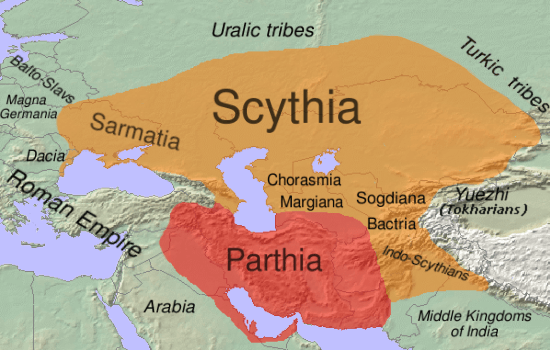 | |
|---|---|---|
| Culture | ||
| Regions | ||
| Related |
| |
Category:Scythia, Category:Populated places in ancient Scythia | ||