Motutunga
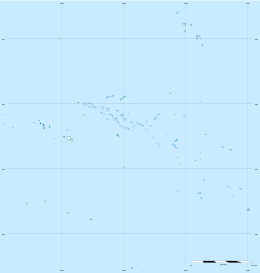
Motutunga Atoll[2] is an atoll of the Tuamotu Archipelago in French Polynesia. It is located 17 km to the east of Tahanea Atoll.
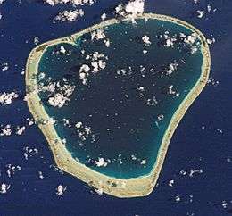 NASA picture of Motutunga Atoll | |
 Motutunga | |
| Geography | |
|---|---|
| Location | Pacific Ocean |
| Coordinates | 17°04′S 144°17′W |
| Archipelago | Tuamotus |
| Area | 126 km2 (49 sq mi) (lagoon) 2.5 km2 (0.97 sq mi) (above water) |
| Length | 15 km (9.3 mi) |
| Width | 14 km (8.7 mi) |
| Administration | |
France | |
| Overseas collectivity | French Polynesia |
| Administrative subdivision | Tuamotus |
| Commune | Anaa |
| Demographics | |
| Population | Uninhabited[1] (2012) |
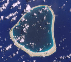
Motutunga Atoll is roughly triangular in shape. It measures 15 km in length with a maximum width of 14 km. The reef fringing the atoll is continuous. There are no deep, navigable passes to reach the lagoon. Motutunga's lagoon has a surface of 126 km².
Motutunga is uninhabited.
History
Motutunga Atoll was first sighted by James Cook on 13 August 1773 who named it Adventure, after the name of his own ship.[2][3]
Spanish navigator Domingo de Boenechea sighted Motutunga on 9 November 1774 on ship Aguila. He named this atoll San Blas[4][5]
Administration
Motutunga belongs to the commune of Anaa that also includes the associated commune of Faaite with the atoll of Faaite and the uninhabited atolls of Tahanea and Motutunga.
See also
- Desert island
- List of islands
References
- "Population". Institut de la statistique de la Polynésie française. Retrieved 9 October 2014.
- Young, J.L. (1899). "Names of the Paumotu Islands, with the old names so far as they are known". Journal of the Polynesian Society. 8 (4): 264–268. Retrieved 7 January 2015.
- Sharp, Andrew, The discovery of the Pacific Islands, Oxford 1960 p.129
- Langdon, Robert. The lost caravel Sidney, 1975 p.129.
- Sharp, Andrew, The discovery of the Pacific Islands, Oxford 1960 p.125
External links
Tuamotus Gambiers | Islands/Atolls | ||
|---|---|---|---|
| Island groups | |||