Eastern Shore (Nova Scotia)
The Eastern Shore is a region of the Canadian province of Nova Scotia. It is the Atlantic coast running northeast from Halifax Harbour to the eastern end of the peninsula at the Strait of Canso.
- For the provincial electoral district, see Eastern Shore (electoral district)
- For the tourism region, see Tourism on the Eastern Shore (Nova Scotia)
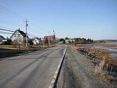
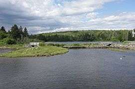
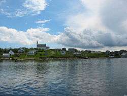
The Eastern Shore is a scenic, yet sparsely settled area, hosting dozens of small fishing harbours and communities; in recent decades the region has become home to a growing number of cottages and recreational properties, given the amount of unspoiled sand beaches and dramatic coastlines. The shore also hosts the majority of Nova Scotia's small islands. The tourism industry is concentrated near popular beaches and provincial parks such as Lawrencetown, Clam Harbour, and Martinique, as well as the centrally-located service communities of Musquodoboit Harbour, Sheet Harbour, Sherbrooke, Canso, Guysborough and Mulgrave. Popular tourist attractions include the Liscombe Lodge resort and conference centre in Liscomb Mills and the Historic Sherbrooke Village in Sherbrooke.[1][2]
The Battle at Jeddore (1722) is one of the many historic events to occur along the shore.
Politically, the Eastern Shore is part of three federal ridings: Cape Breton—Canso in Guysborough, Central Nova in the eastern areas Halifax Regional Municipality, and Sackville—Preston—Chezzetcook at the western end. The provincial ridings include Eastern Shore, Guysborough-Sheet Harbour, as well as several ridings in the eastern part of HRM's urban core (south and east of Dartmouth). In the Halifax Regional Municipality, the Eastern Shore is represented on the Halifax Regional Council as District 1 Eastern Shore - Musquodoboit Valley and District 3 Preston - Lawrencetown - Chezzetcook.
Population
The area between Dartmouth and Cape Breton is sparsely populated.[3]
The decline in the fishing industry has meant an outflow of people to larger urban areas and to other fishing villages in the province.[3] Guysborough and Canso, with populations of 922 and 820 respectively, are the largest communities. There are more than 300 communities along the Eastern Shore, which vary in size.
History
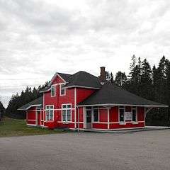
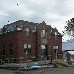
The Eastern Shore is home to numerous historic gold mining areas near Port Dufferin, Tangier, Sherbrooke, and Goldboro, as well as Nova Scotia's most historic seaport, Canso. Canso predates Halifax, Lunenburg and Annapolis Royal as one of North America's earliest settlements. At Sherbrooke, the St. Mary's River empties into the Atlantic and is one of the province's famed Atlantic Salmon runs. Numerous lumber mills operated here during the early 1900s as Nova Scotia entered the 'industrial revolution'. A railway had been proposed during the 1880s to run east from Dartmouth, however the sparse settlement and lack of industrial economic activity saw the railway line swing north up the Musquodoboit River at Musquodoboit Harbour to access the fertile agricultural district of the Musquodoboit Valley. Another railway project was proposed to run between Pictou and the village of Guysborough and on to Canso during 'the age of sail', when Canso rivalled Halifax as the most important first port of call in Nova Scotia for westbound trans-Atlantic vessels, as Canso was roughly the same distance by rail from the New Brunswick–Nova Scotia border as Halifax. A rail line was eventually graded and bridges constructed between Pictou and Guysborough during the 1930s, however, tracks were never laid and the project was abandoned, leaving most of the Eastern Shore without rail service.
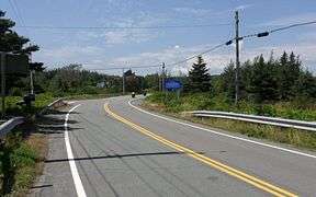
During the post-World War II period, the provincial government upgraded local roads, resulting in the present alignment of Trunk 7. During the 1980s-90s, when the rail line was abandoned, the controlled-access Nova Scotia Highway 107 was built from the Burnside Industrial Park in Dartmouth to Musquodoboit Harbour, to assist commuters and truck traffic travelling to rural HRM and to Hwy. 102 via Hwy. 118.
A 1990s regional development project saw the port of Sheet Harbour redeveloped into an important regional deep-water port. The facility is most heavily used during the winter months, when the Northumberland Strait port of Pictou is iced in and industrial shippers from Pictou County truck shipments to Sheet Harbour. A large wharf, sawmill and industrial greenhouse operation are also located on site.[4] Beaver Harbour was home to a trans-Atlantic cable station which was operated by Teleglobe, but is now decommissioned.[5]
Geography

Most of the Eastern Shore of Nova Scotia consists of sandstone and shale bedrock, forming rolling hills, which are up to 75 metres (246 ft) in elevation and many offshore islands, of which two of the largest are Wolfes Island and Barren Island.[6][7][8] The Eastern Shore is heavily forested. Approximately 12 kilometres (7.5 mi) inland from the coast is the Eastern Shore Granite Ridge. This is an expansive area of 350-million-year-old granite bedrock.[9]
Water bodies
Several major rivers flow into the coast along the Eastern Shore, including the Musquodoboit River,[10] which flows into the Musquodoboit Harbour,[11] Jeddore Harbour,[12] Tangier River,[13] which flows from Tangier Grand Lake to the Atlantic,[14] West River Sheet Harbour, which flows into the Northwest Arm of Sheet Harbour, as well as East River Sheet Harbour into the Northeast Arm.[15][16][17][18] The St. Mary's River also flows into the Atlantic, passing through the community of Sherbrooke.[19] There are many lakes, ponds, flowages and other types of freshwater bodies along the Eastern Shore. The largest of which are Porters Lake,[20] which flows almost directly into the Atlantic Ocean, Lake Charlotte,[21] which flows into Ship Harbour via the Ship Harbour River[22][23] and Tangier Grand Lake,[13] which flows into the Atlantic Ocean via the Tangier River.[14]
The largest water formation by far is the Chedabucto Bay, at the eastern end of the Eastern Shore.[24] There also numerous, albeit much smaller, bays, harbours and other coastal features along the Eastern Shore, including but not limited to: Musquodoboit Harbour,[11] Jeddore Harbour,[12] Ship Harbour,[22] Sheet Harbour,[15][16] Country Harbour,[25] Tor Bay[26] and Guysborough Harbour.[27]
Economy and amenities
Most of the economy along the Eastern Shore is based around fishing, forestry and tourism. There is an industrial port in Sheet Harbour as well.[4]
Tourism
See main page: Tourism on the Eastern Shore (Nova Scotia)
Tourism is becoming an increasingly active industry along the Eastern Shore.
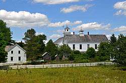
There is a Fisherman's Life Museum in Jeddore Oyster Ponds.[28] There is trout fishing and Atlantic salmon serves as a sport in rivers along the coast. In Eastern Passage, there is a Fishermen's Cove tourist attraction with a few stores.[29] There is an interactive museum located in Sherbrooke, Nova Scotia. It is called the Historic Sherbrooke Village and it depicts life around the 1900s in the village.[1] The longest beaches on the Eastern Shore are Lawrencetown Beach, in Lawrencetown,[30] Martinique Beach, near Musquodoboit Harbour[31] and Taylor Head Beach, located in Spry Bay, within the boundaries of Taylor Head Provincial Park.[32]
Schools
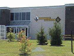
There are nine schools along the Eastern Shore. Most are located in the larger communities. These schools are: Porters Lake Elementary and O'Connell Drive Elementary School, both in Porter's Lake,[33][34] Gaetz Brook Junior High School, in Gaetz Brook,[35] Eastern Shore District High School (ESDH), in Musquodoboit Harbour,[36] Oyster Pond Academy (OPA), in Jeddore Oyster Ponds[37] Lakefront Consolidated School (LCS), in Tangier,[38] Duncan MacMillan High School (DMHS) and Sheet Harbour Consolidated School (SHCS), both in Sheet Harbour[39][40] and Saint Mary's Education Centre/Academy (SMECA), in Sherbrooke.[41]
A new school in Sheet Harbour is currently being built in the former site of Duncan MacMillan High School and Sheet Harbour Consolidated School. It is a merge of the schools Duncan MacMillan High School, Sheet Harbour Consolidated School, Lakefront Consolidated Elementary and Eastern Consolidated School.There is a possibility that both schools in Sheet Harbour, as well as Lakefront Consolidated School in Tangier, will be closed and merged into one P-12 school in the next few years.[42]
Gallery
- Urban Halifax Regional Municipality


- Rural Halifax Regional Municipality


- Guysborough County


References
- "Sherbrooke Village". Nova Scotia Communities, Culture and Heritage. Retrieved 3 February 2016.
- "LISCOMBE LODGE RESORT & CONFERENCE CENTRE". NOVASCOTIA.COM. Retrieved 5 June 2016.
- "Eastern shore Geography". Archived from the original on 2004-02-03. Retrieved 2006-11-04.
- "Port of Sheet Harbour & Industrial Park". Nova Scotia Business Inc. Archived from the original on 2015-09-29. Retrieved 18 August 2015.
- "Business Development". Sheet Harbour Chamber of Commerce. Retrieved 30 May 2015.
- "Wolfes Island". Natural Resources Canada. Retrieved 3 November 2016.
- "Barren Island". Natural Resources Canada. Retrieved 3 November 2016.
- https://novascotia.ca/natr/meb/download/mg/map/htm/map_2000-001.asp
- "Tangier Grand Lake Wilderness Area". Province of Nova Scotia. 31 March 2014. Retrieved 3 February 2016.
- "Musquodoboit River". Natural Resources Canada. Retrieved 5 June 2016.
- "Musquodoboit Harbour". Natural Resources Canada. Retrieved 5 June 2016.
- "Jeddore Harbour". Natural Resources Canada. Retrieved 5 June 2016.
- "Tangier Grand Lake". Natural Resources Canada. Retrieved 5 June 2016.
- "Tangier River". Natural Resources Canada. Retrieved 5 June 2016.
- "Northwest Arm". Natural Resources Canada. Retrieved 5 June 2016.
- "Northeast Arm". Natural Resources Canada. Retrieved 5 June 2016.
- "West River Sheet Harbour". Natural Resources Canada. Retrieved 5 June 2016.
- "East River Sheet Harbour". Natural Resources Canada. Retrieved 5 June 2016.
- "St. Marys River". Natural Resources Canada. Retrieved 5 June 2016.
- "Porters Lake". Natural Resources Canada. Retrieved 5 June 2016.
- "Lake Charlotte". Natural Resources Canada. Retrieved 5 June 2016.
- "Ship Harbour". Natural Resources Canada. Retrieved 5 June 2016.
- "Ship Harbour River". Natural Resources Canada. Retrieved 5 June 2016.
- "Chedabucto Bay". Natural Resources Canada. Retrieved 5 June 2016.
- "Country Harbour". Natural Resources Canada. Retrieved 5 June 2016.
- "Tor Bay". Natural Resources Canada. Retrieved 5 June 2016.
- "Guysborough Harbour". Natural Resources Canada. Retrieved 5 June 2016.
- "Fisherman's Life Museum". Nova Scotia Communities, Culture and Heritage. Retrieved 3 February 2016.
- "Fisherman's Cove". Fisherman's Cove. Retrieved 3 February 2016.
- "LAWRENCETOWN BEACH PROVINCIAL PARK". NOVASCOTIA.COM. Retrieved 3 February 2016.
- "MARTINIQUE BEACH PROVINCIAL PARK". NOVASCOTIA.COM. Retrieved 3 February 2016.
- "Day Use Parks — listed A-Z". Nova Scotia Government. Archived from the original on 2016-01-12. Retrieved 14 November 2015.
- "Porters Lake Elementary". Halifax Regional School Board. Retrieved 8 February 2016.
- "O'Connell Drive Elementary". Halifax Regional School Board. Retrieved 8 February 2016.
- "Gaets Brook Junior High". Halifax Regional School Board. Retrieved 8 February 2016.
- "Eastern Shore District High". Halifax Regional School Board. Retrieved 8 February 2016.
- "Oyster Pond Academy". Halifax Regional School Board. Retrieved 8 February 2016.
- "Lakefront Consolidated Elementary". Halifax Regional School Board. Retrieved 8 February 2016.
- "Duncan MacMillan High". Halifax Regional School Board. Retrieved 8 February 2016.
- "Sheet Harbour Consolidated Elementary". Halifax Regional School Board. Archived from the original on 2016-02-15. Retrieved 8 February 2016.
- "Our School". Saint Mary's Education Centre/Academy. Retrieved 8 November 2015.
- "School Review Committee Response - Sheet Harbour Consolidated Elementary - January 2013" (PDF). Halifax Regional School Board. Retrieved 3 February 2015.
| Government | |||||||
|---|---|---|---|---|---|---|---|
| Services and agencies | |||||||
| Articles of interest | |||||||
| Education |
| ||||||
| Major neighbourhoods & communities |
| ||||||
| |||||||