Little Murray River (Victoria)
The Little Murray River, an anabranch of the Murray River and part of the Murray-Darling basin, is located in the Mallee district of north western Victoria, in eastern Australia.
| Little Murray River | |
|---|---|
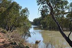 Marraboor River, at Swan Hill | |
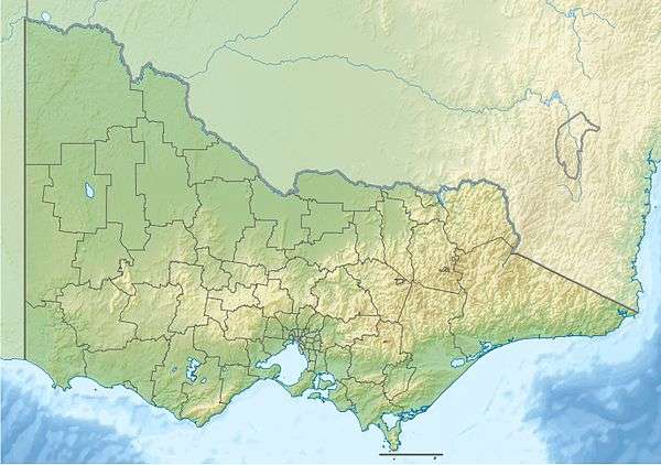 Location of the Little Murray River mouth in Victoria | |
| Native name | Parnimilli[1] |
| Location | |
| Country | Australia |
| State | Victoria |
| Region | Riverina bioregion (IBRA), Mallee |
| LGA | Gannawarra, Swan Hill |
| Physical characteristics | |
| Source | Murray River |
| ⁃ location | near Fish Point |
| ⁃ coordinates | 35°26′48″S 143°48′55″E |
| ⁃ elevation | 85 m (279 ft) |
| Mouth | confluence with the Murray River |
⁃ location | near Swan Hill |
⁃ coordinates | 35°20′35″S 143°33′58″E |
⁃ elevation | 67 m (220 ft) |
| Length | 46 km (29 mi) |
| Basin features | |
| River system | Murray River, Murray–Darling basin |
| Tributaries | |
| ⁃ left | Loddon River |
| Island | Pental Island |
| [2] | |
Location and features
The anabranch leaves the Murray River near Fish Point and flows generally northwest in a highly meandering course, joined by the Loddon River, before it rejoins the Murray near Swan Hill; descending 17 metres (56 ft) over its 46 kilometres (29 mi) course. Little Murray River and the Murray River enclose Pental Island.[2]
The traditional custodians of the land surrounding Little Murray River, the Aboriginal people of the Wemba-Wemba clan, called the river Parnimilli, meaning "little river."[1] Also known as the Marraboor River.[3]
Two bridges cross the river to Pental Island; at Swan Hill in the west, and on Fish Point Road at Fish Point in the east.
References
- "Little Murray River: Historical Information". VicNames. State Government of Victoria. 2011. Archived from the original on 5 April 2013. Retrieved 6 February 2013.
- "Little Murray River". Bonzle Digital Atlas of Australia. Retrieved 6 February 2013.
- Gummow, B. W., 'Native names of places on the lower Murray',