List of historic places in the Greater Vancouver Regional District
The following list includes all of the Canadian Register of Historic Places listings outside of the City of Vancouver, but still within the Greater Vancouver Regional District of British Columbia.[1]
| Name | Address | Coordinates | IDF | IDP | IDM | Image | |
|---|---|---|---|---|---|---|---|
| Aintree | 6825 Cariboo Road, Burnaby, BC | 49°14′56″N 122°54′54″W | 3793 |  More images | |||
| Altese | 3762 Thurston Street, Burnaby, BC | 49°14′04″N 123°01′16″W | 3798 |  | |||
| Altnadene | 6490 Dear Lake Avenue, Burnaby, BC | 49°14′28″N 122°58′08″W | 2355 | 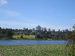 More images | |||
| Anderson Residence | 6450 Deer Lake Avenue, Burnaby, BC | 49°14′25″N 122°58′08″W | 2493 |  More images | |||
| Avalon | 6664 Deer Lake Avenue, Burnaby, BC | 49°14′17″N 122°58′01″W | 2487 |  More images | |||
| Baldwin House | 6543 Deer Lake Drive, Burnaby, BC | 49°13′58″N 122°58′05″W | 2357 |  More images | |||
| Bells Dry Goods Store | 6501 Deer Lake Avenue, Burnaby, BC | 49°14′23″N 122°58′01″W | 2698 |  More images | |||
| Burnaby Civic Employees Union Memorial Fountain | 6501 Deer Lake Avenue, Burnaby, BC | 49°14′24″N 122°58′01″W | 2696 | | |||
| Burnaby South High School Cenotaph and Memorial Tennis Courts | 6650 Southoaks Crescent, Burnaby, BC | 49°13′03″N 122°58′01″W | 2490 | 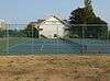 More images | |||
| Central Park Gate | 3883 Imperial Street, Burnaby, BC | 49°13′57″N 123°01′12″W | 2660 |  More images | |||
| Coburn House | 5170 Boundary Road, Burnaby, BC | 49°14′14″N 123°01′23″W | 3802 | | |||
| Cunningham House | 3555 Douglas Road, Burnaby, BC | 49°15′09″N 122°58′59″W | 3794 | | |||
| Deerholme | 6110 Price Street, Burnaby, BC | 49°14′21″N 122°58′26″W | 2489 |  More images | |||
| Drs. Blythe and Violet Eagles Estate | 5655 Sperling Avenue, Burnaby, BC | 49°14′03″N 122°57′58″W | 2358 | | |||
| Edgar Residence | 6450 Deer Lake Drive, Burnaby, BC | 49°13′58″N 122°58′12″W | 2488 |  More images | |||
| Elworth | 6501 Deer Lake Avenue, Burnaby, BC | 49°14′24″N 122°58′05″W | 2697 |  More images | |||
| Fairacres Chauffeur's Cottage | 6344 Deer Lake Avenue, Burnaby, BC | 49°14′28″N 122°58′19″W | 16863 |  More images | |||
| Fairacres Garage and Stables | 6344 Deer Lake Avenue, Burnaby, BC | 49°14′29″N 122°58′19″W | 16864 |  More images | |||
| Fairacres Mansion | 6344 Deer Lake Avenue, Burnaby, BC | 49°14′27″N 122°58′16″W | 2354 |  | |||
| Fairacres Root House | 6344 Deer Lake Avenue, Burnaby, BC | 49°14′27″N 122°58′19″W | 16861 |  More images | |||
| Fairacres Steam Plant | 6344 Deer Lake Avenue, Burnaby, BC | 49°14′25″N 122°58′19″W | 16862 |  More images | |||
| Floden House | 7244 4th Street, Burnaby, BC | 49°13′41″N 122°56′02″W | 3795 |  More images | |||
| Glen-Lyon | 4250 Marine Drive, Burnaby, BC | 49°12′26″N 123°00′32″W | 3804 | | |||
| Glenedward | 5152 Kingsway, Burnaby, BC | 49°13′30″N 122°59′24″W | 3792 |  More images | |||
| Jubilee Grove Arch | 3883 Imperial Street, Burnaby, BC | 49°13′56″N 123°00′47″W | 2359 |  More images | |||
| Kingsway East School | 6650 Southoaks Crescent, Burnaby, BC | 49°13′03″N 122°57′58″W | 2491 |  More images | |||
| Lochdale Community Hall | 490 Sperling Avenue, Burnaby, BC | 49°16′47″N 122°57′50″W | 2356 | | |||
| Love House | 6501 Deer Lake Avenue, Burnaby, BC | 49°14′21″N 122°57′58″W | 2701 | 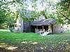 More images | |||
| Mackie House | 6445 Arbroath Street, Burnaby, BC | 49°13′07″N 122°58′08″W | 3790 |  More images | |||
| Morrison House | 3765 Albert Street, Burnaby, BC | 49°16′56″N 123°01′19″W | 3800 | | |||
| North Burnaby Cenotaph | 250 Willingdon Avenue, Burnaby, BC | 49°17′05″N 123°00′00″W | 2492 | 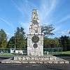 More images | |||
| Overlynn | 3755 McGill Street, Burnaby, BC | 49°17′20″N 123°01′19″W | 3799 | | |||
| Patterson House | 7106 18th Avenue, Burnaby, BC | 49°12′51″N 122°57′18″W | 3797 |  More images | |||
| Seaforth School | 6501 Deer Lake Avenue, Burnaby, BC | 49°14′23″N 122°58′01″W | 2699 | | |||
| Shaw House | 7725 4th Street, Burnaby, BC | 49°13′20″N 122°55′41″W | 3796 | | |||
| Shearer House | 5573 Buckingham Avenue, Burnaby, BC | 49°14′08″N 122°57′36″W | 3791 |  More images | |||
| St. John the Divine Anglican Church | 3891 Kingsway, Burnaby, BC | 49°14′00″N 123°01′05″W | 3803 |  More images | |||
| Thomas Irvine House | 6501 Deer Lake Avenue, Burnaby, BC | 49°14′24″N 122°58′01″W | 2700 | | |||
| Vorce Station | 6501 Deer Lake Avenue, Burnaby, BC | 49°14′25″N 122°58′05″W | 2695 |  More images | |||
| Walker Residence | 5255 Sperling Avenue, Burnaby, BC | 49°14′12″N 122°57′54″W | 2486 |  More images | |||
| Wilson House | 6088 Wilson Avenue, Burnaby, BC | 49°13′45″N 123°00′36″W | 3801 | | |||
| Wintemute House | 7640 Berkley Street, Burnaby, BC | 49°13′45″N 122°56′56″W | 3789 |  More images | |||
| Riverview Hospital | 2601 Lougheed Highway, Coquitlam, BC | 49°15′34″N 122°47′53″W | 11074 | 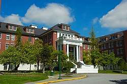 More images | |||
| Alasken-Reifel Shooting Lodge | 5421 Robertson Road, Delta, BC | 49°05′00″N 123°09′00″W | 4379 | | |||
| Alex Fisher Residence | 3691 72 Street, Delta, BC | 49°04′12″N 123°01′48″W | 6357 | | |||
| Alfred Jensen Residence | 11192 River Road, Delta, BC | 49°10′36″N 122°54′47″W | 15289 | | |||
| Arthur Residence and Barn | 6166 34B Avenue, Delta, BC | 49°03′45″N 123°03′07″W | 6368 |  More images | |||
| Asbury/Erskine Farm | 4769 112 Street, Delta, BC | 49°05′19″N 122°54′58″W | 6361 | | |||
| Avondale | 2349 52 Street, Delta, BC | 49°02′35″N 123°05′06″W | 6352 | | |||
| Bank of Montreal | 4896 Delta Street, Delta, BC | 49°05′31″N 123°05′12″W | 6369 | | |||
| Benson Residence | 3610 72 Street, Delta, BC | 49°04′06″N 123°01′23″W | 15258 | | |||
| Bishop Residence | 4388 Arthur Drive, Delta, BC | 49°04′58″N 123°04′41″W | 6356 |  More images | |||
| Black Residence | 3395 41B Street, Delta, BC | 49°03′54″N 123°06′47″W | 6364 | | |||
| Boundary Bay Cemetery | 856 56 Street, Delta, BC | 49°01′05″N 123°03′58″W | 15260 | | |||
| Brackman-Ker Warehouse | 4849 Chisholm Street, Delta, BC | 49°05′31″N 123°05′20″W | 15563 | | |||
| Burrvilla | 6001 River Road, Delta, BC | 49°07′35″N 123°03′29″W | 6340 | | |||
| Cammidge Residence | 550 Boundary Bay Road, Delta, BC | 49°00′54″N 123°02′38″W | 15259 |  More images | |||
| Delta Municipal Hall | 4858 Delta Street, Delta, BC | 49°05′28″N 123°05′10″W | 3669 | | |||
| Ellis Residence | 4826 48 Avenue, Delta, BC | 49°05′24″N 123°05′23″W | 15330 | | |||
| Fawcett Residence | 5058 47A Avenue, Delta, BC | 49°05′07″N 123°04′45″W | 15257 | | |||
| Fawcett Residence | 4532 Arthur Drive, Delta, BC | 49°05′21″N 123°05′00″W | 15328 | | |||
| Flick Residence | 5584 8A Avenue, Delta, BC | 49°01′04″N 123°04′08″W | 6348 | | |||
| Forrer Residence | 4580 Arthur Drive, Delta, BC | 49°05′10″N 123°04′44″W | 6362 | | |||
| Guichon Residence and Barn | 3020 41B Street, Delta, BC | 49°03′24″N 123°06′14″W | 6363 |  More images | |||
| Hangar at Boundary Bay Airport | 4400 72nd Street, Delta, BC | 49°04′49″N 123°00′40″W | 3667 | | |||
| Hodge/Bates Residence, Barn and Outbuildings | 5526 34B Avenue, Delta, BC | 49°03′49″N 123°04′01″W | 6367 |  More images | |||
| Inverholme School | 6001 River Road, Delta, BC | 49°07′36″N 123°03′22″W | 6341 | | |||
| John McKee Residence | 4705 Arthur Drive, Delta, BC | 49°05′19″N 123°04′52″W | 6346 |  More images | |||
| Johnson Residence | 10274 River Road, Delta, BC | 49°09′29″N 122°56′20″W | 15326 | | |||
| Kerr Residence | 3621 Arthur Drive, Delta, BC | 49°04′08″N 123°04′40″W | 15256 | | |||
| Kyte Residence | 4907 Central Avenue, Delta, BC | 49°05′33″N 123°04′48″W | 6349 | | |||
| Ladner Baptist Church | 5008 47A Avenue, Delta, BC | 49°05′20″N 123°05′06″W | 6371 | | |||
| Ladner Clock Tower | 4858 Delta Street, Delta, BC | 49°05′28″N 123°05′10″W | 15287 | | |||
| Lambert Residence | 4671 Arthur Drive, Delta, BC | 49°05′16″N 123°04′48″W | 15332 | | |||
| Lanning, Fawcett & Wilson Ltd. Store | 4907 Chisholm Street, Delta, BC | 49°05′33″N 123°05′17″W | 15263 |  More images | |||
| Mason Residence | 4306 Arthur Drive, Delta, BC | 49°04′53″N 123°04′42″W | 15331 | | |||
| McKenzie Residence | 4994 45 Avenue, Delta, BC | 49°05′06″N 123°05′06″W | 15264 | | |||
| Nels Johnson Residence | 10306 Main Street, Delta, BC | 49°09′24″N 122°56′17″W | 15253 | | |||
| Nesbitt Residence | 10455 River Road, Delta, BC | 49°09′42″N 122°56′02″W | 6360 | | |||
| Nicolich Residence | 4126 River Road West, Delta, BC | 49°05′02″N 123°06′36″W | 6351 | | |||
| Norwegian Cemetery | 8700 Brooke Road, Delta, BC | 49°09′44″N 122°55′26″W | 15254 | | |||
| Olaf Stokkeland Residence | 11096 River Road, Delta, BC | 49°10′23″N 122°54′58″W | 15333 | | |||
| Parmiter Residence | 5331 34B Avenue, Delta, BC | 49°04′02″N 123°04′34″W | 6366 |  More images | |||
| Paterson House | 7234 Ladner Trunk Road, Delta, BC | 49°05′22″N 123°01′23″W | 6342 | | |||
| Rock Pybus Residence and Barn | 3028 53 Street, Delta, BC | 49°03′28″N 123°04′16″W | 6353 | | |||
| Roycroft | 4856 48 Street, Delta, BC | 49°05′24″N 123°05′19″W | 6370 | | |||
| Rupert Fisher Residence | 3865 72 Street, Delta, BC | 49°04′25″N 123°01′48″W | 6350 | | |||
| Scopinich Residence | 4170 River Road West, Delta, BC | 49°05′04″N 123°06′29″W | 15261 | | |||
| Sheldrake Barn | 5734 River Road, Delta, BC | 49°06′24″N 123°03′54″W | 15329 | | |||
| Sherman Residence | 4395 Savoy Street, Delta, BC | 49°05′10″N 123°06′07″W | 6354 |  More images | |||
| St. Mungo Store | 10276 River Road, Delta, BC | 49°09′30″N 122°56′20″W | 15325 | | |||
| St. Stephen's United Church | 9696 Ladner Trunk Road, Delta, BC | 49°05′30″N 122°57′14″W | 3668 | | |||
| Thomas Kerr Residence | 4604 River Road West, Delta, BC | 49°05′18″N 123°05′46″W | 6347 |  More images | |||
| Totem Pole | 4858 Delta Street, Delta, BC | 49°05′28″N 123°05′10″W | 15288 | | |||
| Trinity Norwegian Lutheran Church | 11040 River Road, Delta, BC | 49°10′14″N 122°54′54″W | 15265 | | |||
| Victoria Terminal Railway and Ferry Company Station | 4481 Savoy Street, Delta, BC | 49°05′12″N 123°05′56″W | 6344 |  | |||
| Walter Pybus Residence and Barn | 5300 34B Avenue, Delta, BC | 49°03′52″N 123°04′30″W | 6365 |  More images | |||
| Williamson Residence | 4820 48 Avenue, Delta, BC | 49°05′25″N 123°05′24″W | 15255 | | |||
| Big House | , Langley, BC | 49°10′08″N 122°34′26″W | 4275 | .JPG) More images | |||
| Fort Langley Community Hall | 9167 Glover Crescent, Langley, BC | 49°10′06″N 122°34′48″W | 1862 |  More images | |||
| Fort Langley National Historic Site of Canada | 23433 Mavis Avenue, Langley, BC | 49°10′04″N 122°34′19″W | 7614 | 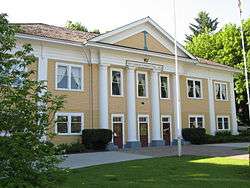 More images | |||
| Harrower House | 21860 Old Yale Road, Langley, BC | 49°05′20″N 122°37′01″W | 1857 | | |||
| Lamb/Stirling House | 21864 Old Yale Road, Langley, BC | 49°05′20″N 122°37′05″W | 1856 | | |||
| Matheson House | 19893 64th Avenue, Langley, BC | 49°07′11″N 122°40′16″W | 1861 |  More images | |||
| Moir Residence | 6840 Glover Road, Langley, BC | 49°07′38″N 122°37′26″W | 1858 | | |||
| Northeast Bastion | , Langley, BC | 49°10′05″N 122°34′08″W | 4273 | 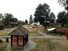 More images | |||
| Redwood Trees | 21600 96th Avenue, Langley, BC | 49°10′36″N 122°37′08″W | 1863 | | |||
| Servants' Quarters | Fort Langley National Historic Site, Langley, BC | 49°10′08″N 122°34′26″W | 4272 |  More images | |||
| Storehouse | 23433 Mavis Street, Langley, BC | 49°10′08″N 122°34′26″W | 2964 |  More images | |||
| Canadian Northern Railway Station | 23245 Mavis Street and Glover Road, Langley District, BC | 49°10′14″N 122°34′41″W | 1845 | 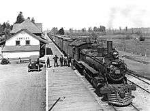 More images | |||
| Lochiel School | 710 204 Street, Langley District, BC | 49°00′54″N 122°39′25″W | 1844 | .jpg) More images | |||
| Sperling Church and Hall | 7206 240th Street, Langley District, BC | 49°08′01″N 122°33′32″W | 1855 | | |||
| Telegraph Trail | 72nd Avenue, Langley District, BC | 49°08′23″N 122°32′42″W | 1860 | | |||
| Traveller's Hotel | 21628 48th Avenue, Langley District, BC | 49°05′20″N 122°37′26″W | 1852 |  More images | |||
| F. J. Hart Building | 3190 271 Street, Langley District, BC | 49°03′35″N 122°28′19″W | 1853 | | |||
| Bank of Montreal | 22355 River Road, Maple Ridge, BC | 49°12′44″N 122°36′11″W | 1909 | | |||
| Byrnes Properties | 26887 and River Road, Maple Ridge, BC | 49°10′24″N 122°28′37″W | 1872 | | |||
| Haney Post Office | 22365 Callighan Street, Maple Ridge, BC | 49°12′49″N 122°36′11″W | 1912 | | |||
| Hill House | 9992 240 Street, Maple Ridge, BC | 49°11′03″N 122°33′22″W | 1911 | | |||
| Leslie Residence | 21695 River Road, Maple Ridge, BC | 49°12′52″N 122°37′12″W | 1878 | | |||
| Manager's House, Port Haney Brick Company | 22520 116 Avenue, Maple Ridge, BC | 49°12′37″N 122°35′49″W | 1906 | | |||
| Maple Ridge Cemetery | 214 Street, Maple Ridge, BC | 49°13′09″N 122°37′41″W | 1907 | | |||
| Masonic Hall | 22272 116th Avenue, Maple Ridge, BC | 49°12′48″N 122°36′18″W | 1877 | | |||
| McFarlane Residence | 11395 205 Street, Maple Ridge, BC | 49°12′34″N 122°39′14″W | 1910 | | |||
| Port Haney Brick Company Office | 22520 116th Avenue, Maple Ridge, BC | 49°12′39″N 122°35′53″W | 1876 | | |||
| Renstrom Residence | 20540 Lorne Avenue, Maple Ridge, BC | 49°12′31″N 122°39′11″W | 1908 | | |||
| St. Andrew's Presbyterian Church | 22279 116 Avenue, Maple Ridge, BC | 49°12′48″N 122°36′18″W | 1875 | 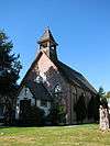 More images | |||
| Sugar Maple Trees | 26721 100 Avenue, Maple Ridge, BC | 49°11′05″N 122°28′55″W | 1873 | 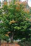 More images | |||
| Whonnock General Store | 26927 River Road, Maple Ridge, BC | 49°10′25″N 122°28′34″W | 1871 |  More images | |||
| Whonnock Post Office | 26915 River Road, Maple Ridge, BC | 49°10′25″N 122°28′37″W | 1870 |  More images | |||
| Blaney Residence | 13074 Harris Road, Pitt Meadows, BC | 49°14′28″N 122°41′13″W | 10254 | | |||
| Hoffman and Son Shop and House | 12265 Harris Road, Pitt Meadows, BC | 49°13′32″N 122°41′24″W | 10248 |  | |||
| McMyn/Masson Residence | 19175 122 Avenue, Pitt Meadows, BC | 49°13′29″N 122°41′28″W | 10252 | | |||
| Park Residence | 19341 Lougheed Highway, Pitt Meadows, BC | 49°13′51″N 122°41′06″W | 10256 | | |||
| Pitt Meadows Community Church | 12109 Harris Road, Pitt Meadows, BC | 49°13′22″N 122°41′24″W | 10251 |  | |||
| Pitt Meadows General Store and Post Office | 12294 Harris Road, Pitt Meadows, BC | 49°13′33″N 122°41′20″W | 10247 |  More images | |||
| Pitt Meadows Municipal Hall | 12460 Harris Road, Pitt Meadows, BC | 49°13′44″N 122°41′20″W | 10249 | ||||
| Pitt Meadows School House | 13414 Harris Road, Pitt Meadows, BC | 49°14′46″N 122°41′20″W | 10250 | | |||
| Struthers Residence | 12229 Harris Road, Pitt Meadows, BC | 49°13′30″N 122°41′24″W | 10253 | | |||
| von Alvensleben Residence | 14776 Harris Road, Pitt Meadows, BC | 49°16′13″N 122°41′17″W | 10255 | | |||
| Melissa Park Lodge | 2175 Mary Hill Road, Port Coquitlam, BC | 49°15′21″N 122°46′43″W | 20334 | | |||
| 2628 St. George Street | 2628 St. George Street (south part of lot), Port Moody, BC | 49°16′32″N 122°51′10″W | 19429 | | |||
| Alexander Residence | 2628 St. George Street (north part of lot), Port Moody, BC | 49°16′33″N 122°51′10″W | 17844 | | |||
| Appleyard Residence | 126 Kyle Street, Port Moody, BC | 49°16′33″N 122°51′23″W | 2584 | | |||
| Barnum Residence | 2625 St. George Street, Port Moody, BC | 49°16′31″N 122°51′11″W | 11814 | | |||
| BC Telephone Company Exchange | 2317 Clarke Street, Port Moody, BC | 49°16′39″N 122°51′36″W | 7664 | | |||
| Belcarra South Cottages | Belcarra Provincial Park, Port Moody, BC | 49°18′37″N 122°55′39″W | 21175 | | |||
| Belton Residence | 300 Second Avenue, Port Moody, BC | 49°18′16″N 122°52′30″W | 18532 | | |||
| Bole House | Belcarra Bay Road, Port Moody, BC | 49°18′32″N 122°55′41″W | 2585 | | |||
| Brelsford Residence | 2713 Jane Street, Port Moody, BC | 49°16′26″N 122°51′04″W | 7669 | | |||
| C.P. Lumber Co. Residence | 2226 Clarke Street, Port Moody, BC | 49°16′40″N 122°51′40″W | 2565 | | |||
| Campbell Residence | 2209 St. George Street, Port Moody, BC | 49°16′31″N 122°51′47″W | 10356 | | |||
| Carr Residence | 2605 St. George Street, Port Moody, BC | 49°16′33″N 122°51′15″W | 19428 | | |||
| Chivers Residence | 306 First Avenue, Port Moody, BC | 49°18′19″N 122°52′26″W | 18531 | | |||
| Clarke Residence | 207 Second Street, Port Moody, BC | 49°18′16″N 122°52′28″W | 18533 | | |||
| Clement Elsdon Residence | 2221 St. George Street, Port Moody, BC | 49°16′31″N 122°51′47″W | 10357 | | |||
| CPR Railway Station | 2734 Murray Street, Port Moody, BC | 49°16′45″N 122°51′04″W | 2562 | | |||
| Davis Residence | 306 Second Avenue, Port Moody, BC | 49°18′18″N 122°52′30″W | 18571 | | |||
| Dr. Cartwright Residence | 2214 St. George Street, Port Moody, BC | 49°16′33″N 122°51′47″W | 7668 | | |||
| Elsdon Residence | 2225 St. George Street, Port Moody, BC | 49°16′31″N 122°51′43″W | 11813 | | |||
| Etter's Beauty Salon and Barber Shop | 2335 Clarke Street, Port Moody, BC | 49°16′39″N 122°51′32″W | 7598 | | |||
| Gilfillan Residence | 2 Dowding Road, Port Moody, BC | 49°17′27″N 122°50′35″W | 7666 | | |||
| Griffin Residence | 2714 Henry Street, Port Moody, BC | 49°16′30″N 122°51′04″W | 17865 | | |||
| Horne Residence | 307 Third Avenue, Port Moody, BC | 49°18′18″N 122°52′34″W | 10352 | | |||
| Hotel Burrard | 2414 St. Johns Street, Port Moody, BC | 49°16′38″N 122°51′25″W | 7665 | | |||
| Hull Residence | 2518 St. George Street, Port Moody, BC | 49°16′33″N 122°51′19″W | 19427 | | |||
| Hutchinson Residence | 359 Ioco Road, Port Moody, BC | 49°17′06″N 122°50′00″W | 19431 | | |||
| Ioco Community Hall | 100-block Third Avenue, Port Moody, BC | 49°18′13″N 122°52′37″W | 18536 | | |||
| Ioco Grocery Store | Third Avenue, Port Moody, BC | 49°18′10″N 122°52′37″W | 18538 | | |||
| Ioco School | 101 First Avenue, Port Moody, BC | 49°18′10″N 122°52′23″W | 10349 | | |||
| Ioco United Church | 1790 Ioco Road, Port Moody, BC | 49°18′08″N 122°52′23″W | 10350 | | |||
| John's Barber Shop | 2337 Clarke Street, Port Moody, BC | 49°16′39″N 122°51′32″W | 5778 | | |||
| Kilvert Residence | 203 Fourth Avenue, Port Moody, BC | 49°18′14″N 122°52′37″W | 18573 | | |||
| MacDonald and Betterton Residence | 304 Second Avenue, Port Moody, BC | 49°18′18″N 122°52′30″W | 18537 | | |||
| Martha Johnston Residence | 2131 St. Johns Street, Port Moody, BC | 49°16′35″N 122°51′50″W | 10354 | | |||
| McLean Residence | 2224 Clarke Street, Port Moody, BC | 49°16′40″N 122°51′43″W | 2566 | | |||
| McNeice Residence | 2201 St. George Street, Port Moody, BC | 49°16′31″N 122°51′50″W | 10355 | | |||
| Medley Residence | 200 Third Avenue, Port Moody, BC | 49°18′13″N 122°52′34″W | 10351 | | |||
| Miller Residence | 641 Ioco Road, Port Moody, BC | 49°17′29″N 122°50′49″W | 7667 | | |||
| Moisio Residence | 2614 St. Johns Street, Port Moody, BC | 49°16′37″N 122°51′14″W | 17863 | | |||
| Nielsen Residence | 112 Moray Street, Port Moody, BC | 49°16′34″N 122°50′06″W | 19430 | | |||
| Old City Hall | 2425 St. Johns Street, Port Moody, BC | 49°16′35″N 122°51′22″W | 2564 | | |||
| Old Orchard Park Caretaker's Residence | 644 Bentley Road, Port Moody, BC | 49°17′25″N 122°50′49″W | 19433 | | |||
| P. Burns and Co. Butcher Shop | 2419 Clarke Street, Port Moody, BC | 49°16′39″N 122°51′25″W | 2583 | | |||
| Pleasantside Grocery | 631 Ioco Road, Port Moody, BC | 49°17′28″N 122°50′38″W | 2586 | | |||
| Potter Residence | 316 Second Avenue, Port Moody, BC | 49°18′21″N 122°52′30″W | 18534 | | |||
| Reynolds Residence | 207 Third Avenue, Port Moody, BC | 49°18′15″N 122°52′34″W | 18550 | | |||
| Roe Residence | 2227 St. Johns Street, Port Moody, BC | 49°16′36″N 122°51′43″W | 2563 | | |||
| Royal Bank | 2346 Clarke Street, Port Moody, BC | 49°16′41″N 122°51′32″W | 5771 | | |||
| Runnels Residence | 303 Third Avenue, Port Moody, BC | 49°18′17″N 122°52′34″W | 18572 | | |||
| St. John the Apostle Anglican Church | 2208 St. Johns Street, Port Moody, BC | 49°16′37″N 122°51′50″W | 10353 | | |||
| Symmes Residence | 2222 St. Johns Street, Port Moody, BC | 49°16′37″N 122°51′43″W | 17864 | | |||
| Thurston Residence | 140 Moody Street, Port Moody, BC | 49°16′30″N 122°51′00″W | 17862 | | |||
| Tremaine Residence | 205 Second Avenue, Port Moody, BC | 49°18′15″N 122°52′26″W | 18570 | | |||
| Vaughan Residence | 125 Elgin Street, Port Moody, BC | 49°16′33″N 122°51′42″W | 11811 | | |||
| White Residence | 2329 St. Johns Street, Port Moody, BC | 49°16′36″N 122°51′35″W | 10358 | | |||
| Williams Residence | 2214 Clarke Street, Port Moody, BC | 49°16′40″N 122°51′48″W | 11812 | | |||
| 7011 Ash Street | 7011 Ash Street, Richmond, BC | 49°09′46″N 123°07′12″W | 2392 | | |||
| Abercrombie House | 13333 Princess Street, Richmond, BC | 49°06′59″N 123°09′22″W | 2390 | | |||
| BCIT Hangar, Building T-131 at the Vancouver International Airport | 5301 Airport Road South, Richmond, BC | 49°10′48″N 123°09′58″W | 16127 | | |||
| Branscombe House | 4900 Steveston Highway, Richmond, BC | 49°08′01″N 123°10′12″W | 1131 |  More images | |||
| Brighouse Homestead and Heritage Trees | 6900 River Road, Richmond, BC | 49°10′35″N 123°08′49″W | 2384 | | |||
| Brighouse Lacrosse Box | 7840 Granville Avenue, Richmond, BC | 49°09′42″N 123°08′20″W | 2368 | | |||
| Britannia Shipyard National Historic Site of Canada | 5189 Westwater Drive, Richmond, BC | 49°07′17″N 123°10′08″W | 7819 | | |||
| CPR Power Poles and Railway Tracks | 4005 Moncton Street, Richmond, BC | 49°07′35″N 123°10′41″W | 2396 | | |||
| Eldstrom House | 9711 Finn Road, Richmond, BC | 49°07′13″N 123°07′01″W | 2385 | | |||
| General Currie School | 8220 General Currie Road, Richmond, BC | 49°09′32″N 123°08′02″W | 2362 | | |||
| Gilmore Potato Pit | 10631 Dyke Road, Richmond, BC | 49°06′59″N 123°06′29″W | 11757 | | |||
| Goldie Harris House | 11620 No. 4 Road, Richmond, BC | 49°07′40″N 123°06′50″W | 11756 | | |||
| Gulf of Georgia Cannery National Historic Site of Canada | 12138 4th Avenue, Richmond, BC | 49°07′29″N 123°11′13″W | 7621 |  | |||
| Harbour Air Hangar, Building T-018 at the Vancouver International Airport | 4670 Cowley Crescent, Richmond, BC | 49°10′49″N 123°09′58″W | 16101 |  More images | |||
| Ida Steves House | 4431 Steveston Highway, Richmond, BC | 49°08′03″N 123°11′38″W | 2606 | | |||
| London Farmhouse | 6511 Dyke Road, Richmond, BC | 49°06′50″N 123°09′04″W | 2386 | | |||
| Martial Arts Centre | 4251 Moncton Street, Richmond, BC | 49°07′34″N 123°10′37″W | 2605 |  More images | |||
| McKinney House | 6471 Dyke Road, Richmond, BC | 49°06′54″N 123°09′11″W | 2387 | | |||
| Minoru Chapel | 7191 Granville Avenue, Richmond, BC | 49°10′02″N 123°08′46″W | 2367 |  More images | |||
| No. 1 Road Pumpstation | No. 1 Road, Richmond, BC | 49°07′25″N 123°10′52″W | 2395 |  More images | |||
| Northern Bank | 3811 Moncton Street, Richmond, BC | 49°07′31″N 123°10′59″W | 2365 | | |||
| Pierrefonds Gardens | 7191 Granville Avenue, Richmond, BC | 49°10′03″N 123°08′46″W | 2607 | | |||
| Radio Canada Building | 9460 No. 4 Road, Richmond, BC | 49°08′35″N 123°06′50″W | 2389 | | |||
| Rathburn House | 5780 No. 7 Road, Richmond, BC | 49°10′16″N 123°02′42″W | 11760 | | |||
| Ray's Drygoods | 3831 Moncton Street, Richmond, BC | 49°07′31″N 123°10′59″W | 11759 | | |||
| Richmond Cenotaph | 6911 No. 3 Road, Richmond, BC | 49°09′48″N 123°08′13″W | 2391 | | |||
| Richmond Rod and Gun Club | 7760 River Road, Richmond, BC | 49°11′05″N 123°08′17″W | 2608 | | |||
| Scotch Pond | 2220 Chatham Road, Richmond, BC | 49°07′36″N 123°11′53″W | 2397 |  More images | |||
| South Arm Presbyterian Church | 11051 No 3 Road, Richmond, BC | 49°07′58″N 123°08′17″W | 2388 | | |||
| Steveston Courthouse | 12011 3rd Avenue, Richmond, BC | 49°07′34″N 123°11′10″W | 2366 |  More images | |||
| Steveston Telephone Exchange | 12004 No. 1 Road, Richmond, BC | 49°07′35″N 123°10′52″W | 2393 |  More images | |||
| Tilson Barn | 10631 Dyke Road, Richmond, BC | 49°07′00″N 123°06′29″W | 11758 | | |||
| Fish Cannery | 4th Avenue, Steveston, Richmond, BC | 49°07′30″N 123°11′13″W | 15747 | 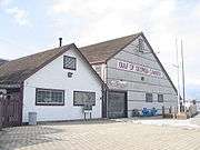 More images | |||
| 1931 Willoughby Elementary School | 7949 208th Avenue, Township of Langley, BC | 49°08′50″N 122°38′46″W | 6020 |  More images | |||
| Alex Houston Residence | 10735 Allard Crescent, Township of Langley, BC | 49°11′53″N 122°35′42″W | 6025 |  More images | |||
| Blair Sugar Maple Tree | 5404 216th Street, Township of Langley, BC | 49°06′04″N 122°37′26″W | 6041 |  More images | |||
| Campbell Residence | 67-20738 84 Avenue, Township of Langley, BC | 49°09′14″N 122°38′47″W | 18617 | | |||
| David Jones Residence | 65-20738 84 Avenue, Township of Langley, BC | 49°09′14″N 122°38′46″W | 18637 | | |||
| Dixon House and Barn | 6120 Glover Road, Township of Langley, BC | 49°06′49″N 122°38′35″W | 6049 | | |||
| Hassall Residence | 9117 272nd Street, Township of Langley, BC | 49°10′03″N 122°28′23″W | 6024 | | |||
| Henry Leaf Residence | 5458 272nd Street, Township of Langley, BC | 49°06′08″N 122°28′16″W | 6018 | | |||
| Houston Milk House | 10735 Allard Crescent, Township of Langley, BC | 49°11′53″N 122°35′42″W | 6035 |  More images | |||
| Johnston Memorial Maple Tree | 216th Street and Glover Road, Township of Langley, BC | 49°07′36″N 122°37′26″W | 6040 | | |||
| Karr/Mercer Barn | 10735 Allard Crescent, Township of Langley, BC | 49°11′52″N 122°35′46″W | 6034 |  More images | |||
| McCrimmon Residence | 21641 48th Avenue, Township of Langley, BC | 49°05′21″N 122°37′23″W | 6022 | | |||
| Murrayville Community Hall | 21667 48th Avenue, Township of Langley, BC | 49°05′23″N 122°37′23″W | 6050 |  More images | |||
| Murrayville Pumphouse | 21500 Old Yale Road, Township of Langley, BC | 49°05′27″N 122°37′41″W | 6021 |  More images | |||
| PY Porter House | 4786 217A Street, Township of Langley, BC | 49°05′21″N 122°37′16″W | 6051 |  More images | |||
| Saint Andrew's United Church | 9025 Glover Road, Township of Langley, BC | 49°09′59″N 122°34′55″W | 6043 |  More images | |||
| Saint George's Anglican Church | 9160 Church Street, Township of Langley, BC | 49°10′06″N 122°34′41″W | 6048 |  More images | |||
| Sharon United Church | 21562 Old Yale Road, Township of Langley, BC | 49°05′23″N 122°37′34″W | 6042 |  More images | |||
| Trattle Memorial Maple Tree | 96th Avenue and Trattle Street, Township of Langley, BC | 49°10′15″N 122°35′13″W | 6038 | | |||
| Willoughby Community Hall | 8280 208th Street, Township of Langley, BC | 49°09′10″N 122°38′42″W | 6023 |  More images | |||
| Willoughby Methodist Church | 66-20738 84 Avenue, Township of Langley, BC | 49°09′14″N 122°38′46″W | 18636 | | |||
| Wilson Memorial Maple Tree | 96th Avenue and Glover Road, Township of Langley, BC | 49°10′06″N 122°34′48″W | 6039 | | |||
| Wright Memorial Maple Tree | 96th Avenue and Wright Street, Township of Langley, BC | 49°10′20″N 122°35′24″W | 6037 |  More images | |||
| Annand/Rowlatt Farmstead | 710 204th Street, Township of Langley, BC | 49°00′54″N 122°39′22″W | 6019 | |
References
- "Canadian Register - Vancouver". Canada's Historic Places. Parks Canada. Retrieved 4 March 2015.
- (Individual site references appear in the table above as external links)
This article is issued from Wikipedia. The text is licensed under Creative Commons - Attribution - Sharealike. Additional terms may apply for the media files.