Linwood, Kansas
Linwood is a city in Leavenworth County, Kansas, United States. As of the 2010 census, the city population was 375.[7] It is located along K-32 highway between Lawrence and Bonner Springs. It is part of the Kansas City metropolitan area.[8]
Linwood, Kansas | |
|---|---|
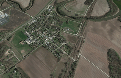 Aerial view of Linwood (2017) | |
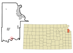 Location within Leavenworth County and Kansas | |
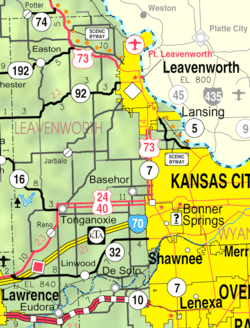 KDOT map of Leavenworth County (legend) | |
| Coordinates: 39°0′3″N 95°2′14″W | |
| Country | United States |
| State | Kansas |
| County | Leavenworth |
| Founded | 1860s |
| Platted | 1867 |
| Incorporated | 1895 [1] |
| Named for | Linden tree |
| Area | |
| • Total | 0.73 sq mi (1.89 km2) |
| • Land | 0.71 sq mi (1.84 km2) |
| • Water | 0.02 sq mi (0.05 km2) |
| Elevation | 804 ft (245 m) |
| Population | |
| • Total | 375 |
| • Estimate (2018)[4] | 391 |
| • Density | 510/sq mi (200/km2) |
| Time zone | UTC-6 (CST) |
| • Summer (DST) | UTC-5 (CDT) |
| ZIP code | 66052 |
| Area code | 913 |
| FIPS code | 20-41475 [5] |
| GNIS ID | 0478854 [6] |
| Website | cityoflinwood.org |
History
Beginnings
Linwood was founded as Journeycake, being named after Charles Journeycake, the last Delaware chief. (Sometimes people made fun of the name Journeycake by calling it "Johnny Cake".) The community was platted on both sides of Stranger Creek, near its mouth at the Kansas River.
In May 1860, a treaty was signed at Sarcoxieville, 3 miles (4.8 km) northeast of Linwood, by Chief Sarcoxie of the Delaware and by the United States.[9] After the treaty's signature, each member of the tribe was assigned a parcel of land, and the balance of the tribe's territories were sold to the predecessor of the Union Pacific Railroad. Meanwhile, the U.S. government established a trading post near Stranger Creek until the tribe was moved to the Indian Territory in 1867. Located beside the Union Pacific Railroad tracks, the store became the first school in the community.
Union Pacific Railroad
In September 1863, the Union Pacific Railroad began building the main line westward across the Great Plains from Kansas City, Kansas, to Denver, Colorado. This was the long-line railroad in Kansas for 2–3 years. The first 40 miles (64 km) was open in 1864 from Wyandotte (now a suburb of Kansas City) to Lawrence. William A. Harris moved to Kansas in 1865 employed as a civil engineer for the Union Pacific Railroad. In 1868 it became the Kansas Pacific Railroad because it was easier to refer to.
Name change
The original community of Journeycake was officially platted as Stranger on July 11, 1867, and recorded at the Leavenworth County Courthouse. When the name Stranger became a problem for the Postal Service who confused Stranger with a nearby community also named Stranger (referred to as "Big" Stranger), it was renamed Linwood on December 20, 1877. Legend has it that one day when the citizens were cutting wood for the church, Colonel Loring suggested they change the name to Linwood, because of the many linden trees that grew in the area. But, according to the Kansas Historical Collections, the community of Stranger had its name changed to Linwood by Senator William A. Harris because of his great appreciation for the linwood trees that were abundant in the vicinity of Stranger Creek.
Senator Harris
William A. Harris moved to Kansas in 1865 employed as a civil engineer for the Union Pacific Railroad until 1868, when he moved to Lawrence, Kansas. He was appointed agent for the railroad companies in the sale of the Delaware Reservation and other lands. In 1884 Harris became a prominent citizen of Linwood, where he engaged in agricultural pursuits and stock raising. He bought several 100 acres (400,000 m2) of land just west of Linwood that bordered the city. On a high hill within sight of city he built a modest two story mansion with fifteen rooms, the Harris House. Harris was elected as a Democratic Congressman to the Fifty-third Congress (1893–1895) and as a Populist to the U.S. Senate (1897–1903). He was an unsuccessful candidate for Governor of Kansas in 1906. Harris died in 1909, and is buried in Lawrence, Kansas.
Relocation
Much of Linwood's commerce came from the saw mills on the river, so the city had grown very near the banks of the Kansas River (affectionately known as the “Kaw” River) that flows eastward to the Missouri. After the 1903 flood damaged and endangered much of the city, it was relocated about one mile (1.6 km) north to its present location out of “the bottoms” (as they are still known today) near the river.
21st century
Present day Linwood is a small city which is accessed solely off of ![]()
2019 tornado
On May 28, 2019 an EF4 tornado with Doppler windspeed measurements of over 187 mph struck the outlying areas of the city and severely damaged homes.[10] At least 13 injuries have been reported due to the storm. The city itself was spared any major damage with just the occasional roof damage and loss of trees and fencing.
Geography
Linwood is located at 39°0′3″N 95°2′14″W (39.000722, -95.037199).[11] According to the United States Census Bureau, the city has a total area of 0.73 square miles (1.89 km2), of which, 0.71 square miles (1.84 km2) is land and 0.02 square miles (0.05 km2) is water.[2] Linwood is situated along the north bank of the Kansas River.
Demographics
| Historical population | |||
|---|---|---|---|
| Census | Pop. | %± | |
| 1880 | 125 | — | |
| 1890 | 306 | 144.8% | |
| 1900 | 349 | 14.1% | |
| 1910 | 323 | −7.4% | |
| 1920 | 364 | 12.7% | |
| 1930 | 295 | −19.0% | |
| 1940 | 299 | 1.4% | |
| 1950 | 261 | −12.7% | |
| 1960 | 375 | 43.7% | |
| 1970 | 323 | −13.9% | |
| 1980 | 343 | 6.2% | |
| 1990 | 409 | 19.2% | |
| 2000 | 374 | −8.6% | |
| 2010 | 375 | 0.3% | |
| Est. 2018 | 391 | [4] | 4.3% |
| U.S. Decennial Census | |||
2010 census
As of the census[3] of 2010, there were 375 people, 139 households, and 92 families residing in the city. The population density was 528.2 inhabitants per square mile (203.9/km2). There were 149 housing units at an average density of 209.9 per square mile (81.0/km2). The racial makeup of the city was 92.5% White, 0.3% Native American, 0.3% Asian, 4.0% from other races, and 2.9% from two or more races. Hispanic or Latino of any race were 6.9% of the population.
There were 139 households of which 37.4% had children under the age of 18 living with them, 42.4% were married couples living together, 10.8% had a female householder with no husband present, 12.9% had a male householder with no wife present, and 33.8% were non-families. 25.9% of all households were made up of individuals and 8.7% had someone living alone who was 65 years of age or older. The average household size was 2.70 and the average family size was 3.14.
The median age in the city was 31.8 years. 27.2% of residents were under the age of 18; 12.8% were between the ages of 18 and 24; 30.9% were from 25 to 44; 21% were from 45 to 64; and 8% were 65 years of age or older. The gender makeup of the city was 53.3% male and 46.7% female.
2000 census
As of the census[5] of 2000, there were 374 people, 129 households, and 87 families residing in the city. The population density was 902.0 people per square mile (352.2/km²). There were 146 housing units at an average density of 352.1 per square mile (137.5/km²). The racial makeup of the city was 90% White, 1% African American, 4% from other races, and 5% from two or more races. Hispanic or Latino of any race were 8% of the population.
There were 129 households out of which 45% had children under the age of 18 living with them, 47% were married couples living together, 14% had a female householder with no husband present, and 32% were non-families. 26% of all households were made up of individuals and 9% had someone living alone who was 65 years of age or older. The average household size was 2.9 and the average family size was 3.5.
In the city, the population was spread out with 35% under the age of 18, 13% from 18 to 24, 30% from 25 to 44, 17% from 45 to 64, and 5% who were 65 years of age or older. The median age was 27 years. For every 100 females, there were 92.8 males. For every 100 females age 18 and over, there were 93.6 males.
The median income for a household in the city was $35,313, and the median income for a family was $39,125. Males had a median income of $26,875 versus $24,896 for females. The per capita income for the city was $13,008. About 6.1% of families and 7.2% of the population were below the poverty line, including 9.5% of those under age 18 and none of those age 65 or over.
Notable people
- William Harris (1841-1909), Kansas senator
- Charles Journeycake (1817-1894), founder of Linwood
See also
- March 2006 tornado outbreak sequence
- List of United States tornadoes in April 2009
- List of United States tornadoes in May 2019
References
- "US Gazetteer files 2010". United States Census Bureau. Archived from the original on 2012-07-02. Retrieved 2012-07-06.
- "U.S. Census website". United States Census Bureau. Retrieved 2012-07-06.
- "Population and Housing Unit Estimates". Retrieved April 2, 2020.
- "U.S. Census website". United States Census Bureau. Retrieved 2008-01-31.
- "US Board on Geographic Names". United States Geological Survey. 2007-10-25. Retrieved 2008-01-31.
- "2010 City Population and Housing Occupancy Status". U.S. Census Bureau. Retrieved March 6, 2011.
- https://www.marc.org/Data-Economy/Metrodataline/General-Information/Statistical-Areas
- Pers N-Z, Lenape-Delaware History.net, 2006-06-09. Accessed 2007-08-09.
- "Massive tornado rips through Linwood, Kansas, destroying homes and keeping KC on edge". The Kansas City Star. May 28, 2019. Archived from the original on May 29, 2019.
- "US Gazetteer files: 2010, 2000, and 1990". United States Census Bureau. 2011-02-12. Retrieved 2011-04-23.
Further reading
External links
- City of Linwood
- Linwood - Directory of Public Officials
- Linwood Library
- Pictures of Linwood, Kansas
- Linwood City Map, KDOT
Municipalities and communities of Leavenworth County, Kansas, United States | ||
|---|---|---|
| Cities | 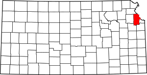 Map of Kansas highlighting Leavenworth County | |
| Unincorporated communities | ||
| Townships | ||
| Ghost town | ||
| Footnotes | ‡This populated place also has portions in an adjacent county or counties | |
Kansas City metropolitan area's cities and counties | ||
|---|---|---|
| Central city |  | |
| Largest cities (over 100,000 in 2000) | ||
| Medium-sized cities (10,000 to 100,000 in 2000) | ||
| Smaller Cities (between 5,000 and 9,900 in 2010) | ||
| Counties | ||