Ajara (India)
Ajara is a census town and taluka headquarters Of Gadhinglaj Subdivision in Kolhapur district in the state of Maharashtra, India.
Ajara | |
|---|---|
Town | |
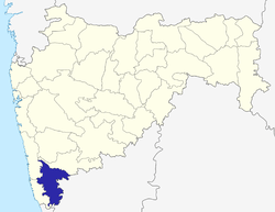
 Ajara Location in Maharashtra, India | |
| Coordinates: 16.12°N 74.2°E | |
| Country | |
| State | Maharashtra |
| District | Kolhapur |
| Government | |
| • Body | Nagar Palika |
| Elevation | 660 m (2,170 ft) |
| Population (2011) | |
| • Total | 18,000 |
| Languages | |
| • Official | Marathi |
| Time zone | UTC+5:30 (IST) |
| PIN | |
| ISO 3166 code | IN-MH |
| Website | maharashtra |
Geography
Ajara is located at 16.12°N 74.2°E. It has an average elevation of 660 metres (2165 feet).
Ajara is known to be one of the southernmost talukas of Kolhapur District of Maharashtra. It is known for its scenic and green landscape, as well as for the Ajara Ghansaal rice.
Ajara falls on the way to Savantwadi, Goa from Kolhapur; it is also the last place of Desh region before Konkan on this route. Ajara is 84 km from Kolhapur and only 33 km from Amboli hill station.
Buses plying from Vengurla, Savantwadi to Kolhapur, Pune via Amboli ghat go via Ajara. As a taluka place, it does have a bus stand, bus depot, school-colleges, bazarpeth, Hotels, etc. Gadhinglaj is the nearest major city for Ajara.
Demographics
As of 2011 India census,[1] Ajara had a population of 18000 . Males constitute 51% of the population and females 49%. Ajara has an average literacy rate of 75%, higher than the national average of 59.5%; with 55% of the males and 45% of females literate. 12% of the population is under 6 years of age.[2] Marathi is predominantly spoken here.
Places To Visit
Ajara has a place named Ramtirth. It is believed that lord Rama stayed at this place during his Vanvaas. There is a lord Rama temple that is situated on the banks of the river Hiranyakeshi. It is nearly 2km away from the main road. The temple is surrounded by rocks,river on one side and a dense forest. The forest is the shelter of verity of birds and animals. Along whith this there are number of other temples that can be visited like Ravalnath temple.
See also
- Pedrewadi
- Haloli
References
- "Census of India 2001: Data from the 2001 Census, including cities, villages and towns (Provisional)". Census Commission of India. Archived from the original on 16 June 2004. Retrieved 1 November 2008.
- "Pin code of Ajara". citypincode.in. Retrieved 22 March 2014.
Kolhapur district topics | |||||
|---|---|---|---|---|---|
| History |
|  | |||
| Geography | |||||
| Cities and towns | |||||
| Transport |
| ||||
| Visitor's attractions |
| ||||
| Culture | |||||
| Education |
| ||||
| Lok Sabha Constituencies | |||||
| Vidhan Sabha Constituencies |
| ||||
| Taluka/Tehsil | |||||
| Stadiums | |||||
‡ This constituency also has portions in Sangli district
| |||||