Khao Wong District
Khao Wong (Thai: เขาวง, pronounced [kʰǎw wōŋ]) is a district (amphoe) in the eastern part of Kalasin Province, northeastern Thailand.
Khao Wong เขาวง | |
|---|---|
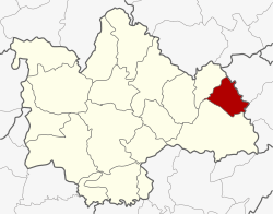 District location in Kalasin Province | |
| Coordinates: 16°42′0″N 104°5′24″E | |
| Country | Thailand |
| Province | Kalasin |
| Seat | Khum Kao |
| Area | |
| • Total | 205.1 km2 (79.2 sq mi) |
| Population (2005) | |
| • Total | 35,130 |
| • Density | 171.3/km2 (444/sq mi) |
| Time zone | UTC+7 (ICT) |
| Postal code | 46160 |
| Geocode | 4606 |
Geography
Neighboring districts are (from the south clockwise) Kuchinarai and Na Khu of Kalasin Province, Dong Luang and Khamcha-i of Mukdahan Province.
History
The minor district (king amphoe) was created on 1 June 1969, when the five tambons Khum Kao, Song Plueai, Na Khu, Phu Laen Chang, and Nong Phue were split off from Kuchinarai District.[1] It was upgraded to a full district on 1 April 1974.[2]
Administration
The district is divided into six subdistricts (tambons), which are further subdivided into 59 villages (mubans). Kut Sim is a township (thesaban tambon) which covers parts of tambons Khum Kao, Kut Sim Khum Mai, and tambon Kut Pla Khao. There are a further five tambon administrative organizations (TAO).
| No. | Name | Thai name | Villages | Pop. | |
|---|---|---|---|---|---|
| 1. | Khum Kao | คุ้มเก่า | 13 | 9,137 | |
| 2. | Song Plueai | สงเปลือย | 12 | 7,271 | |
| 3. | Nong Phue | หนองผือ | 10 | 5,884 | |
| 6. | Kut Sim Khum Mai | กุดสิมคุ้มใหม่ | 12 | 6,808 | |
| 8. | Saphang Thong | สระพังทอง | 7 | 2,924 | |
| 11. | Kut Pla Khao | กุดปลาค้าว | 5 | 3,106 |
Missing numbers are tambons which now form Na Khu District.
References
- ประกาศกระทรวงมหาดไทย เรื่อง แบ่งท้องที่ตั้งเป็นกิ่งอำเภอ (PDF). Royal Gazette (in Thai). 86 (55 ง): 1974. 17 June 1969.
- พระราชกฤษฎีกาตั้งอำเภอเขาวง อำเภอเชียงม่วน อำเภอดอนตาล อำเภอชาติตระการ อำเภอภูเรือ อำเภอเคียนซา อำเภอน้ำโสม อำเภอหนองวัวซอ และอำเภอน้ำยืน พ.ศ. ๒๕๑๗ (PDF). Royal Gazette (in Thai). 91 (54 ก special issue): 30–33. 28 March 1974.