Don Chan District
Don Chan (Thai: ดอนจาน, pronounced [dɔ̄ːn t͡ɕāːn]) is a district (amphoe) of Kalasin Province, northeastern Thailand.
Don Chan ดอนจาน | |
|---|---|
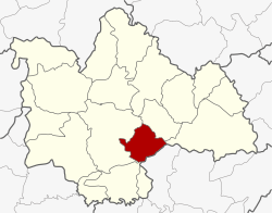 District location in Kalasin Province | |
| Coordinates: 16°27′30″N 103°41′42″E | |
| Country | Thailand |
| Province | Kalasin |
| Seat | Don Chan |
| Area | |
| • Total | 236.6 km2 (91.4 sq mi) |
| Population (2005) | |
| • Total | 25,164 |
| • Density | 106.4/km2 (276/sq mi) |
| Time zone | UTC+7 (ICT) |
| Postal code | 46000 |
| Geocode | 4617 |
Geography
Neighboring districts are (from the south clockwise): Kamalasai, Mueang Kalasin, Na Mon, and Kuchinarai of Kalasin Province, and Pho Chai of Roi Et Province.
History
The minor district (king amphoe) was created on 15 July 1996, when it was split off from Mueang Kalasin District.[1]
On 15 May 2007, all 81 minor districts were upgraded to full districts.[2] With publication in the Royal Gazette on 24 August, the upgrade became official.[3]
Administration
The district is divided into five sub-districts (tambons), which are further subdivided into 48 villages (mubans). There are no municipal (thesaban) areas, and five tambon administrative organizations (TAO).
| No. | Name | Thai name | Villages | Pop. | |
|---|---|---|---|---|---|
| 1. | Don Chan | ดอนจาน | 9 | 7,034 | |
| 2. | Sa-at Chai Si | สะอาดไชยศรี | 8 | 3,708 | |
| 3. | Dong Phayung | ดงพยุง | 13 | 5,441 | |
| 4. | Muang Na | ม่วงนา | 9 | 4,348 | |
| 5. | Na Champa | นาจำปา | 9 | 4,633 |
References
- ประกาศกระทรวงมหาดไทย เรื่อง แบ่งเขตท้องที่อำเภอเมืองกาฬสินธุ์ จังหวัดกาฬสินธุ์ ตั้งเป็นกิ่งอำเภอดอนจาน (PDF). Royal Gazette (in Thai). 113 (Special 18 ง): 24. 26 June 1996.
- แถลงผลการประชุม ครม. ประจำวันที่ 15 พ.ค. 2550 (in Thai). Manager Online.
- พระราชกฤษฎีกาตั้งอำเภอฆ้องชัย...และอำเภอเหล่าเสือโก้ก พ.ศ. ๒๕๕๐ (PDF). Royal Gazette (in Thai). 124 (46 ก): 14–21. 24 August 2007.