Dong Luang District
Dong Luang (Thai: ดงหลวง, pronounced [dōŋ lǔa̯ŋ]) is a district (amphoe) of Mukdahan Province, northeastern Thailand.
Dong Luang ดงหลวง | |
|---|---|
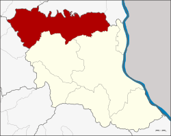 District location in Mukdahan Province | |
| Coordinates: 16°48′55″N 104°32′16″E | |
| Country | Thailand |
| Province | Mukdahan |
| Seat | Dong Luang |
| Area | |
| • Total | 1,076.2 km2 (415.5 sq mi) |
| Population (2005) | |
| • Total | 35,808 |
| • Density | 33.3/km2 (86/sq mi) |
| Time zone | UTC+7 (ICT) |
| Postal code | 49140 |
| Geocode | 4904 |
Geography
Neighboring districts are (from the south clockwise) Mueang Mukdahan and Khamcha-i of Mukdahan Province; Khao Wong and Na Khu of Kalasin Province; Tao Ngoi of Sakon Nakhon Province; and Na Kae and That Phanom of Nakhon Phanom Province.
History
The minor district (king amphoe) was established on 1 April 1977, when the three tambons Dong Luang, Kok Tum, and Nong Bua were split off from Na Kae District.[1] When Mukdahan Province was created in 1982, Dong Luang was one of districts forming the new province, and became reassigned to be a subordinate of Mueang Mukdahan District. The minor district was upgraded to a full district on 16 July 1984.[2]
Administration
The district is divided into six sub-districts (tambon), which are further subdivided into 57 villages (muban). There are no municipal (thesaban) areas, and six tambon administrative organization (TAO).
| No. | Name | Thai name | Villages | Pop. | |
|---|---|---|---|---|---|
| 1. | Dong Luang | ดงหลวง | 12 | 7,532 | |
| 2. | Nong Bua | หนองบัว | 8 | 4,412 | |
| 3. | Kok Tum | กกตูม | 15 | 8,727 | |
| 4. | Nong Khaen | หนองแคน | 7 | 4,648 | |
| 5. | Chanot Noi | ชะโนดน้อย | 7 | 5,259 | |
| 6. | Phang Daeng | พังแดง | 8 | 5,230 |
References
- ประกาศกระทรวงมหาดไทย เรื่อง แบ่งท้องที่อำเภอนาแก จังหวัดนครพนม ตั้งเป็นกิ่งอำเภอดงหลวง (PDF). Royal Gazette (in Thai). 94 (26 ง): 1316. March 29, 1977.
- พระราชกฤษฎีกาตั้งอำเภอลานกระบือ อำเภอดงหลวง อำเภอทรายมูล อำเภอแม่เมาะ และอำเภอบัวเชด พ.ศ. ๒๕๒๗ (PDF). Royal Gazette (in Thai). 101 (96 ก special): 10–12. July 16, 1984.