Kamalasai District
Kamalasai (Thai: กมลาไสย, pronounced [kā.mā.lāː.sǎj]) is a district (amphoe) in the southern part of Kalasin Province, northeastern Thailand.
Kamalasai กมลาไสย | |
|---|---|
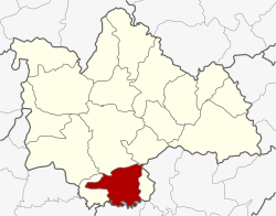 District location in Kalasin Province | |
| Coordinates: 16°20′20″N 103°34′31″E | |
| Country | Thailand |
| Province | Kalasin |
| Subdistrict | 8 |
| Muban | 111 |
| Area | |
| • Total | 325.3 km2 (125.6 sq mi) |
| Population (2015) | |
| • Total | 69,731 |
| • Density | 213.8/km2 (554/sq mi) |
| Time zone | UTC+7 (ICT) |
| Postal code | 46130 |
| Geocode | 4603 |
Geography
Neighboring districts are (from the west clockwise): Khong Chai, Mueang Kalasin, Don Chan of Kalasin Province, Pho Chai of Roi Et Province, Rong Kham of Kalasin Province, and Changhan of Roi Et Province.
Administration
Central administration
Kamalasai is divided into eight sub-districts (tambons), which are further subdivided into 111 administrative villages (mubans).
| No. | Name | Thai | Villages | Pop.[1] |
|---|---|---|---|---|
| 1. | Kamalasai | กมลาไสย | 18 | 11,377 |
| 2. | Lak Mueang | หลักเมือง | 14 | 9,810 |
| 3. | Phon Ngam | โพนงาม | 13 | 7,865 |
| 4. | Dong Ling | ดงลิง | 17 | 10,448 |
| 5. | Thanya | ธัญญา | 15 | 9,743 |
| 8. | Nong Paen | หนองแปน | 9 | 6,876 |
| 10. | Chao Tha | เจ้าท่า | 16 | 8,263 |
| 11. | Khok Sombun | โคกสมบูรณ์ | 9 | 5,349 |
Missing numbers are tambon which now form Khong Chai District.
Local administration
There are five sub-district municipalities (thesaban tambons) in the district:
- Kamalasai (Thai: เทศบาลตำบลกมลาไสย) consisting of parts of sub-districts Kamalasai and Lak Mueang.
- Thanya (Thai: เทศบาลตำบลธัญญา) consisting of parts of sub-district Thanya.
- Nong Paen (Thai: เทศบาลตำบลหนองแปน) consisting of the sub-district Nong Paen.
- Lak Mueang (Thai: เทศบาลตำบลหลักเมือง) consisting of parts of sub-district Lak Mueang.
- Dong Ling (Thai: เทศบาลตำบลดงลิง) consisting of sub-district Dong Ling.
There are five sub-district administrative organizations (SAO) in the district:
- Kamalasai (Thai: องค์การบริหารส่วนตำบลกมลาไสย) consisting of parts of sub-district Kamalasai.
- Phon Ngam (Thai: องค์การบริหารส่วนตำบลโพนงาม) consisting of the sub-district Phon Ngam.
- Thanya (Thai: องค์การบริหารส่วนตำบลธัญญา) consisting of parts of sub-district Thanya.
- Chao Tha (Thai: องค์การบริหารส่วนตำบลเจ้าท่า) consisting of the sub-district Chao Tha.
- Khok Sombun (Thai: องค์การบริหารส่วนตำบลโคกสมบูรณ์) consisting of the sub-district Khok Sombun.
References
- "Population statistics 2015" (in Thai). Department of Provincial Administration. Retrieved 13 April 2016.
This article is issued from Wikipedia. The text is licensed under Creative Commons - Attribution - Sharealike. Additional terms may apply for the media files.