Kamrup region
Kamrup is the modern region situated between two rivers, the Manas and the Barnady in Western Assam, congruent modern "Undivided Kamrup district",[1][2] though historian Dinesh Chandra Sircar suspects Kamapitha division as fabrications from late medieval times.[3]
Kamrup Kamarupa | |
|---|---|
Region | |
 | |
| Coordinates: 26.25°N 91.5°E | |
| Country | India |
| Ancient capital | Pragjyotishpura, Durjaya |
| City | Barpeta, Guwahati, Nalbari, Palashbari, Rangiya |
| Population (2011) | |
| • Total | 6,000,000 |
| Time zone | UTC+5.30 (UTC+05:30 (IST)) |
| Area codes | 0361 |
| Website | www www www www |

Pre-colonial Kamrup was a large territory consisting of Western Assam and North Bengal,[4] which keep reducing in size in subsequent periods. In the nineteenth century, eastern Kamrup became part of Colonial Assam while parts of western Kamrup merged with Bengal. Ancient cities Pragjyotishpura and Durjaya were located in modern Kamrup. Kamrup is considered as a politically, socially and culturally separate unit,[5] and cultural artifacts from this region are called Kamrupi.
Etymology
The origin of name attributed to a legend in the Kalika Purana which mentions that it is in this region that Kamadeva regained his form.[6]
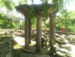
Ancient Kamrup (350–1140)
The first historical mention of Kamarupa comes from Samudragupta's 4th-century Allahabad prasasti, where it is mentioned along with Davaka and Samatata as frontier kingdoms of the Gupta empire. Davaka, currently in Nagaon district (central Assam), is not mentioned in historical texts again, which indicates that the kings of Kamarupa must have absorbed it.[7] Though the kingdom came to be known as Kamarupa, the kings called themselves the rulers of Pragjyotisha (Pragjyotishadhipati), and not Kamarupa;[8] nevertheless Kamarupa continued to be mentioned in inscriptions, such as Nidhanpur inscription of Bhaskar Varman.[9] Vaidydeva, an 11th-century ruler, named Kamarupa as a mandala within the Pragjyotisha bhukti.[10] According to Sircar, the Kamarupa mandala is congruent to undivided Kamrup of the modern times.[11]
Although the epigraphic records define Kamarupa as a smaller region within the historic kingdom, the 9th–10th-century shakta work Kalika Purana names the kingdom Kamarupa. Yogini Tantra provides the traditional boundary: Karatoya river in the west, Dikkaravasini (Sadiya) in the east and the Brahmaputra-Lakhya river confluence in the south forming a triangle.[12] Both the western boundary as well as the name agrees with the 7th-century account left by Chinese traveler Hiuen Tsang who visited the region in the seventh century c.e, identified the kingdom as Kamarupa (Ka-mo-lu-po) which was located to the east of the Karatoya (Ka-lo-tu).[13] Though the ancient kingdom covered initially present undivided Kamrup region, Western Assam[14] but later expanded to include rest of the Brahmaputra valley, North Bengal as well as most of the northern parts of Bangladesh, Bhutan and at some point parts of Bengal and Bihar, starting with acquisition of Davaka (Central Assam) in east. The medieval and pre-modern usage of "Kamrup" was limited to North Bengal and western Assam.
Medieval Kamrup
Kamrup/Kamata (1255-1581)
The Kamarupa region soon lost a unified political rule. Sandhya, a 13th-century ruler in the Kamarupanagara (North Guwahati), moved his capital to present-day North Bengal and his kingdom came to be called Kamata;[15] or sometimes as Kamata-Kamrup,[16] with its eastern boundary at the Manas river.[17] This kingdom was a part of the original Kamarupa kingdom and included in general Koch Bihar, Darrang, Kamrup districts, and northern Mymensing.[18] In the extreme east of the erstwhile Kamarupa kingdom the Chutiya, Kachari and the Ahom kingdoms emerged, with the Baro-Bhuyans providing the buffer between these kingdoms in the east and the Kamata kingdom in the west.[19]
Kamrup/Koch Hajo (1581-1612)
In the beginning of the 16th century Viswa Singha filled the vacuum left by the destruction of the Khen dynasty of Kamata and consolidated his rule over the Baro-Bhuyan chieftains ruling over the Kamrup region, and by the time of Naranarayana, the kingdom extended a firm rule between the Karatoya and the Bhareli rivers. Even though the Koch kings called themselves Kamateshwars (lords of Kamata),[20] their kingdom came to be called the Koch kingdom and not as Kamrup.
In 1581 the Kamata kingdom was bifurcated with Raghudev gaining control over the portion to the east of the Sankosh river up to the Bharali river[21] in the north bank; and east of the Brahmaputra in present-day Bangladesh. Raghudev's kingdom came to be called Koch Hajo in Muslim chronicles, and Kamrup in Ekasarana documents.[22] As the Mughal gained power in Dhaka, Koch Bihar entered into an alliance with them and arraigned themselves against Parikshitnarayana, the son of Raghudev, who had come to power in Koch Hajo in the meanwhile. The Mughals pushed eastward, removed Parikshit from power in Koch Hajo/Kamrup by 1615 (up to the Barnadi river), and came into direct military conflict with the Ahom kingdom; and after the first round of battles, they established control over nearly the entire Koch Hajo, right up to Barnadi river.[23]
Sarkar Kamrup (1612-1682)

The Mughals established four sarkars in the newly acquired land---among which were Dhekeri (between Sankosh and Manas) and Kamrup (between Manas and Barnadi).[24] Kamrup was also renamed as Shujabad, after Shah Shuja, the Subahdar of Bengal.[25] There were a number of Muslim rulers of Kamrup during this period and they were referred to as the Faujdars of Shujabad.[26] The sixth faujdar, Lutfullah Shirazi, built a hilltop mosque in Koch Hajo in 1657. The mosque contained the mazar (mausoleum) of Prince Ghiyath ad-Din Awliya of Iraq, who is commonly credited for introducing Islam to the region.[27] The Mughals lost Kamrup forever in 1682 after the Battle of Itakhuli. Incomplete list of Faujdars of Guahati:
- Makram Khan (1612-1614)
- Mir Sufi (1614-1616)
- Shaykh Kamal (1616-1632)
- Abd as-Salam (1632-1638)
- Noorullah (1638-1656)
- Lutfullah Shirazi (1656-1658)
Kamrup/Borphukan's domain (1682-1820)
After the Battle of Itakhuli (1682), the Ahom kingdom established control over Sarkar Kamrup, and it became the domain of the Borphukan, based in Guwahati. The region continued to be called Kamrup and its eastern and western boundaries were identical to the later British district.[28] In addition to the Kamrup region, the Borphukan's domain included the additional region to the east up to Kaliabor. The Koch prince that oversaw Darrang, too, reported to the Borphukan. The Ahoms did not impose their administrative system fully over Kamrup, and the resultant pargana-based system was a mixed Mughal-Ahom system, in contrast to the Paik system in the rest of the kingdom in the east.[29]
Kamrup/Burmese empire (1821-1824)
The region became part of the Burmese empire between 1821 and 1824.
Colonial Kamrup (1833-1947)
The region came under Burmese control in 1822. The British, in control over the region to the west of the Manas river since the transfer of Bengal in 1765, marched into Guwahati on 28 March 1824 at the beginning of the First Anglo-Burmese War and established administrative control by October.[30] The Kamrup district that the British constituted in 1833/1836 was largely congruous to the Mughal Sarkar Kamrup of 1639.[31]

Modern Kamrup
After Indian Independence in 1947, the Kamrup district maintained its form. The district was divided, beginning in 1983, and the original district is often called "Undivided Kamrup district". The Kamapitha, Sarkar Kamrup of 1639 and the Undivided Kamrup district from the Colonial as well as the Independent periods is today defined as the Kamrup.
See also
- Kamrup
- Kamrupi
- Dewangiri
References
- Kali Prasad Goswami, "Kāmākhyā Temple: Past and Present", 1998, Page 25 The Guwahati area up to the Manas river formed the waist on the position of the genital organ (kama) and was known as the Kamapitha
- Pratap Chandra Choudhury, The history of civilisation of the people of Assam to the twelfth century , Page 448, 1959 The Kamapitha of the Tantras was no other than Kamarupa and Kamakhya.
- "These theoretical divisions are not known from the early epigraphic records and may have been fabricated in the late medieval period." (Sircar 1990, p. 68)
- Upendranath Goswami (1970), A Study on Kāmrūpī: A Dialect of Assamese, Page iii
- Upendranath Goswami (1970), A Study on Kāmrūpī: A Dialect of Assamese
- Hemanta Kumar Sarma (1992), Socio-Religious Life of the Assamese Hindus: A Study of the Fasts and Festivals of Kamrup District, p.4, p.p.262, Daya Publishing House
- "It is presumed that (Kalyana Varman) conquered Davaka, incorporating it within the kingdom of Kamarupa" (Puri 1968, p. 11)
- "The name Kamarupa does not appear in local grants where Pragjyotisha alone figures with the local rulers called Pragjyotishadhipati." (Puri 1968, p. 3)
- Epigraphia Indica Vol XII and XIX
- (Puri 1968, p. 3)
- (Sircar 1990, p. 70)
- (Sircar 1990, pp. 63–64)
- (Sircar 1990, p. 64)
- Tej Ram Sharma (1978), Personal and Geographical Names in the Gupta Inscriptions, p.254
- "Hema Saraswati in his Prahrada-carit says that Durlabhanarayan was the unequaled king of Kamata-mandala" (Neog 1990, p. 40)
- (Gogoi 2002, p. 17)
- "The invasion of Mughisuddin, though abortive, had shaken the Kamarupa kingdom. It was reorganized as a new state. 'Kamata' by name with Kamatapur as capital. The exact time when the change was made is uncertain. But possibly it had been made by Sandhya (c1250-1270) as a safeguard against mounting dangers from the east and the west. Its control over the eastern regions beyond the Manah (Manas river) was lax." (Sarkar 1992, pp. 40–41)
- (Sarkar 1992, p. 44)
- (Sircar 1990, p. 171)
- (Nath 1989)
- Though Chilarai and Naranarayana established control up to Subansiri river via the Treaty of Majuli, the Sukhaamphaa recovered control between Bhareli and Subansiri soon after.
- "The eastern division (of the Koch kingdom) was known as 'Kamrup' in the local sources and as 'Koch Hajo' in the Persian chronicles." (Nath 1989, p. 86)
- Treaty of Asurar Ali
- (Gogoi 2002, p. 99)
- Balakrishnan, Srinivasan. "The Masjid atop the mountain". Tripura Chronicle.
- Nath, Rajmohan (1948). "Appendix". The back-ground of Assamese culture. A. K. Nath. p. 3.CS1 maint: ref=harv (link)
- Goswami, Māmaṇi Raẏachama (2002). "Down Memory Lane". An Unfinished Autobiography. p. 67.
- "Camroop (Kamrup), on the west, or towards Bengal, is bounded by the Manaha river (Manas river); on the north by Raotan, on the east by Bushnudeee (Barnadi river) which separates it from Dehrungh (Darrang) and on the south by Berhampooter (Brahmaputra river)", Wade, Dr John Peter, (1805) "A Geographical Sketch of Assam" in Asiatic Annual Register, reprinted (Sharma 1972)
- (Gogoi 2002, p. 98)
- (Bannerjee 1992, pp. 5–6)
- (Banerjee 1992, pp. 53–54)
Bibliography
- Bannerje, A C (1992). "Chapter 1: The New Regime, 1826-31". In Barpujari, H K (ed.). The Comprehensive History of Assam: Modern Period. IV. Guwahati: Publication Board, Assam. pp. 1–43.CS1 maint: ref=harv (link)
- Gogoi, Jahnabi (2002), Agrarian System Of Medieval Assam, New Delhi: Concept Publishing CompanyCS1 maint: ref=harv (link)
- Nath, D (1989), History of the Koch Kingdom: 1515-1615, Delhi: Mittal PublicationsCS1 maint: ref=harv (link)
- Neog, Maheshwar (1980). Early History of the Vaishnava Faith and Movement in Assam. Delhi: Motilal Banarasidass.CS1 maint: ref=harv (link)
- Puri, Baij Nath (1968). Studies in Early History and Administration in Assam. Gauhati University.CS1 maint: ref=harv (link)
- Sarkar, J. N. (1992), "Chapter II The Turko-Afghan Invasions", in Barpujari, H. K. (ed.), The Comprehensive History of Assam, 2, Guwahati: Assam Publication Board, pp. 35–48CS1 maint: ref=harv (link)
- Sircar, D C (1990), "Pragjyotisha-Kamarupa", in Barpujari, H K (ed.), The Comprehensive History of Assam, I, Guwahati: Publication Board, Assam, pp. 59–78CS1 maint: ref=harv (link)
- Sharma, Benudhar, ed. (1972). An Account of Assam. Gauhati: Assam Jyoti.CS1 maint: ref=harv (link)