Kampala Northern Bypass Highway
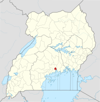
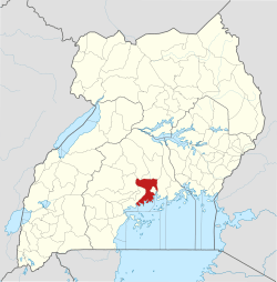
The Kampala Northern Bypass Highway, often referred to as the Northern Bypass, is a road in Uganda. It forms a semicircle across the northern suburbs of Kampala, Uganda's capital and largest city. The road was constructed to relieve traffic congestion within the city center, allowing cross-country traffic to bypass the city's downtown area.[1]
| Kampala Northern Bypass Highway | |
|---|---|
| Route information | |
| Length | 14 mi (23 km) |
| History | Designated in 2004 Expected completion in 2020 |
| Major junctions | |
| East end | Bweyogerere |
| Naalya Kisaasi Bukoto Bwaise Namungoona | |
| West end | Busega |
| Highway system | |
| Roads in Uganda | |
Location
The bypass stretches from Namboole, approximately 11 kilometres (7 mi) to the east of downtown Kampala.[2] The highway winds through the suburbs of Naalya, Kiwaatule, Kulambiro, Kigoowa, Bukoto, Mulago, Makerere, Bwaise, Kawaala, and Namungoona, to end at Busega, approximately 8 kilometres (5.0 mi) west of the city.[3] The highway measures approximately 22 kilometres (14 mi) in length.[4][5] The coordinates of the road at its northernmost point are 00°21′56″N 32°36′18″E.[6]
Overview
The bypass opened to traffic on 1 October 2009.[7] Constructed between 2004 and 2009, the bypass is about 22 kilometres (14 mi) long.[7] The project was funded by the European Union and the Uganda government.[7]
Expansion
In August 2012, Ugandan print media reported that expansion of the bypass to dual carriageway for its entire length would begin in early 2013.[8] Funding for the expansion is being provided by the European Investment Bank, the European Union, and the Ugandan government.[8]
In May 2014, the Uganda National Roads Authority awarded the construction contract for the expansion to Mota-Engil, Engenharia E Construcao SA, a subsidiary of the Mota-Engil civil engineering and construction conglomerate based in Portugal. Construction was expected to start in June 2014 and last 30 months.[3]
In October 2014, Ugandan print media reported that the construction start was postponed to the end of 2014 and would last approximately 30 months.[9]
On 23 February 2015, the widening of the bypass was officially launched.[10][5][11]
Construction costs are budgeted at €67.4 million. The breakdown of the funding sources is in the table below:[12]
| Rank | Development Partner | Contribution in Euros | Percentage | Notes |
|---|---|---|---|---|
| 1 | European Union | 37.0 million | 54.90 | Grant |
| 2 | European Investment Bank | 15.0 million | 22.25 | Loan |
| 3 | Government of Uganda | 15.4 million | 22.85 | Investment |
| Total | 67.4 million | 100.00 | ||
As of December 2018, an estimated 51 percent of the work had been completed, with completion planned in 2021. Six interchanges are planned to replace existing roundabouts at (1) Sentema Road (3) Hoima Road (3) Gayaza Road (4) Bukoto/Kyebando (5) Ntinda/Kisaasi and at (6) Naalya.[13]
As of March 2020, with an estimated 70 percent of the expansion completed, completion was still planned for the 4th quarter of 2021. Te delays were blamed on protracted land acquisition processes, changes in road design and increased scope of work (construction of new road interchanges).[14]
Points of interest
Some of the points of interest along or near the bypass include:[15] (1) Mandela National Stadium, at Bweyogerere. (2) Mulago Hill, the highway skirts the northern borders of the hill between Bukoto and Bwaise. (3) Kampala–Bombo Road, crosses the Northern Bypass, at the northern end of Makerere University Campus.(4) Makerere University, the road passes near the northern borders of the university campus between Bwaise and Kawaala. (5) Kampala–Mityana Road, joins the highway at Busega where Kasumba Square Mall is located. (6) Entebbe–Kampala Expressway, joins the bypass highway at Busega. (7) Kampala–Masaka Road, is connected to the bypass highway by a short connector at Busega.[16]
References
- Kyle Duncan Kushaba (9 August 2016). "Bweyogerere: The home of Ugandan soccer". New Vision. Kampala. Retrieved 15 November 2016.
- GFC (15 June 2016). "Distance between Mandela National Stadium, Kampala, Central Region, Uganda and Post Office Building, Kampala Road, Kampala, Central Region, Uganda". Globefeed.com (GFC). Retrieved 15 June 2016.
- Anguyo, Innocent (13 May 2014). "Portuguese firm awarded sh200b Northern Bypass contract". Kampala: New Vision. Retrieved 12 November 2015.
- GFC (12 February 2016). "Distance between Namboole Road Bus Stop, Kampala, Central Region, Uganda and Geossy Company Limited, Kampala, Central Region, Uganda". Glbefeed.com (GFC). Retrieved 12 February 2016.
- Bwire, Nelson (27 March 2015). "Expansion works on Northern Bypass expected to ease trade". Daily Monitor. Kampala. Retrieved 15 June 2016.
- Google (11 November 2015). "Location of Kampala Northern Bypass Highway At Kisaasi Interchange" (Map). Google Maps. Google. Retrieved 11 November 2015.
- Mulondo, Moses (28 September 2009). "Northern Bypass opens on Thursday". New Vision. Archived from the original on 10 July 2015. Retrieved 12 November 2015.
- Balagadde, Samuel (10 August 2012). "Expansion of Northern Bypass starts early 2013". New Vision. Retrieved 12 November 2015.
- Balagadde, Samuel (16 October 2014). "Sh30b set for compensation on second phase of Northern Bypass". New Vision. Kampala. Retrieved 12 November 2015.
- Kazibwe, Kenneth (24 February 2015). "Museveni Launches $67m Northern Bypass Extension". Chimpreports.com. Retrieved 12 November 2015.
- Musisi, Frederic (2 August 2016). "Uganda: UNRA Warns Encroachers on Entebbe Road Reserve". Daily Monitor via AllAfrica.com. Kampala. Retrieved 4 August 2016.
- APA (24 February 2015). "Ugandan leader commissions EU-funded Northern By-Pass highway". En.starafrica.com. Archived from the original on 25 February 2015. Retrieved 12 November 2015.
- Kabengwa, James (10 December 2018). "Land disputes disrupt works on Northern Bypass". Daily Monitor. Kampala. Retrieved 10 December 2018.
- Arthur Arnold Wadero (6 March 2020). "Government pledges to complete northern bypass in 2021". Daily Monitor. Kampala. Retrieved 6 March 2020.
- Google (12 February 2016). "Map Showing the Location And Route of Kampala Northern Bypass Highway And the Neighborhoods It Traverses" (Map). Google Maps. Google. Retrieved 12 February 2016.
- Google (15 June 2016). "Map of Short Road Connector Between Kampala Northern Bypass Highway to The Top And Kampala–Masaka Road to the Bottom" (Map). Google Maps. Google. Retrieved 15 June 2016.
External links
- Kampala Northern Bypass Expansion Progress Update as of 15 January 2018 (Video)
- President Museveni Launches Expansion of Northern Bypass Highway
- Kampala Northern Bypass project way behind schedule