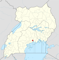
Kampala
Kampala (UK: /kæmˈpɑːlə/,[3][4] US: /kɑːmˈ-/)[3][5] is the capital and largest city of Uganda. The city proper was estimated to have a population of 1,680,800 people on 31 July 2019 and is divided into the five boroughs of Kampala Central Division, Kawempe Division, Makindye Division, Nakawa Division, and Rubaga Division.
Kampala | |
|---|---|
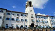
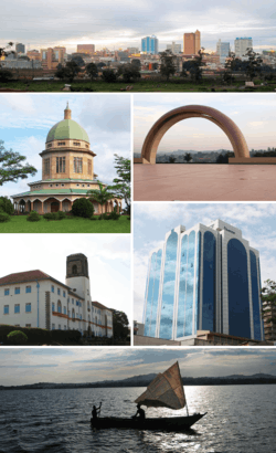 Montage of various landmarks in Kampala, Uganda. | |
| Coordinates: 00°18′49″N 32°34′52″E | |
| Country | Uganda |
| City | Kampala |
| Government | |
| • Lord Mayor | Erias Lukwago |
| • Executive Director | Andrew Kitaka[1] |
| Area | |
| • Capital city | 189 km2 (73 sq mi) |
| • Land | 176 km2 (68 sq mi) |
| • Water | 13 km2 (5 sq mi) |
| • Metro | 8,451.9 km2 (3,263.3 sq mi) |
| Elevation | 1,200 m (3,900 ft) |
| Population (2019) | |
| • Capital city | 1,680,600[2] |
| • Metro | 6,709,900[2] |
| Demonyms | Munakampala |
| Time zone | UTC+3 (EAT) |
| Website | www |

Kampala's metropolitan area consists of the city proper and the neighboring Wakiso District, Mukono District, Mpigi District, Buikwe District and Luweero District. It has a rapidly growing population that is estimated at 6,709,900 people in 2019 by the Uganda Bureau of Statistics[6] in an area of 8,451.9 km2 (3,263.3 square miles).
In 2015, this metropolitan area generated an estimated nominal GDP of $13.80221 billion (constant US dollars of 2011) according to Xuantong Wang et al.,[7] which was more than half of Uganda's GDP for that year, indicating the importance of Kampala to Uganda's economy.
Kampala is reported to be among the fastest-growing cities in Africa, with an annual population growth rate of 4.03 percent,[8] by City Mayors. Kampala has been ranked the best city to live in East Africa[9] ahead of Nairobi and Kigali by Mercer, a global development consulting agency based in New York City.
Etymology
Kampala originally referred to only the present-day Old Kampala hill, on whose summit Fort Lugard was located, and the initial headquarters of the British colonialists in the soon to be Uganda Protectorate.
Before the British construction and occupation of Fort Lugard, the hill was a hunting reserve of the Kabaka (King) of Buganda and had several species of antelope, especially the impala. As a result, when the British colonial agents were allocated this hill by the then Kabaka (King) of Buganda, they referred to it as "The Hill of the Impala".
The Baganda, in whose territory this British settlement was located, then translated "Hill of the Impala" as Akasozi ke'Empala. This was then shortened to K'empala and finally Kampala. "Kasozi" means "hill", "ke" "of", and "empala" the plural of "impala". Hence the name "Kampala" came to refer to this initial British colonial settlement that would later on spread out from the occupied Old Kampala hill near the pre-existing Kibuga (capital) of the Buganda Kingdom.[10]
History
This area of numerous hills and swamps that later become known as Kampala was part of the core of the highly centralized Buganda Kingdom. It was also the site of the shifting Kibuga (capital) of the different Bassekabaka (kings) of the Buganda Kingdom with each Kabaka (king) upon coronation or subsequently during their reign setting up their Kibuga (capital) on a new and or different hill as they wished or desired.
The first written description of this Kibuga (capital) was by the explorer Richard Francis Burton in his book, The Lake Region of East Africa published in 1860. In the book, Burton relying on the information collected by Snay Bin Amir, an Arab trader, described the Kibuga as
…the settlement is not less than a day’s journey in length, the buildings are of cane and rattan. The sultan's (Kabaka) palace is at least a mile long and the circular huts neatly arranged in a line are surrounded by a strong fence which has only four gates.
In 1862, when explorer John Speke arrived in Buganda, the Kibuga (capital) was at Bandabarogo, present-day Banda Hill, and the reigning Kabaka (King) was Mutesa I.[11]
In 1875, explorer Henry Morton Stanley reported the capital as being at present-day Lubaga Hill where he met the same Kabaka Mutesa I. During this visit, Henry Stanley Morton wrote a letter that was published in the Daily Telegraphy, inviting missionaries to come to Buganda. He also described the Kibuga in his 1870s dispatches to the New York Herald, thus:
As we approached the capital, the highway from Usavara [Busabala] increased in width from 20 ft [6 meters] to 150 ft [45 meters]...Arrived at the capital I found the vast collection of huts crowning the eminence were the Royal Quarters, around which ran several palisades and circular courts, between which and the city was a circular road, ranging from 100 ft [30 meters] to 200 ft [60 meters] in width with gardens and huts...
— Bennet, N.R. (ed.) Stanley's Dispatches to the New York Herald, 1871–1872, 1874–1877, Boston, 1970.
In 1877 the first lot of missionaries of Church Mission Society who were of the Protestant faith, arrived from the United Kingdom and were allocated Namirembe Hill. Two years later in 1879 the Catholic White Fathers missionaries also arrived, first settling at the present day village of Kitebi near Lubaga but would subsequently be allocated Lubaga Hill. The arrival of these two missionary groups laid the ground for the religious wars of 1888 to 1892 between their new converts and forced the missionaries from Britain to then lobby for the British government to take over Buganda/Uganda as a protectorate.
In 1890 Frederick Lugard, an agent of the Imperial British East Africa Company, arrived in Buganda during the reign of Ssekabaka Mwanga II with whom he signed a treaty of protection by the British government over Buganda, and the Kibuga (capital) was at Mengo Hill. Captain Lugard would, later on, be allocated the hill that would soon be known as Old Kampala, and on which he built a fort.
In 1895 Mengo Senior School, the first school offering Western education in Kampala, was opened by the Church Missionary Society at Namirembe hill, where mostly children of chiefs and pages of the royal palaces were the students.
In 1897 Ssekabaka Mwanga rebelled and waged a war against British rule and was subsequently captured and deported in 1899 to the Seychelles alongside Omukama Kabalega, and his 3-year-old son was made king by the combined forces of the British officers, Nubian soldiers and Baganda collaborators.[12] This state of affairs later culminated in the signing of the Buganda Agreement (1900) that formalized British colonial rule in Buganda.
Also in 1897, Kampala's first Western-style health facility Mengo Hospital was opened on Namirembe hill by British doctor and missionary Sir Albert Ruskin Cook. In addition the same Dr Albert Cook would in 1913 found Mulago Hospital, the current National Referral Hospital, at Mulago hill.
In 1899, the Missionary Sisters of Our Lady of Africa founded Lubaga Hospital on Lubaga Hill.
In 1900, the regents of the infant king Daudi Cwa 11, Apolo Kagwa the Katikiro (Prime Minister) of Buganda, Stanislaus Mugwanya the Mulamuzi (Chief Judge) of Buganda, and Zakaria Kisingiri the Muwanika (Chief Treasurer) of Buganda, with Bishop Alfred Tucker, signed the Buganda Agreement on behalf of Buganda with Sir Harry Johnston who signed on behalf of the British Government.[13][14] This agreement by Sir Harry Johnston created new land tenures such as freehold, Crown land, and mailo, and divided up and allocated the land in such a way that would come to define the development of Kampala.
The land in Buganda's capital (Kibuga) including Mengo Hill and Makerere Hill, was allocated to the young king, the Baganda colonial collaborators, etc. under mailo and freehold. The religious missions were also formally allocated land they were previously occupying. Thus the Catholic White Fathers got Lubaga Hill, the Protestant Church Missionary Society got Namirembe Hill, the Muslims under Prince Nuhu Mbogo's leadership received Kibuli Hill, the British Catholic Mill Hill Missionaries received most of Nsambya Hill. The Uganda Protectorate government obtained land classified as Crown lands in the area such as Old Kampala Hill, Nakasero Hill, etc.
To legalize the above changes, the following laws and ordinances were subsequently passed: The Crown lands Ordinance of 1903, The Land Law of 1908, The Registration of Land Titles ordinance of 1922 and the Busulu and Envujo law of 1928.[15][16]
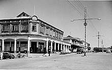
In 1906, the Crown lands consisting of Old Kampala, Nakasero hills etc. and covering 567 hectares (5.67 km2; 1,400 acres) was consolidated and gazetted as Kampala Township.
In 1912 Kampala Township received its first land-use plan and had a European and Asian population of 2,850.[17]
In 1922 Kampala's oldest university, Makerere, was founded as the Uganda Technical College at the present Makerere Hill and initially offered carpentry, building construction, mechanics, arts, education, agriculture, and medicine.
In 1930 the first sewerage plan was prepared to target a population of 20,000 people in Nakasero and Old Kampala areas of the Kampala township. This plan guided sewerage development from 1936 to 1940 in planned urban areas of the Kampala Township and excluded the Kibuga area occupied by the Baganda and other natives.[18]
In 1931, the Uganda Railway line reached Kampala, connecting Kampala to Mombasa Port thirty-five years from the commencement of its construction.[19]
In 1938, The East African Power & Lighting Company was granted a license for thermal electric power generation and distribution for the towns of Kampala and Entebbe, and in the same year Governor Sir Philip Mitchel switched on Kampala and Uganda's first electric street lights.[20][21]
In 1945, Ernst May a German architect, was commissioned by the Uganda Protectorate Government to design a new physical plan for Kampala. Ernst May's plan of 1947 was intended to extend Kampala eastwards covering Kololo Hill and Naguru Hill, and with commercial center on the southern slopes of Nakasero Hill, an industrial zone in the southeast of Kampala and for the first time a planned residential zone for the Ugandan natives.[22] The plan was never fully implemented, and in 1951 the third physical plan by Henry Kendall was instead adopted, though it incorporated some elements of Ernst May's 1947 plan.[23]
Henry Kendall's 1951 plan expanded Kampala from the 5.67 km2 (2.19 square miles) area of 1930 plan to an area of 28 km2 (11 square miles) incorporating areas like Kololo Hill, and Industrial Area. However, like the first two planning schemes, the 1951 plan failed to achieve many of its stated objectives.[23]
On 9 October 1962, Uganda gained independence; subsequently the capital city was transferred from Entebbe to Kampala and in the same year, Kampala was granted city status.
In 1968, six years after Uganda attained independence, the boundaries of Kampala were expanded incorporating the Kibuga (then known as Mengo Municipality), Kawempe and Nakawa Townships, and areas including Muyenga and Ggaba.[24] This increased the administrative area of Kampala from 28 km2 (11 square miles) to the current 189 km2 (73 square miles). 1968 is also the year that local lawyer A.G. Mehta was elected the mayor of the new Kampala, making him one of the first Indian mayors of the city.[25] Mehta died in office in 1969.
In 1972, the fourth physical plan for Kampala was made covering the newly incorporated areas of Kampala's boundary extensions of 1968, but the subsequent political and economic turmoil of the 1970s and 1980s meant the plan was never implemented.[24][26] Similarly, the fifth physical plan for Kampala made in 1994, like the 1972 plan, was also never implemented.
In 2010 the Kampala Capital City Authority act was enacted, giving the Ugandan government more control of the administration of Kampala. The act also created the Kampala Metropolitan Physical Planning Authority with stated aims of improving the infrastructure of the City of Kampala and the surrounding districts of Wakiso, Mukono, Buikwe, Mpigi and Luwero.[27]
Geography
Topography
The City of Kampala covers a total area of 189 km2 (73 square miles), comprising 176 km2 (68 square miles) of land and 13 km2 (5.0 square miles) of water.
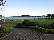
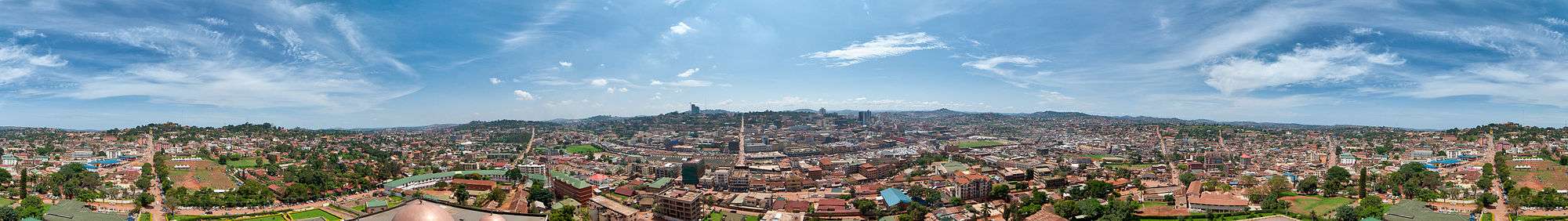
Kampala is a hilly place with its valleys filled with sluggish rivers/ swamps. The highest point in the city proper is the summit of Kololo hill at 1,311 metres (4,301 ft), located in the center of the city and the lowest point at the shores of Lake Victoria south of the city center at altitude of 1,135 metres (3,724 ft).
Hills
Kampala was originally built on seven hills, but it has expanded to cover more than the original seven hills.
The original seven hills are:
- Old Kampala Hill on which Fort Lugard was located, the first seat of the British colonialists in Uganda.
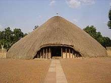
- The second is Mengo Hill which was the then Kibuga (capital) of Buganda kingdom at the start of British colonial rule.
- The third is Kibuli Hill, that is home to the Kibuli Mosque.
- The fourth is Namirembe Hill, that was home to the Anglican (Wangeleza) faction of the Buganda religious wars of 1888 to 1892 and site of Namirembe Anglican Cathedral.
- The fifth is Lubaga Hill, that was home to the White Fathers Catholic (Wafaransa) faction of the above-mentioned Buganda religious wars and also site of the Rubaga Catholic Cathedral.
- The sixth is Nsambya Hill, site of the former Cathedral of St Peter's Nsambya and allocated to the British Catholic Mill Hill Mission during the signing of the Uganda Agreement (1900).
- The seventh is Nakasero Hill on whose summit was Fort Nakasero, a British military installation built after relocating from Fort Lugard in Old Kampala. The hill was also the site of the European Hospital (the current government analytical laboratory opposite Ministry of Public Service headquarters).
Swamps/sluggish rivers
Due to Kampala's hilly nature and tropical climate, the valleys have sluggish rivers/ swamps that tend to flow southwards towards Lake Victoria or northwards. These seasonal and or permanent swamps cover 15% of Kampala's land area. They include:
- Kinawataka swamp/sluggish river covering an area of 1.5 km2 (0.58 square miles) flowing southwards into Lake Victoria and is located in Nakawa Division.[28]
- Nakivubo swamp/sluggish river covering an area of 5.29 km2 (2.04 square miles) flowing southwards to Lake Victoria from the foothills of Makerere and of length 9 kilometres (5.6 mi).[28][29]
- Lubigi swamp/sluggish river covering an area of 2.85 km2 (1.10 square miles) flowing westwards from the foothills of Kisaasi into the Mayanja River.[28]
- Kansanga swamp/sluggish river.
- Kyetinda swamp/sluggish river.
Vegetation
Kampala, due to the diversity of habitats that include wetlands and hills, was previously covered with short-grasses on the tops of the hills, elephant grass (Pennisetum purpureum Schumach.), Cyperus papyrus, African water lily etc. in the swamps and evergreen forests with trees such as African olive (mpafu) and Natal fig (mutuba).[30]
Geology
Kampala is located on the East African Plateau between the two arms of the East African Rift and on the northern limits of Tanzania Craton.
Climate
Kampala has a tropical rainforest climate (Af) under the Köppen-Geiger climate classification system.[31]
A facet of Kampala's weather is that it features two annual wetter seasons. While the city does not have a true dry season month, it experiences heavier precipitation from August to December and from February to June. However, it's between February and June that Kampala sees substantially heavier rainfall per month, with April typically seeing the heaviest amount of precipitation at an average of around 169 millimetres (6.7 in) of rain.
| Climate data for Kampala | |||||||||||||
|---|---|---|---|---|---|---|---|---|---|---|---|---|---|
| Month | Jan | Feb | Mar | Apr | May | Jun | Jul | Aug | Sep | Oct | Nov | Dec | Year |
| Record high °C (°F) | 33 (91) |
36 (97) |
33 (91) |
33 (91) |
29 (84) |
29 (84) |
29 (84) |
29 (84) |
31 (88) |
32 (90) |
32 (90) |
32 (90) |
36 (97) |
| Average high °C (°F) | 28.6 (83.5) |
29.3 (84.7) |
28.7 (83.7) |
27.7 (81.9) |
27.3 (81.1) |
27.1 (80.8) |
26.9 (80.4) |
27.2 (81.0) |
27.9 (82.2) |
27.7 (81.9) |
27.4 (81.3) |
27.9 (82.2) |
27.8 (82.0) |
| Daily mean °C (°F) | 23.2 (73.8) |
23.7 (74.7) |
23.4 (74.1) |
22.9 (73.2) |
22.6 (72.7) |
22.4 (72.3) |
22.0 (71.6) |
22.2 (72.0) |
22.6 (72.7) |
22.6 (72.7) |
22.5 (72.5) |
22.7 (72.9) |
22.7 (72.9) |
| Average low °C (°F) | 17.7 (63.9) |
18.0 (64.4) |
18.1 (64.6) |
18.0 (64.4) |
17.9 (64.2) |
17.6 (63.7) |
17.1 (62.8) |
17.1 (62.8) |
17.2 (63.0) |
17.4 (63.3) |
17.5 (63.5) |
17.5 (63.5) |
17.6 (63.7) |
| Record low °C (°F) | 12 (54) |
14 (57) |
13 (55) |
14 (57) |
15 (59) |
12 (54) |
12 (54) |
12 (54) |
13 (55) |
13 (55) |
14 (57) |
12 (54) |
12 (54) |
| Average rainfall mm (inches) | 68.4 (2.69) |
63.0 (2.48) |
131.5 (5.18) |
169.3 (6.67) |
117.5 (4.63) |
69.2 (2.72) |
63.1 (2.48) |
95.7 (3.77) |
108.4 (4.27) |
138.0 (5.43) |
148.7 (5.85) |
91.5 (3.60) |
1,264.3 (49.77) |
| Average rainy days (≥ 1.0 mm) | 4.8 | 5.1 | 9.5 | 12.2 | 10.9 | 6.3 | 4.7 | 6.7 | 8.6 | 9.1 | 8.4 | 7.4 | 93.7 |
| Average relative humidity (%) | 66 | 68.5 | 73 | 78.5 | 80.5 | 78.5 | 77.5 | 77.5 | 75.5 | 73.5 | 73 | 71.5 | 74.5 |
| Mean monthly sunshine hours | 155 | 170 | 155 | 120 | 124 | 180 | 186 | 155 | 150 | 155 | 150 | 124 | 1,824 |
| Source 1: World Meteorological Organization,[32] Climate-Data.org for mean temperatures[31] | |||||||||||||
| Source 2: BBC Weather[33] | |||||||||||||
Education
Pre-primary education
Pre-primary education is offered only by private entities which are located in the various neighborhoods of Kampala, and is lightly regulated by the Ministry of Education and Sports and starts from age of 6 weeks. Education in Kampala city is provided by a vast number of public and private institutions offering a wide range of educational training that includes pre-primary, primary, secondary, vocational, technical undergraduate and post-graduate education.
Primary and secondary education in Kampala
Kampala has a number of both primary and secondary schools in every parish that are mostly privately owned and a handful that are state-owned and are also lightly regulated by the City Education directorate and Ministry of Education and Sports.[34]
Some of the private institutions:
Vocational and technical education in Kampala
Kampala has a number of both private and state institutions offering training in a broad range of fields as indicated in the table below:
| Vocation/technical
institution |
Speciality | Location | Ownership | Est |
|---|---|---|---|---|
| Nakawa Vocational Training Institute[35] |
|
Nakawa | State owned | 1971 |
| Tiner International School of Beauty[36] |
|
Wandegeya | Private | 1995 |
| Jimmy Sekasi Institute of Catering[37] |
|
Kabalagala | Private | 1989 |
| St Mbaaga Major Seminary[38] |
|
Ggaba | Private | 1976 |
Demographics
The population of Kampala city proper has been rapidly increasing from 62,264 in 1948 to 1,189,142 in 2002 then 1,507,080 in 2014. In 2019 the population was estimated to be 1,650,800.[39][40]
Kampala, being the capital city and economic engine of Uganda, has a diverse ethnic population drawn from all parts of the country and also from neighboring countries such as Democratic Republic of the Congo, Rwanda, South Sudan, Eritrea, Somalia, and even from countries as far away as India and China.[41][42][43][44]
Cross-cultural intimate relations in Kampala and even Uganda generally speaking are still unusual. Although many of Kampala's residents live and work in close contact, they still define themselves by their ethnic origins. This is more evident in the native languages used at home, work places and even in public spaces alongside Luganda and English. In addition to the Baganda and Banyankole, other large ethnic groups include the Basoga, Bafumbira, Batoro, Bakiga, Alur, Bagisu (better known as Bamasaba), Banyoro, Iteso, Langi, and Acholi.[45]
Historical population data for Kampala
| Year | 1948 | 1959 | 1969 | 1980 | 1991 | 2002 | 2014 | 2019 |
|---|---|---|---|---|---|---|---|---|
| Kampala (city proper) | 62,264[46] | 107,058[46] | 330,700[47] | 458,503[47] | 774,241[47] | 1,189,142[47] | 1,507,080[47] | 1,650,800[47] |
Culture
Cultural institutions
Prominent institutions include the Uganda Museum and the Ugandan National Theatre.
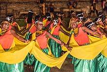
Ndere Cultural Centre
A prominent cultural centre in the Kampala area of Kisasi that aims to promote Ugandan and African cultural expressions through music, dance, and drama. The name Ndere is derived from the noun 'endere', which means flute. As an instrument found in all cultures, it is chosen as a peaceful symbol of the universality of cultural expressions. The Ndere centre is famous for its Ndere troupe, a music and dance troupe that perform several nights every week at the centre showcasing music and dance from all over Uganda as well as Rwanda and Burundi.[48]
People
Notable people
- Apollo Milton Obote, led Uganda to independence in 1962 from the British colonial government[49]
- Yoweri Kaguta Museveni, the longest serving president[50] of the Republic Of Uganda
- Nancy Kacungira, presenter and reporter at BBC World News, winner of the first ever BBC Komla Dumor Award[51]
- Robert Kyagulanyi Ssentamu, Ugandan politician, businessman, entrepreneur, philanthropist and musician
- Micheal Azira, Ugandan footballer, who plays for the Colorado Rapids in Major League Soccer
- Allen Kagina, Executive Director, Uganda National Roads Authority, UNRA
- Yasmin Alibhai-Brown, British journalist and author
- Cornelius Boza-Edwards, former boxer
- Richard Gibson, British actor
- Mandy Juruni, basketball coach
- Aamito Lagum, fashion model, winner of the first season of Africa's Next Top Model
- John Mugabi, world champion boxer[52]
- Kato Mukasa, humanist activist and co-founder of the Humanist Association for Leadership, Equity and Accountability
- Muteesa I, the 30th Kabaka of Buganda
- Muwenda Mutebi II of Buganda, the 36th Kabaka of Buganda
- Rajat Neogy, Ugandan-Indian journalist, writer, poet and founder and editor of Transition Magazine
- Shimit Amin, Uganda-born Indian filmmaker
- Sudhir Ruparelia, Ugandan entrepreneur and builder, Founder Chairman of Ruparelia Group
- Paulo Muwanga, former president and prime minister
- Denis Onyango, footballer
- Eng. Moses Hassim Magogo, FUFA President who took Uganda Cranes to AFCON after 39 years and first Ugandan on CAF Executive
- Samuel Sejjaaka, professor
- Wasswa Serwanga, American football player
- Marcel Theroux, British novelist
- Erias Lukwago, Ugandan lawyer and politician and currently the Lord Mayor of Kampala City
- Phiona Mutesi, chess prodigy and subject of the 2012 book and 2016 Disney film Queen of Katwe
- Martin Ssempa, pastor-doctor and head of a large congregation
- Pione Sisto, footballer, Ugandan born Danish footballer, currently playing for Spanish Club Celta Vigo
- John Sentamu, Archbishop of York
- Ash Amin, British academic and geographer
- Elvis Kintu Nsonyi, Personal Assistant to Kampala Lord Mayor Erias Lukwago, political activist, human rights defender and politician affiliated with the Democratic Party
Honorary citizens
People awarded the honorary citizenship of Kampala are:
| Date | Name | Notes |
|---|---|---|
| 16 June 2017 | Aga Khan IV (1936–present) | British humanitarian and Imam of Nizari-Ismaili Shia Islam[53][54] |
Sports
Kampala is home to the City Oilers, one of East Africa's top basketball club teams. It is the only East African team that competes in the FIBA Africa Clubs Champions Cup. The Oilers play their home games in the MTN Arena, which is based in Kampala's Lugogo Area.[55]
The city hosted the IAAF World Cross Country Championships in 2017.
Economy
Efforts are underway to relocate heavy industry to the Kampala Business and Industrial Park, located in Namanve, Mukono District, approximately 14 kilometres (8.7 mi) east of the city's central business district,[56] thereby cutting down on city traffic congestion. Some of the businesses that maintain their headquarters in the city center include all of the 25 commercial banks licensed in Uganda; the New Vision Group, the leading news media conglomerate and majority owned by the government; and the Daily Monitor publication, a member of the Kenya-based Nation Media Group. Air Uganda maintained its headquarters in an office complex on Kololo Hill in Kampala.[57] Crown Beverages Limited, the sole Pepsi-Cola franchise bottler in the country, is situated in Nakawa, a division of Kampala, about 5 kilometres (3 mi) east of the city centre.[58]
The informal sector is a large contributor to Kampala's GDP. Citizens who work in the formal sector also participate in informal activities to earn more income for their families. A public servant in Kampala, for example, may engage in aviculture in addition to working in the formal sector. Other informal fields include owning taxis and urban agriculture. The use of Kampala's wetlands for urban farming has increased over the past few decades. It connects the informal rural settlements with the more industrialized parts of the city. The produce grown in the wetlands is sold in markets in the urban areas.[59]
In December 2015, Google launched its first Wi-Fi network in Kampala.[60]
While more than 30 percent of Kampala's inhabitants practice urban agriculture, the city of Kampala donated 13 hectares (32 acres) to promote urban agriculture in the northeastern parish of Kyanja, in Nakawa Division.[61]
Transport
Kampala is served by Entebbe International Airport, which is the largest airport in Uganda.
Boda-bodas (local motorbike transport) are a popular mode of transport that gives access to many areas within and outside the city. Standard fees for these range from USh:1,000 to 2,000 or more. Boda-bodas are useful for passing through rush-hour traffic, although many are poorly maintained and dangerous.[62]
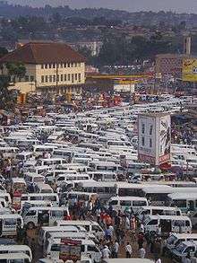
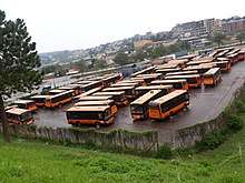
In early 2007, it was announced that Kampala would remove commuter taxis from its streets and replace them with a comprehensive city bus service. (In Kampala, the term "taxi" refers to a 15-seater minibus used as public transport.) The bus service was expected to cover the greater Kampala metropolitan area including Mukono, Mpigi, Bombo, Entebbe, Wakiso and Gayaza. As of December 2011 the service had not yet started.[63] Having successfully completed the Northern Bypass, the government, in collaboration with its stakeholders, now plans to introduce the Bus Rapid Transit (BRT) system in Kampala by 2014. On 12 March 2012, Pioneer Easy Bus Company, a private transport company, started public bus service in Kampala with an estimated 100 buses each with a 60-passenger capacity (30 seated and 30 standing), acquired from China. Another 422 buses were expected in the country in 2012 to complement the current fleet. The buses operate 24 hours daily. The company has a concession to provide public transport in the city for the next five years.[64][65] The buses were impounded for back taxes in December 2013. The company expected to resume operation in February 2015.[66]
In 2014, Uganda's President Yoweri Museveni and a Chinese transportation company signed a Memorandum of Understanding, to embark at some point on building a light rail system in Kampala, similar to the one recently completed in Addis Ababa, Ethiopia.
On 11 April 2011, the pressure group Activists for Change (A4C) held its first Walk to Work protest near Kampala, in response to a comment by President Museveni on the increased cost of fuel, which had risen by 50 percent between January and April 2011. He said: "What I call on the public to do is to use fuel sparingly. Don't drive to bars."[67][68] The protest, which called on workers to walk to work to highlight the increased cost of transport in Uganda,[67] was disrupted by police, who fired tear gas and arrested three-time presidential candidate Kizza Besigye and Democratic Party leader Norbert Mao.[69] In the course of the protest, Besigye was shot in the right arm by a rubber bullet. The government blamed the violence on protesters.[68]
In 2016, the Rift Valley Railways Consortium (RVR) and Kampala Capital City Authority established passenger rail service between Namanve and Kampala and between Kampala and Kyengera. Those services were temporarily discontinued after RVR lost its concession in Uganda in October 2017.[70] However, when Uganda Railways Corporation took over the operations of the metre gauge railway system in Uganda in 2018, the service was restored in February that year.[71] A new Kampala to Port Bell route is being planned to be added in the 2018/2019 financial year.[70]
Places of worship
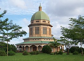 Baha'i House of Worship in Kampala
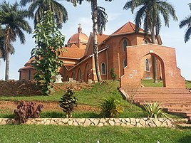 St. Paul's Anglican Cathedral located on Namirembe Hill
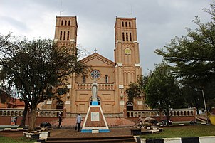 Rubaga Cathedral, the seat for the Roman Catholic Church
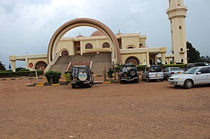 Gadafi Mosque
Among the places of worship are predominantly Christian churches and temples: Roman Catholic Archdiocese of Kampala (Catholic Church), Church of Uganda (Anglican Communion), Presbyterian Church in Uganda (World Communion of Reformed Churches), Baptist Union of Uganda (Baptist World Alliance), and Assemblies of God.[72] There are also Muslim mosques.
Kampala hosts a Bahá'í House of Worship known as the Mother Temple of Africa and is situated on Kikaya Hill on the outskirts of the city. The temple was inaugurated in January 1961.[73]
Gallery
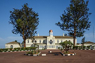 Mengo Palace
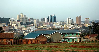 Kampala skyline
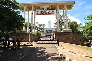 Entrance to the Parliament building
_04.JPG) Stride monument
Stride monument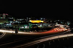 Kampala City by night
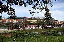
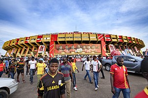 Nelson Mandela National Stadium, the home of the national football team, the Uganda Cranes
_02.JPG) Independence Monument
Independence Monument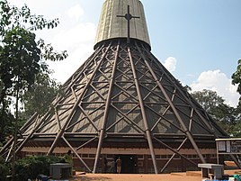 Namugongo Martyrs Shrine
 Uganda Museum
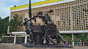 National Theatre
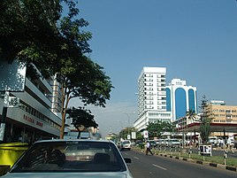 Uganda House – Kampala / Jinja Road
See also
References
- Salim Segawa (18 December 2018). "Who Is Andrew Kitaka Mubiru, The KCCA Acting Executive Director?". Kampala: PulseLive Uganda. Archived from the original on 24 August 2019. Retrieved 24 August 2019.
- https://www.ubos.org/wp-content/uploads/publications/09_2019Final_2020_21_LLG_IPFs_Sept_2019.pdf
- "Kampala". Collins English Dictionary. HarperCollins. Retrieved 2 August 2019.
- "Kampala". Lexico UK Dictionary. Oxford University Press. Retrieved 2 August 2019.
- "Kampala". The American Heritage Dictionary of the English Language (5th ed.). Boston: Houghton Mifflin Harcourt. Retrieved 2 August 2019.
- https://www.ubos.org/wp-content/uploads/publication/09_2019Final_2020_21_LLG_IPFs_Sept_2019.pdf%5B%5D
- Wang, Xuantong; Rafa, Mickey; Moyer, Jonathan D.; Li, Jing; Scheer, Jennifer; Sutton, Paul (16 January 2019). "Estimation and Mapping of Sub-National GDP in Uganda Using NPP-VIIRS Imagery". Remote Sensing. 11 (2): 163. Bibcode:2019RemS...11..163W. doi:10.3390/rs11020163.
- "City Mayors: World's fastest-growing urban areas (1)". www.citymayors.com.
- Muhindo, Clare (2016-02-26). "Kampala Ranked Best City In East Africa". New Vision. Retrieved 2019-08-27.
- "Kampala: Origin of The Name". Myetymology.com. Archived from the original on 31 December 2013. Retrieved 11 June 2014.
- "Journal of the Discovery of the Source of the Nile". Harper. 1864.
- "The betrayal and capture of Mwanga and Kabalega". Daily Monitor. Retrieved 2019-10-30.
- "The great Buganda land grab of 1900". Daily Monitor. Retrieved 2019-10-27.
- Gutkind, P.C.W; Southall, A.W (1957). Townsmen In The Making, Kampala and it's suburbs. Kampala: East African Institute Of Social Research. p. 4. ISBN 978-0013388883.
- Mukwaya, A.B (1953). "The Land Tenure System in Buganda: Present day Tendecies". The Eagle Press. pp.1-22.
- Mukwaya, A.B (1953). "Land Tenure in Buganda: Present Day Practices" (PDF). Makerere University. Retrieved 27 October 2019.
- Nyakwebara, C (2010). "Chronology of Planning in Kampala: Implications for Future Structure Planning". The Urban Planning Magazine. No. 1. pp. 3–6.
- Nilsson, David (2006). "A heritage of unsustainability? Reviewing the origin of the large-scale water and sanitation system in Kampala, Uganda". Environment and Urbanization. SAGE Publications. 18 (2): 369–385. doi:10.1177/0956247806069618. ISSN 0956-2478.
- Lubega, Henry (2015-04-18). "History of Uganda Railway". Daily Monitor. Retrieved 2019-08-27.
- Gore, Christopher D. (2017). Electricity in Africa: The Politics of Transformation in Uganda. Boydell & Brewer. p. 34. ISBN 978-1-84701-168-8.
- Mugabe, Faustin (2018-04-20). "110 years of electricity in Uganda". Daily Monitor. Retrieved 2019-08-27.
- Pinther, Kerstin; Förster, Larissa; Hanussek, Christian (2012). Afropolis: City Media Art. Jacana Media. p. 59. ISBN 978-1-4314-0325-7.
- Folkers, Antoni S. et al. (2019). "Modern Architecture in Africa: Practical Encounters with Intricate African Modernity". Springer. 1st Ed. p. 61.
- Situation Analysis of Informal Settlements in Kampala (PDF). United Nations Human Settlements Programme. 2007.
- "Kampala's Mayors since Independence". www.newvision.co.ug.
- Omolo-Okalebo, Fredrick; Sengendo, Hannington (Jan–Feb 2011). Perspectives on City Planning of Post Independence Kampala: The Emergence of the Metropolitan Growth Model and the Hexagonal Cell (PDF). Second International Conference on Advances in Engineering and Technology. pp. 64–71.
- "Kampala Capital City Act, 2010". Uganda Legal Information Institute. 2010-12-28. Retrieved 2019-08-27.
- Gumm, Emily (2011-04-01). "The Use and Misuse of Wetlands in Kampala". Independent Study Project (ISP) Collection.
- "Nakivubo Channel, where good and bad meet". Daily Monitor. Retrieved 2019-11-01.
- Thomas, A. S. (July 1946). "The Vegetation of Some Hillsides in Uganda: Illustrations of Human Influence in Tropical Ecology. II". The Journal of Ecology. 33 (2): 153–172. doi:10.2307/2256463. JSTOR 2256463.
- "Kampala Climate". Climate-Data.org. Retrieved 2019-08-27.
- "World Weather Information Service: Kampala". World Meteorological Organization. Retrieved 2019-08-27.
- "Kampala". BBC Weather. Retrieved 2019-08-27.
- "Education - KAMPALA CAPITAL CITY AUTHORITY | for a better City".
- "Nakawa Vocational training Institute — Uganda BTVET – Business Technical Vocational Education and Training". www.btvet-uganda.org. Retrieved 2019-09-17.
- "Tiner International School of Beauty Hairdressing Art & Fashion Designing — Uganda BTVET – Business Technical Vocational Education and Training". www.btvet-uganda.org. Retrieved 2019-09-17.
- "Jimmy Sekasi Institute of Catering — Uganda BTVET – Business Technical Vocational Education and Training". www.btvet-uganda.org. Retrieved 2019-09-17.
- "100 seminarians graduate at St. Mbaaga Seminary". www.newvision.co.ug. Retrieved 2019-09-17.
- "Uganda: Regions, Major Cities & Towns". CityPopulation.de. 1980-01-18. Retrieved 2019-08-27.
- UBOS. "National Population and Housing Census 2014 Main Report" (PDF). Uganda Bureau of Statistics (UBOS). Archived from the original (PDF) on 12 October 2017. Retrieved 1 January 2017.
- "More than 10,000 Chinese migrants in Uganda illegally".
- https://www.immigration.go.ug/media/press-statement-28-suspected-illegal-immigrants-arrested
- "Kisenyi slum: The Little Mogadishu of Kampala".
- https://www.kcca.go.ug/media/docs/Kampala%20Urban%20Refugees%20And%20Host%20Community%20Needs%20Report.pdf
- "Africa :: Uganda". The World Factbook (CIA.gov). 2019-08-21. Retrieved 2019-08-27.
- Parkin, David (2013-11-05). Neighbours and Nationals in an African City Ward. Routledge. ISBN 9781136532412.
- "Statistical – Page 20 – Uganda Bureau of Statistics". Retrieved 2019-09-17.
- Kakembo, Titus (2014-03-05). "Ndere Centre, Where African Culture Is Very Alive". New Vision. Retrieved 2019-08-27.
- "Apollo Milton Obote", Wikipedia, 2020-04-25, retrieved 2020-04-25
- "Yoweri Museveni", Wikipedia, 2020-03-09, retrieved 2020-03-11
- "Komla Dumor Award winner announced". BBC News. 2015-08-17. Retrieved 2019-08-26.
- "John Mugabi". Boxing Records Archive. 1960-03-04. Retrieved 2019-08-27.
- Semakula, John (2017-06-16). "KCCA To Award Aga Khan With Honorary Citizenship". New Vision. Retrieved 2019-08-27.
- URN (2017-06-15). "Aga Khan granted Honorary Citizenship of Kampala". The Observer – Uganda. Retrieved 2019-08-26.
- Mutebi, Charles (2013-05-17). "Juruni Eyes 2013 Basketball Crown". New Vision. Retrieved 2019-08-27.
- "Distance between Kampala Road and Namanve Industrial Park, Mukono, Central Region, Uganda". Globefeed Distance Calculator. Retrieved 2019-08-27.
- "Air Uganda Increases Flights To Dar". New Vision. 2009-02-23. Retrieved 2019-08-27.
- "Two decades of positive growth for Crown Beverages". The Independent (Uganda). Kampala. 14 October 2013. Archived from the original on 3 February 2016. Retrieved 3 February 2016.
- Isunju, John Bosco; Orach, Christopher Garimoi; Kemp, Jaco (2015-12-14). "Hazards and vulnerabilities among informal wetland communities in Kampala, Uganda". Environment and Urbanization. SAGE Publications. 28 (1): 275–293. doi:10.1177/0956247815613689. ISSN 0956-2478.
- "Google launches wi-fi network in Kampala, Uganda". BBC News. 2015-12-04. Retrieved 2019-08-27.
- Wolfe, Jeanne M.; McCans, Sarah (June 2009). "Designing for Urban Agriculture in an African City: Kampala, Uganda" (PDF). Open House International. 34 (2). ISSN 0168-2601. OCLC 311401512.
- Kagolo, Francis; Kariuki, Joseph (2008-08-24). "Deadly Ride: Boda Bodas Leading Cause of Hospital Casualties". New Vision. Retrieved 2019-08-27.
- Semakula, John (2011-12-28). "Pioneer Easy Buses To Offer 24 Hour Service". New Vision. Retrieved 2019-08-27.
- Muhairwe, Priscilla (5 April 2011). "Pioneer Easy Bus Set to Introduce Electronic Pay Buses". The Independent (Uganda). Retrieved 11 June 2014.
- "Pioneer Buses Start Service, Taxi Strike Flops". Welcometokampala.com. 12 March 2012. Archived from the original on 5 May 2014. Retrieved 11 June 2014.
- "Pioneer buses back: What has changed?". Daily Monitor.
- "Deadly Crackdown on Uganda's Walk-to-Work Protests". TIME.com. 23 April 2011. Retrieved 25 May 2015.
- Musaazi Namiti. "Uganda walk-to-work protests kick up dust". Retrieved 25 May 2015.
- "Kizza Besigye held over Uganda 'Walk to Work' protest". BBC News. 12 April 2011. Retrieved 25 May 2015.
- Ngwomwoya, Amos (23 February 2018). "Passenger train services to resume on Monday". Daily Monitor. Kampala. Retrieved 24 February 2018.
- Ochwo, Alfred; Ahukana, Mercy (27 February 2018). "Kampalans welcome revamped passenger train services". The Observer (Uganda). Kampala. Retrieved 2 March 2018.
- Melton, J. Gordon; Baumann, Martin (2010). Religions of the World: A Comprehensive Encyclopedia of Beliefs and Practices (2nd ed.). ABC-CLIO. p. 2920. ISBN 978-1-59884-204-3. OCLC 764567612.
- "Fifty years on, Uganda's Baha'i temple stands as a symbol of unity and progress – Bahá'í World News Service (BWNS)". 18 January 2011.
External links
| Wikimedia Commons has media related to Kampala. |
![]()
- Official website
- Musinguzi, Bamuturaki (2016-01-29). "Kampala now mapping its historical buildings". The East African. Retrieved 2019-08-26.
- Google (10 August 2019), "Kampala" (Map), Google Maps, Google, retrieved 10 August 2019
| Authority control |
|
|---|