Kali Sindh River
The Kali Sindh, is a river in Madhya Pradesh and Rajasthan in northern India. It is a tributary of the Chambal River in the Ganges Basin. The main tributaries of the Kali Sindh are the Parwan, Niwaj and Ahu rivers.[1] The Kali Sindh River drains a major portion of the Malwa region, and is the biggest river flowing in the Malwa region of Madhya Pradesh.
Geography
The Kali Sindh is a perennial stream in the Chambal drainage of the Yamuna Basin of the greater Ganges Basin. It typically reaches flood stage during the monsoon season of India. In its lower reaches it forms an alluvial plain. Bauxite deposits are found along the Kali Sindh in Kota district at Baselio, Majola, and Sherol-khera.[2]
The total length of the Kali Sindh river is 550 kilometers, of which 405 kilometers are in Madhya Pradesh and 145 kilometers in Rajasthan.
Course
The Kali Sindh rises in the Vindhya Range[1] near Bagli in Dewas district of Madhya Pradesh.
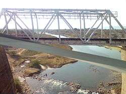
It crosses State Highway No 18 east of Indore near Sonkatch and blocks the road traffic for hours when in flood.[3] It crosses Shajapur district. Then it makes the boundary between Shajapur and Rajgarh districts near Soyatkalan and enters Rajasthan near Binda village. It passes through Baran, Jhalawar and Kota districts of Rajasthan and joins the Chambal River at Nonera village in Kota district. The Kali Sindh is fed by the Ahu, Niwaj and Parwan Rivers.
Major tributaries
The main tributaries of the Kali Sindh River are:
- the Ahu River which flows generally northerly through Jhalawar and Kota districts of Rajasthan, is joined by its tributary the Amjar, and flows into the Kali Sindh near Gagraun (Gagroun);[4][5]
- the Niwaj River which flows through Jhalawar and Kota districts of Rajasthan; and
- the Parban River (Parwan) which originates in Sehore district of Madhya Pradesh. The Parban flows through Sehore, Shajapur and Rajgarh districts in Madhya Pradesh, and through the Jhalawar, Kota and Baran districts of Rajasthan. It meets the Kali Sindh in Baran district of Rajasthan.
Dams on Kalisindh River
- Kalisindh Dam is a major dam across the river situated in Jhalawar district of Rajasthan.[6]
Historical places
- Sonkatch (Dewas district in Madhya Pradesh)
- Sarangpur Rajgarh
- Nalkheda (Shajapur)
- Soyatkalan (On left bank)
- Jhalra Patan (Jhalawar) (On left bank)
- Jhalawar (On right bank)
References
- "Kali Sindh River". india9 (Online Highways LLC.). 20 July 2005. Archived from the original on 29 May 2012.
- "Bauxite in Rajasthan". Mines and Minerals of Rajasthan.
- "Madhya Pradesh Flood/ Kali Sindh and Guneri rivers overflowing in Dewas, 52 villages lose contact, flood in Narmada". DB Post. Bhopal, Madhya Pradesh. 26 August 2019. Archived from the original on 6 April 2020.
- Bradshaw, George (1864). Bradshaw's hand-book to the Bombay presidency and North-western provinces of India. London: W. J. Adams. pp. 421-422.
- Thornton, Edward (1858). "Ahoo or Ahu". A Gazetteer of the Territories Under the Government of the East India Company and of the Native States on the Continent of India (second ed.). London: Wm. H. Allen. p. 16.
- "Dams in Rajasthan -". www.india-wris.nrsc.gov.in. Retrieved 18 November 2018.