Jorethang
Jorethang is a major town in South Sikkim district in the Indian state of Sikkim. Jorethang lies on the Rangeet River, a tributary of the Teesta River, on the way to Pelling from Darjeeling, Siliguri and Kalimpong.
Jorethang | |
|---|---|
Town | |
 | |
 Jorethang Location in Sikkim, India  Jorethang Jorethang (India) | |
| Coordinates: 27.131°N 88.283°E | |
| Country | |
| State | Sikkim |
| District | South Sikkim |
| Government | |
| • Type | Nagar Panchayat |
| Elevation | 322 m (1,056 ft) |
| Population (2011) | |
| • Total | 9,009 |
| Languages | |
| • Official | Nepali, Bhutia, Lepcha, Limbu, Newari, Rai, Gurung, Magar, Sherpa, Tamang and Sunwar |
| Time zone | UTC+5:30 (IST) |
| PIN | 737121 |
| Vehicle registration | SK-04 |
Demographics

As of 2011 State census,[1] Jorethang had a population of 9,009. Males constitute 52% of the population and females 48%. Jorethang has an average literacy rate of 88.85%, higher than the state average of 81.42%: male literacy is 93.36%, and female literacy is 84.20%. In Jorethang, 10.63% of the population is under 6 years of age.
Education
Schools in Jorethang offer primary, secondary and senior secondary education. There are various school like New Buds Academy, St. Francis' School, Little Angles Academy, Govt. Sen. Sec. School.[2]
Maghe Sankranti Mela
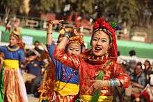

This festival is held on the first of Magh in the Bikram Samwat Nepali calendar (about 14 January), marking the sun’s entrance into Makar rashi (Capricorn). It is one of the main festivals celebrated by the Nepali community in Sikkim dating from 1961.[3]
References
- "Jorethang Population Census 2011". Jorethang Nagar Panchayat.
- "List of Schools in Jorethang (South Sikkim), Sikkim | Schools in India". allindiafacts.com. Retrieved 3 May 2016.
- "Maghe Mela and what it means to Sikkim". Envis Centre on Eco-Tourism. 12 January 2010. Retrieved 7 February 2019.
External links
| Topics | |
|---|---|
| Administration |
|
| Districts | |
| Towns | |
| Rivers | |
| Lakes |
|
| Glaciers | |
| See also | |