East Sikkim district
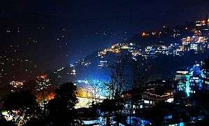
East Sikkim is one of the four administrative districts of the Indian state of Sikkim. Geographically, East Sikkim occupies the south-east corner of the state. The capital of East Sikkim is Gangtok, which is also the state capital. It is the hub of all administrative activity in the state.
East Sikkim | |
|---|---|
District | |
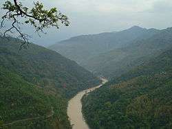 The Teesta River flows for almost the entire length of Sikkim. | |
 East Sikkim's location in Sikkim | |
| Coordinates: 27°19′N 88°36′E | |
| Country | |
| State | Sikkim |
| Headquarters | Gangtok |
| Area | |
| • Total | 964 km2 (372 sq mi) |
| Elevation | 610 m (2,000 ft) |
| Population (2011) | |
| • Total | 283,583 |
| • Density | 290/km2 (760/sq mi) |
| Time zone | UTC+05:30 (IST) |
| ISO 3166 code | IN-SK |
| Website | eastsikkim |
The civilian region is administered by a district collector, appointed by the state government and the military area by a major general. As of 2011 it is the most populous of the four districts of Sikkim.[1]
History
East Sikkim was part of the kingdom of Sikkim for most of its history. In the 19th century, the district was under the rule of the Bhutanese. After the Anglo Bhutan War, the territory was virtually under the command of the British forces. After India's independence in 1947, the area was part of the kingdom of Sikkim under the protection of India. During the Sino-Indian War of 1962, the Nathula Pass witnessed a few skirmishes between India and China. In 1975, the Sikkim formally became part of the Indian Union as India's 22nd state. The district was under the occupation of the Nepalese for 30 years in the eighteenth and nineteenth centuries.
Geography
The district occupies an area of 964 km2.
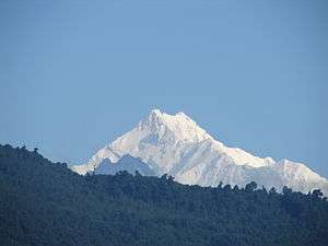
Military-wise, the district is a very sensitive area with the Indian army having control over most areas east of Gangtok and near its borders with People's Republic of China and Bhutan. Visitors to this region are restricted and just a few areas are open to tourists in the areas east of Gangtok. Popular tourist locales are the Tsongmo Lake, Baba Mandir and the Nathu La pass. The pass formed the offshoot of the ancient Silk Road which connected Lhasa to India. The pass and Baba Mandir are open to Indian nationals only. To enter this region a special permit is required; the Inner Line Permit has to be obtained one day prior to departure. This permit is made through local tourist offices. Other tourist areas include the town of Gangtok, the Phodong Monastery north of Gangtok and the Rumtek Monastery. Other special attractions in the Capital City Gangtok are M G Marg, Hanuman Tok, Ranka Monastery, Himalayan Zoological Park, Palzor Stadium, Tashi View Point. Zuluk And Gnathang Valley are famous attractions in East Sikkim.
Demographics
According to the 2011 census East Sikkim district has a population of 283,583,[1] roughly equal to the nation of Barbados.[2] This gives it a ranking of 574th in India (out of a total of 640).[1] The district has a population density of 295 inhabitants per square kilometre (760/sq mi) .[1] Its population growth rate over the decade 2001-2011 was 14.79%.[1] East Sikkim has a sex ratio of 872 females for every 1000 males,[1] and a literacy rate of 84.67%.[1]
At the time of the 2011 Census of India, 65.59% of the population in the district spoke Nepali, 12.03% Hindi, 8.16% Sikkimese, 3.41% Lepcha, 1.68% Bengali, 1.55% Limbu, 1.49% Tamang, 1.14% Sherpa, 0.75% Rai and 0.51% Tibetan as their first language.[3]
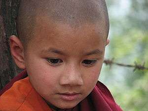
People in East Sikkim are mostly of Nepali ethnicity, arriving in search of jobs after the British appropriated the state in the 19th century. Other ethnicities include the Bhutias, the Tibetans and the Lepchas. Nepali is the predominant language in the region.
Flora and fauna
East Sikkim district is home to four wildlife sanctuaries: Barsey Rhododendron, Fambong Lho, Pangolakha and Kyongnosla Alpine.[4]
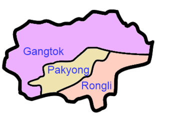
Divisions


References
- "District Census 2011". Census2011.co.in. 2011. Retrieved 30 September 2011.
- US Directorate of Intelligence. "Country Comparison:Population". Retrieved 1 October 2011.
Barbados 286,705 July 2011 est.
- 2011 Census of India, Population By Mother Tongue
- Indian Ministry of Forests and Environment. "Protected areas: Sikkim". Archived from the original on 23 August 2011. Retrieved 25 September 2011.
- Sikkim Administrative Divisions (PDF) (Map). The Registrar General & Census Commissioner, India, New Delhi, Ministry of Home Affairs, Government of India. 2011. Retrieved 29 September 2011.
- "MDDS e-Governance Code (Sikkim Rural)" (PDF). Office of the Registrar General & Census Commissioner, India. 2011. Retrieved 15 October 2011.
External links
- Official district government website

Places adjacent to East Sikkim district | ||||||||||
|---|---|---|---|---|---|---|---|---|---|---|
| ||||||||||
| Topics | |
|---|---|
| Administration |
|
| Districts | |
| Towns | |
| Rivers | |
| Lakes |
|
| Glaciers | |
| See also | |