Jat, Sangli
Jat is a town and taluka headquarters in Miraj subdivision of Sangli district in southern Maharashtra. It is often spelled as "Jath" according to South Indian lexical nomenclature. Jat is one of the largest tehsils in Maharashtra state. Demographically, it has historically been a part of Man Desh.
Jat | |
|---|---|
Tehsil | |
| Jat | |
 Jat Location in Maharashtra  Jat Jat (India) | |
| Coordinates: 17°3′N 75°13′E | |
| Country | |
| State | Maharashtra |
| District | Sangli |
| Government | |
| • Body | Municipality |
| Area | |
| • Total | 2,258.28 km2 (871.93 sq mi) |
| Population (2011) | |
| • Total | 327,747 |
| • Density | 150/km2 (380/sq mi) |
| Demonym(s) | Jatkar |
| Language | |
| • Official | Marathi |
| • Other | Kannada |
| Time zone | UTC+5:30 (IST) |
| PIN | 416-404 |
| Telephone code | +91-2344 |
| Vehicle registration | MH-10 |
| Coastline | 0 kilometres (0 mi) |
| Literacy | 83.83% |
| Climate | Sunny |
| Avg. summer temperature | 25–40 °C (77–104 °F) |
| Avg. winter temperature | 20–27 °C (68–81 °F) |
| Website | jat |
It was the former capital of Jath State, one of the non-salute Maratha princely states of British India, under the Bombay Presidency, and later the Deccan States Agency. It was a southern Maratha Jahagir.
History
Some sources say, in ancient period, town was called Jayantinagar. Jat was capital of former Maratha Jagir ruled by Dafales. Most of the dynasty period was affiliated to Bijapur. For some period it was associated with Kolhapur as well as Satara Maratha Dynasties. Later Jat became a non-salute princely state until 8 march 1948 and then joined dominion of India. Then it was part of Satara district. When Sangli district was formed, Jat became eastern tahasil of Sangli.
Culture
Yallamma temple is situated to the South of Jat. It celebrates an annual fair on Chaitra Paurnima (Full Moon) in the month of Margashirsha. It also hosts one of the largest cattle fairs in southern Maharashtra and Northern Karnataka.
Guddapur, a village in Jat taluka, is also very famous shrine of Goddess Dhanamma.
Daridev temple is located south west of Jat, near to Muchandi village. Its annual fair is celebrated in the second week of April each year.
Near to the city, a temple of Ambabai situated on a hill. The temple celebrates its annual fair in the Navaratra.
Education
S R V M High School Jat was established in 1885. S R V M High School Jat is a Co-ed highschool and junior college. It is affiliated with Maharashtra State Board of Secondary and Higher Secondary Education (MSBSHSE).It is operated by Maratha Mandir Society, Mumbai.
Below are few notable schools with year of establishment in bracket.
K.M. Highschool and Jr. College, Jath (1959), Guru Basaveshwar Highschool, Bilur (1961), M.V Highschool and Jr. College Umadi (1961), SGBVM and Jr.College, Sankh (1967), Jat Highschool Jath (1967), Raje Ramrao Mahavidhyalaya, Jath (1969), Shri Gajanan Highschool and Jr.College Jadarbabalad (1977)
Demographics
According to the 2011 census Jath taluka has a population of 3,28,124. Out of which 168,256 are males while 160,068 are females. In 2011 there were total 64,007 families residing in Jat Taluka. The Average Sex Ratio of Jat Taluka is 951. As per Census 2011, all of the population of Jat Taluka lives in urban areas. The average literacy rate in urban area is 70.4% and the sex ratio of Jat Taluka is 951.The total literacy rate of Jat Taluka is 70.37%.
Marathi is the official language while Kannada is also spoken by significant population. As per 2011 census, Marathi-speaking population of Jath taluka is nearly 59% of the total population whereas Kannada speakers are round 35% of total population.
Transportation
Nearest International Airports
Pune International Airport : 290 Km
Mumbai International Airport : 470 Km
Nearest Domestic Airport
Kolhapur Airport : 136 Km
Main Railway Stations (CR)
Miraj Junction railway station: 78.2 Km
Bijapur railway station: 66 Km
References
| History | 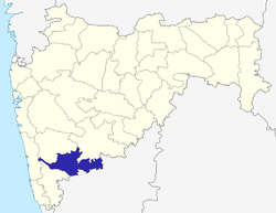 | |
|---|---|---|
| Geography | ||
| Cities and towns | ||
| Transport | ||
| Lok Sabha constituencies | ||
| Vidhan Sabha constituencies | ||
| Tehsil | ||
| Tourist attractions | ||
| Education | ||
| Topics | |||||||||||||
|---|---|---|---|---|---|---|---|---|---|---|---|---|---|
| Regions | |||||||||||||
| Divisions and Districts |
| ||||||||||||
| Million-plus cities in Maharashtra | |||||||||||||
| Other cities with municipal corporations | |||||||||||||
Portal:India | |||||||||||||