Jansen, Colorado
Jansen is an unincorporated community and census-designated place (CDP) in Las Animas County, Colorado, United States. In 2010, it had a population of 112.[2] The U.S. Post Office at Trinidad (ZIP Code 81082) now serves Jansen postal addresses.[3]
Jansen, Colorado | |
|---|---|
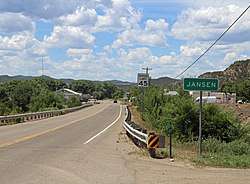 Looking west along Highway 12 in Jansen | |
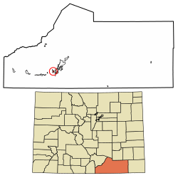 Location in Las Animas County, Colorado | |
 Jansen Location in the United States | |
| Coordinates: 37°08′55″N 104°32′21″W | |
| Country | |
| State | |
| County | Las Animas[1] |
| Area | |
| • Total | 1.17 sq mi (3.04 km2) |
| • Land | 1.17 sq mi (3.04 km2) |
| • Water | 0.0 sq mi (0.0 km2) |
| Elevation | 6,129 ft (1,868 m) |
| Population (2010) | |
| • Total | 112 |
| • Density | 96/sq mi (36.9/km2) |
| [2] | |
| Time zone | UTC-7 (MST) |
| • Summer (DST) | UTC-6 (MDT) |
| ZIP code[3] | 81082 (Trinidad) |
| Area code(s) | 719 |
| GNIS feature ID | 0204812 |
| FIPS code | 08-39250 |
Geography
Jansen is located in western Las Animas County at 37°08′55″N 104°32′21″W (37.148550,-104.539204), in the valley of the Purgatoire River. Colorado State Highway 12 passes through the community, leading northeast 2 miles (3 km) to Trinidad, the county seat, and west 5 miles (8 km) to Cokedale.
The Jansen CDP has an area of 1.2 square miles (3.0 km2), with no bodies of water.[2]
See also
- Outline of Colorado
- State of Colorado
- Colorado cities and towns
- Colorado census designated places
- Colorado cities and towns
References
- "US Board on Geographic Names". United States Geological Survey. 2007-10-25. Retrieved 2008-01-31.
- "Geographic Identifiers: 2010 Census Summary File 1 (G001), Jansen CDP, Colorado". American FactFinder. U.S. Census Bureau. Archived from the original on February 13, 2020. Retrieved September 17, 2019.
- "ZIP Code Lookup". United States Postal Service. January 3, 2007. Archived from the original (JavaScript/HTML) on November 23, 2010. Retrieved January 3, 2007.
- "Census of Population and Housing". Census.gov. Retrieved June 4, 2016.
Municipalities and communities of Las Animas County, Colorado, United States | ||
|---|---|---|
| City | 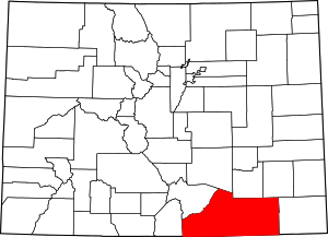 Map of Colorado highlighting Las Animas County | |
| Towns | ||
| CDPs | ||
| Unincorporated communities | ||
| Ghost towns | ||
This article is issued from Wikipedia. The text is licensed under Creative Commons - Attribution - Sharealike. Additional terms may apply for the media files.