El Moro, Colorado
El Moro is a census-designated place in Las Animas County, Colorado, United States.[2] As of the 2010 census it had a population of 221.[1]
El Moro, Colorado | |
|---|---|
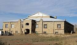 The former El Moro Public School (now privately held) | |
 El Moro  El Moro | |
| Coordinates: | |
| Country | United States |
| State | Colorado |
| County | Las Animas |
| Government | |
| • Type | Unincorporated |
| Area | |
| • Total | 11.12 sq mi (28.81 km2) |
| • Land | 11.10 sq mi (28.75 km2) |
| • Water | 0.03 sq mi (0.07 km2) |
| Elevation | 5,930 ft (1,810 m) |
| Population (2010) | |
| • Total | 221 |
| • Density | 19.9/sq mi (7.69/km2) |
| Time zone | UTC−7 (Mountain (MST)) |
| • Summer (DST) | UTC−6 (MDT) |
| ZIP code | 81082 |
| Area code(s) | 719 |
| FIPS code | 08-24290 |
| GNIS feature ID | 194727[2] |
A post office called El Moro was established in 1876, and remained in operation until 1933.[3] El Moro is a name derived from Spanish meaning "the Moor".[4]
Geography
El Moro is in west-central Las Animas County, bordering the northeast side of the city of Trinidad, the county seat. U.S. Route 160 runs along the southeast edge of the CDP, leading southwest 3.5 miles (5.6 km) to the center of Trinidad and east 119 miles (192 km) to Springfield. U.S. Route 350 branches off from US 160 at the eastern edge of El Moro and leads northeast 73 miles (117 km) to La Junta. The city of Pueblo is 81 miles (130 km) to the north via Interstate 25, which runs just west of the El Moro CDP.
According to the U.S. Census Bureau, the El Moro CDP has a total area of 11.12 square miles (28.81 km2), of which 11.10 square miles (28.75 km2) are land and 0.03 square miles (0.07 km2), or 0.23%, are water.[1] The Purgatoire River runs through the community, flowing northeast toward the Arkansas River.
References
- "Geographic Identifiers: 2010 Census Summary File 1 (G001), El Moro CDP, Colorado". American FactFinder. U.S. Census Bureau. Archived from the original on February 13, 2020. Retrieved September 12, 2019.
- U.S. Geological Survey Geographic Names Information System: El Moro, Colorado
- "Post Offices". Jim Forte Postal History. Archived from the original on 6 March 2016. Retrieved 25 June 2016.
- Dawson, John Frank. Place Names in Colorado: Why 700 Communities Were So Named, 150 of Spanish or Indian Origin. Denver, CO: The J. Frank Dawson Publishing Co. p. 20.
- "Census of Population and Housing". Census.gov. Retrieved June 4, 2016.
Municipalities and communities of Las Animas County, Colorado, United States | ||
|---|---|---|
| City | 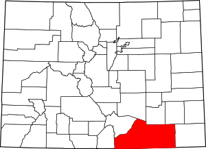 Map of Colorado highlighting Las Animas County | |
| Towns | ||
| CDPs | ||
| Unincorporated communities | ||
| Ghost towns | ||