Interstate 55 in Illinois
Interstate 55 (I-55) is a major north–south Interstate Highway in the U.S. state of Illinois that connects the St. Louis, Missouri, and Chicago metropolitan areas. It enters the state from Missouri on the Poplar Street Bridge near East St. Louis and runs to U.S. Route 41 (US 41, Lake Shore Drive) near downtown Chicago where the highway ends, a distance of 294.38 miles (473.76 km).[2] The Road also runs through the cities of Springfield, Bloomington, and Joliet. The section in DuPage County is officially named Joliet Freeway or Will Rogers Freeway and in Cook County is officially named the Stevenson Expressway.
| ||||
|---|---|---|---|---|

I-55 highlighted in red | ||||
| Route information | ||||
| Maintained by IDOT | ||||
| Length | 294.38 mi[1] (473.76 km) | |||
| Major junctions | ||||
| South end | ||||
| North end | ||||
| Location | ||||
| Counties | St. Clair, Madison, Macoupin, Montgomery, Sangamon, Logan, McLean, Livingston, Grundy, Will, DuPage, Cook | |||
| Highway system | ||||
| ||||

Route description
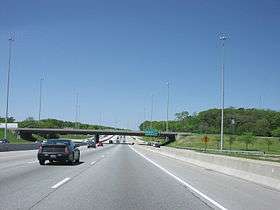
I-55 within Illinois carries heavy traffic, with an average of more than 20,000 vehicles per day for most of its length.[3] Significant portions of I-55 contain six lanes (three lanes in each direction) and are heavily used by commuters.[4] I-55 in Illinois begins in East St. Louis on the Poplar Street Bridge over the Mississippi River at the Missouri–Illinois state line[4] and runs southwest to northeast through the state, ending in Chicago at US 41 (Lake Shore Drive). Along the way, it goes through four metropolitan areas in the state: the Illinois portion of the St. Louis metropolitan area, the Springfield metropolitan area, the Bloomington-Normal metropolitan area, and the Chicago metropolitan area (also known as Chicagoland).[4]
I-55 enters the Chicago metro area as the Stevenson Expressway and provides easy access to downtown Chicago via both the I-90/I-94 (Dan Ryan Expressway) interchange and US 41 (Lake Shore Drive) at the northern terminus of I-55, near Cermak Road and the lakefront.
History
I-55 in Illinois is the fourth road to connect St. Louis and Chicago. The first was the Pontiac Trail in 1915. This was largely improved and paved as the new Illinois Route 4 (IL 4) by 1924.[5] In 1926, IL 4 was designated as the route of the new U.S 66, and a new section of US 66 was built to bypass slower sections of IL 4 south of Springfield by 1930. Through the 1950s US 66 was continually widened, straightened, and improved to handle its growing traffic, until its entire length was four lanes wide by 1957.[6]
The roots of I-55 could be traced back to the need of a national highway system.[7] President Dwight D. Eisenhower saw the need of a national network of highways that would help with the mobilization of the army. He had been impressed with the autobahn he saw in Germany during World War II. In 1956 he signed the Federal Aid Highway Act into existence.[7] Although the act provided for a highway replacing Route 66, it was spared destruction for a while because of it being more modern than other routes at the time.[7] Illinois would build its first new Interstate highways on other routes such as I-80, I-57, and I-70, before turning its attention once again to the St. Louis-to-Chicago route.
However, during the 1970s, Route 66 was finally replaced by I-55 as the fourth St. Louis-to-Chicago highway, serving most of the same communities along the way as the original Pontiac Trail. It was built in sections across Illinois, often on the original Route 66 roadbed. A common construction tactic where Route 66 was already four lanes wide, was to build new southbound lanes for I-55 west of the original road, then rebuild the original southbound lanes of US 66 to be the new northbound lanes for I-55, leaving the original northbound lanes of old US 66 as a two-way frontage road.[7] One can find many signs posted for Historic US 66, especially where it deviates from I-55.
The earliest stretch of I-55 was a portion of US 66 which had already been built as a freeway between Gardner and I-294 (Tri-State Tollway) in Indian Head Park, and which was added to the Interstate system by simply erecting new signs in 1960.[8] Later portions of the highway were built in the 1960s between East St. Louis and Hamel, as bypasses of Springfield and Bloomington-Normal.[9] The rest of the road was completed in the 1970s.
The Stevenson Expressway opened on October 24, 1964 as the Southwest Expressway. It was renamed after Adlai Stevenson,[10] the former governor of Illinois, on September 1, 1965, a month and a half after his death. The Stevenson's original termini were US 66 in DuPage County to the west, and the Dan Ryan Expressway to the east.
In 1999–2000, the expressway was completely rebuilt from Central Avenue north to Lake Shore Drive, including the ramps to the Dan Ryan. The Illinois Department of Transportation (IDOT) was criticized at the time for not adding a fourth lane in each direction to the highway.[11]
In 2017, the Illinois General Assembly voted to rename approximately 70 miles (110 km) of I-55 from the Tri-State Tollway (I-294) to Pontiac in honor of Barack Obama.[12][13]
Upgrades and current construction
Because of the heavy traffic on I-55, IDOT spends millions of dollars per year maintaining the roadway, adding lanes, and replacing bridges to increase the capacity of the highway.[14][15]
In northeastern Illinois near Joliet, a widening project that expanded I-55 from two to three lanes in each direction between I-80 (exit 250) and Weber Road (exit 263) was completed on October 29, 2008.[16]
In the 2000s decade, the Damen Avenue (exit 290) and Pulaski Road (exit 287) interchanges were rebuilt as a single-point urban interchange (SPUI) configuration; in 2014 reconstruction as a SPUI was completed for the Central Avenue (exit 285) interchange. The Arsenal Road (exit 245) interchange was under complete rebuilding and reconfiguration as of 2012, and the deteriorated overpass at IL 129 (exit 238) was removed in 2012 in anticipation of future construction of a full interchange, temporarily leaving the IL 129 interchange with only a northbound exit and northbound entrance.[17][18]
At St. Louis, the Stan Musial Veterans Memorial Bridge carrying I-70 across the Mississippi River, and costing $667 million, was completed in 2014 to relieve congestion on I-55's Poplar Street Bridge.[19][20]
Future
Governor Bruce Rauner, in early 2016, made a proposal to explore expanding the Stevenson Expressway portion of I-55 by adding an additional lane in each direction to ease congestion. Under his proposal, toll lanes would be constructed and operated through a potential private-public partnership.[21]
Exit list
| County | Location | mi[22] | km | Exit | Destinations | Notes |
|---|---|---|---|---|---|---|
| Mississippi River | 0.00 | 0.00 | Continuation into Missouri | |||
| Poplar Street Bridge | ||||||
| St. Clair | East St. Louis | 0.63 | 1.01 | Southern end of IL 3/GRR concurrency | ||
| 0.90 | 1.45 | Tudor Avenue | Entrance ramp from Piggott Avenue | |||
| 1.30 | 2.09 | 1 | Northbound exit and southbound entrance; to Broadway Avenue | |||
| 1.80 | 2.90 | 2A | Third Street – Eads Bridge | Southbound exit and northbound entrance | ||
| 1.91 | 3.07 | 2B-C | Martin Luther King Bridge – Downtown St. Louis | Southbound exit and northbound entrance; left exit is signed as exit 2B and right exit as 2C | ||
| 2.67 | 4.30 | 3A | Northern end of I-64/IL 3 concurrency | |||
| 2.88 | 4.63 | 3B | Southern end of I-70 concurrency; southbound exit and northbound entrance | |||
| 2.98 | 4.80 | 3C | Exchange Avenue | Southbound exit and northbound entrance | ||
| Madison | | 3.99 | 6.42 | 4 | Signed as exits 4A (south) & 4B (north) southbound | |
| Fairmont City | 6.32 | 10.17 | 6 | Northern end of GRR concurrency | ||
| Collinsville | 8.84 | 14.23 | 9 | Black Lane | Northbound exit and southbound entrance | |
| 9.86 | 15.87 | 10 | I-255 exit 25 | |||
| 11.00 | 17.70 | 11 | ||||
| Maryville | 14.55 | 23.42 | 15 | Signed as exits 15A (south) & 15B (north) | ||
| Troy | 16.91 | 27.21 | 17 | Northern end of US 40 concurrency | ||
| 17.91 | 28.82 | 18 | ||||
| | 19.08 | 30.71 | 20A | Northern end of I-70 concurrency | ||
| | 19.32 | 31.09 | 20B | I-270 exit 15 | ||
| Edwardsville | 22.39 | 36.03 | 23 | |||
| Hamel | 29.57 | 47.59 | 30 | |||
| | 33.15 | 53.35 | 33 | |||
| Livingston | 36.71 | 59.08 | 37 | New Douglas Road / Nicholls Street – Livingston, New Douglas | ||
| Macoupin | | 40.47 | 65.13 | 41 | Staunton Road – Staunton | |
| White City | 44.05 | 70.89 | 44 | |||
| Montgomery | Litchfield | 52.35 | 84.25 | 52 | ||
| | 59.98 | 96.53 | 60 | Eastern terminus of IL 108 | ||
| | 63.02 | 101.42 | 63 | Southern terminus of IL 48; northern terminus of IL 127 | ||
| Farmersville | 71.51 | 115.08 | 72 | |||
| Sangamon | Divernon | 80.00 | 128.75 | 80 | Southern end of Historic US 66 concurrency | |
| | 81.53 | 131.21 | 82 | Northern end of Historic US 66 concurrency | ||
| | 83.35 | 134.14 | 83 | Old Route 66 – Glenarm | ||
| Springfield | 88.26 | 142.04 | 88 | Southern end of Historic US 66 concurrency | ||
| 90.16 | 145.10 | 90 | Toronto Road | |||
| 91.84 | 147.80 | 92A | Left exit northbound; northern end of Historic US 66 concurrency | |||
| 92.28 | 148.51 | 92B | Southern end of I-72/US 36 concurrency; left exit northbound | |||
| 94.42 | 151.95 | 94 | Stevenson Drive, East Lake Drive | |||
| 96.37 | 155.09 | 96 | Signed as exits 96A (south) & 96B (north) | |||
| 97.47 | 156.86 | 98A | Northern end of I-72/US 36 concurrency | |||
| 98B | Downtown Springfield | |||||
| 99.53 | 160.18 | 100 | Signed as exits 100A (IL 54 east) & 100B (Sangamon Avenue); Illinois State Fairgrounds | |||
| Sherman | 104.50 | 168.18 | 105 | Abraham Lincoln Capital Airport; southern end of Historic US 66 concurrency | ||
| Williamsville | 109.13 | 175.63 | 109 | Northern end of Historic US 66 concurrency | ||
| Logan | Elkhart | 114.56 | 184.37 | 115 | CR 700 North / Kennedy Road – Elkhart, Mount Pulaski | |
| | 119.42 | 192.19 | 119 | |||
| | 122.51 | 197.16 | 123 | |||
| Lincoln | 125.78 | 202.42 | 126 | Northern terminus of IL 121 | ||
| | 127.04 | 204.45 | 127 | Southern terminus of I-155, I-155 exit 0 | ||
| | 132.21 | 212.77 | 133 | |||
| | 139.81 | 225.00 | 140 | South Street / 2350th Street – Atlanta, Lawndale, Waynesville | ||
| McLean | | 144.68 | 232.84 | 145 | ||
| | 153.74 | 247.42 | 154 | 850 North Road – Shirley, Funks Grove | ||
| | 156.38– 156.85 | 251.67– 252.43 | 157A | Southern end of I-74/US 51 concurrency | ||
| Bloomington | 157B | Signed as exit 134B southbound | ||||
| 159.69 | 257.00 | 160 | ||||
| | 163.32 | 262.84 | 163 | Northern end of I-74 concurrency; I-74 exit 127 | ||
| | 164.48 | 264.70 | 164 | Northern end of US 51 concurrency; southern terminus of I-39 | ||
| Normal | 164.81 | 265.24 | 165 | Signed as exits 165A (south) & 165B (north) northbound | ||
| 167.36 | 269.34 | 167 | ||||
| | 170.99 | 275.18 | 171 | |||
| Lexington | 178.29 | 286.93 | 178 | |||
| Chenoa | 186.60 | 300.30 | 187 | |||
| Livingston | | 196.62 | 316.43 | 197 | ||
| | 200.46 | 322.61 | 201 | To IL 170 | ||
| | 209.03 | 336.40 | 209 | |||
| Dwight | 217.02 | 349.26 | 217 | |||
| Grundy | | 219.91 | 353.91 | 220 | ||
| | 226.88 | 365.13 | 227 | |||
| Grundy–Will county line | | 233.42 | 375.65 | 233 | Reed Road – Braidwood | |
| Will | | 235.63 | 379.21 | 236 | ||
| | 238.32 | 383.54 | 238 | Northbound exit and entrance; northern terminus of IL 129 | ||
| | 240.41 | 386.90 | 240 | Lorenzo Road | ||
| | 240.97 | 387.80 | 241 | |||
| | 243.91 | 392.54 | 244 | Chicagoland Speedway | ||
| | 246.67 | 396.98 | 247 | |||
| Channahon | 248.15 | 399.36 | 248 | |||
| 250.25 | 402.74 | 250 | Signed as exits 250A (east) & 250B (west); I-80 exit 126 | |||
| Shorewood | 251.40 | 404.59 | 251 | Northbound exit and southbound entrance; southern terminus of IL 59 | ||
| Shorewood–Joliet city line | 252.79 | 406.83 | 253 | |||
| Joliet–Plainfield city line | 257.41 | 414.26 | 257 | |||
| Plainfield | 261.08 | 420.17 | 261 | Southbound exit and northbound entrance; eastern terminus of IL 126 | ||
| Romeoville–Bolingbrook city line | 263.43 | 423.95 | 263 | |||
| Bolingbrook | 267.02 | 429.73 | 267 | |||
| 268.73 | 432.48 | 268 | Southbound exit and northbound entrance; southern end of Historic US 66 concurrency | |||
| 269.34 | 433.46 | 269 | I-355 exit 12 | |||
| DuPage | Darien | 270.85 | 435.89 | 271 | Signed as exits 271A (south) & 271B (north) | |
| 272.86 | 439.13 | 273 | Signed as exits 273A (south) & 273B (north); Argonne National Laboratory | |||
| Willowbrook–Burr Ridge city line | 274.50 | 441.76 | 274 | |||
| DuPage–Cook county line | Burr Ridge | 276.33 | 444.71 | 276A-B | County Line Road | Signed as exits 276A (south) & 276B (north) |
| Cook | Indian Head Park | 276.80 | 445.47 | 276C | Northbound exit and southbound entrance; northern end of Historic US 66 concurrency; southern end of Stevenson Expressway | |
| Indian Head Park–Countryside city line | 277.57 | 446.71 | 277 | Signed as exits 277A (north) & 277B (south); I-294 exit 23; no southbound exit to I-294 south | ||
| Countryside–Hodgkins city line | 278.87 | 448.80 | 279 | Signed as exits 279A (east/south) & 279B (west/north) | ||
| Summit | 282.29 | 454.30 | 282 | Signed as exits 282A (south) & 282B (north) northbound; Brookfield Zoo | ||
| Summit–Chicago city line | 283.40 | 456.09 | 283 | |||
| Chicago | 285.57 | 459.58 | 285 | Central Avenue (5600 West) | ||
| 286.67 | 461.35 | 286 | ||||
| 287.74 | 463.07 | 287 | Pulaski Road (4000 West) | |||
| 288.83 | 464.83 | 288 | Kedzie Avenue (3200 West) | Southbound exit and northbound entrance | ||
| 289.37 | 465.70 | 289 | California Avenue (2800 West) | Northbound exit and southbound entrance | ||
| 290.44 | 467.42 | 290 | Damen Avenue (2000 West) | |||
| 290.96 | 468.25 | 290 | Ashland Avenue (1600 West) | Northbound exit and southbound entrance | ||
| 292.34 | 470.48 | 292 | Signed as exits 292A (west) & 292B (east) northbound, and as exits 292 (west) & 293B (east) southbound | |||
| 292.91 | 471.39 | 293A | Cermak Road – Chinatown (2200 South) | Northbound exit and southbound entrance | ||
| 293.13 | 471.75 | 293C | State Street (0 East/West) | Southbound exit and northbound entrance | ||
| 293.61 | 472.52 | 293D | Martin L. King Drive (400 East) | Northbound exit and southbound entrance | ||
| 293.88 | 472.95 | — | Northern terminus of I-55; northern terminus of Stevenson Expressway; all trucks must exit onto US 41 south | |||
1.000 mi = 1.609 km; 1.000 km = 0.621 mi
| ||||||
Related routes
Auxiliary routes
I-55 has three auxiliary routes in Illinois:


Springfield business loop
| |
|---|---|
| Location | Springfield |
Business Loop 55 refers to a major arterial surface street that serves downtown Springfield, Illinois. It runs north from the intersection of Interstates 55 and Interstate 72 through downtown to Illinois Route 4 (Veterans' Parkway). It then runs northeast to Sherman.[23]
All of Business Loop 55 was part of U.S. Route 66 at some point.
Major junctions
The entire route is in Sangamon County.
| Location | mi[24] | km | Destinations | Notes | |
|---|---|---|---|---|---|
| Springfield | 0.0– 0.7 | 0.0– 1.1 | Exit 92A (I-55), Exit 97B (I-72) | ||
| 4.9 | 7.9 | ||||
| 5.0 | 8.0 | ||||
| 7.0 | 11.3 | Southern end of IL 29 concurrency | |||
| 8.0 | 12.9 | Northern end of IL 29 concurrency, northern terminus of IL 4 | |||
| Sherman | 12.1 | 19.5 | Eastern terminus of IL 124 | ||
| 12.7 | 20.4 | Exit 105 (I-55), no access to I-55 northbound from this point | |||
| Williams Township | 13.9 | 22.4 | Only access to I-55 northbound | ||
1.000 mi = 1.609 km; 1.000 km = 0.621 mi
| |||||
Lincoln business loop
| |
|---|---|
| Location | Lincoln |
The Lincoln business route services the downtown of Lincoln, Illinois. It begins southwest of Lincoln and follows the former US 66 to Fifth Street. It then turns east on Fifth Street, southeast on Clinton Street, and northeast on Kickapoo Street at the city's center. The route continues northeast to rejoin the former routing of US 66 northeast of town near the Logan County Airport, at which point it continues along that route to end at I-55 further northeast of Lincoln.
Bloomington–Normal business loop
| |
|---|---|
| Location | Bloomington–Normal |
The routing of the Bloomington-Normal business loop is known for its entire length as Veterans Parkway. It is a divided, limited-access highway bypassing the Bloomington-Normal area to the south and east. The route's north-south portion largely passes through a retail core, including Eastland Mall and The Shoppes at College Hills. The is also the recommended route from I-39, I-55 and I-74 to Central Illinois Regional Airport via IL 9.
Major junctions
The entire route is in McLean County.
| Location | mi | km | Destinations | Notes | |
|---|---|---|---|---|---|
| Bloomington | Exit 157 on I-55; exit 134 on westbound I-74 | ||||
| Western end of Historic Route 66 concurrency | |||||
| Diamond interchange, eastern end of Historic US 66 concurrency | |||||
| Central Illinois Regional Airport | |||||
| Normal | Southbound exit only | ||||
| I-55 exit 167; road continues to the north as Pipeline Road | |||||
1.000 mi = 1.609 km; 1.000 km = 0.621 mi
| |||||
References
- Adderly, Kevin (October 31, 2002). "Table 1: Main Routes of the Dwight D. Eisenhower National System Of Interstate and Defense Highways as of October 31, 2002". Route Log and Finder List. Federal Highway Administration. OCLC 47914009. Retrieved December 30, 2013.
- MapPoint (Map). Microsoft. 2002.
- 2011 Average Daily Total Traffic (PDF) (Map). Scale not given. Cartography by Office of Planning and Programming. Illinois Department of Transportation. 2011. Retrieved December 30, 2013.
- "I-55". Illinois Highway Ends. Self-published. Retrieved January 28, 2013.
- Illinois Official Auto Trails Map (Map). c. 1:950,000 and c. 1:1,110,000. Illinois Automobile Department. 1924. Retrieved December 30, 2013.
- Illinois Official Highway Map (Map). 1:805,000. Cartography by H.M. Gousha. Illinois Division of Highways. 1957. Retrieved December 30, 2013.
- Stork, Peter (2008). "History: Alignments and Bypasses". Digital Route 66. Archived from the original on May 11, 2008.
- Illinois Official Highway Map (Map). 1:790,000. Cartography by H.M. Gousha. Illinois Division of Highways. 1960. Retrieved December 30, 2013.
- Illinois Official Highway Map (Map). 1:772,500. Cartography by Rand McNally. Illinois Division of Highways. 1969. Retrieved December 30, 2013.
- Municipal Reference Collection (August 1997). "1964 Southwest Expressway Opened September 1, 1965—Renamed Adlai E. Stevenson Expressway". Chicago Public Library. Archived from the original on December 13, 2007.
- Hilkevitch, John (March 26, 2006). "Buckle Up, It Looks like a Long Ride". Chicago Tribune. Retrieved March 26, 2006.
- "Section of I-55 to Be Named After Former President Obama". Chicago: WLS-TV. July 4, 2017. Retrieved September 25, 2017.
- Malagon, Elvia (July 3, 2018). "Why There Was No Pomp, Circumstance or Former President When Obama Expressway Signs Went Up on I-55". Chicago Tribune. Retrieved July 4, 2018.
- "I-55 Resurfacing Work". The Herald News. Joliet, IL. May 24, 2002.
- Cain, Cindy Wojdyla (April 22, 2005). "Interstate Overhaul 55 and 80: 'Tight Cloverleaf' to Be Redone Starting in May". The Herald News. Joliet, IL.
- "Governor Blagojevich Announces Completion of Interstate 55 Widening Project: I-55 Corridor Improvement Project Added One Lane in Each Direction from Weber Rd to I-80; Goal Is to Increase Safety and Reduce Congestion" (Press release). Office of the Governor. October 29, 2008. Archived from the original on December 31, 2013. Retrieved December 30, 2013.
- "Southbound I-55 Ramp Closure in Wilmington" (PDF) (Press release). Illinois Department of Transportation. Retrieved February 11, 2013.
- "I-55 Wilmington Study". Illinois Department of Transportation. Archived from the original on June 4, 2013. Retrieved February 11, 2013.
- "New Bridge May Mean Tolls on All Mississippi Bridges Here Making Motorists Pay Is a Last Resort But a Possibility, Officials Say". St. Louis Post-Dispatch. October 6, 1999.
- "New Mississippi River Bridge Opens to Traffic". St. Louis Post-Dispatch. February 9, 2014.
- "Gov. Rauner Pushes to Develop Toll Lanes on I-55". Chicago: WMAQ-TV. February 4, 2016. Retrieved February 4, 2016.
- Illinois Technology Transfer Center (2006). "T2 GIS Data". Illinois Department of Transportation. Retrieved November 8, 2007.
- General Highway Map: Sangamon County, Illinois (PDF) (Map). Illinois Department of Transportation. February 20, 2009. Retrieved January 2, 2013.
- Google (January 2, 2013). "Interstate 55 Business (Springfield)" (Map). Google Maps. Google. Retrieved January 2, 2013.
External links
| Wikimedia Commons has media related to Interstate 55 in Illinois. |
- Stevenson Expressway Timeline at the Chicago Public Library
- Historic, Current & Average Travel Times For The Stevenson Expressway
| Previous state: Missouri |
Illinois | Next state: Terminus |