Williamsville, Illinois
Williamsville is a village in Sangamon County, Illinois, United States. The population was 1,476 at the 2010 census, and 1,491 at a 2018 estimate. It is part of the Springfield, Illinois Metropolitan Statistical Area.
Williamsville | |
|---|---|
Village | |
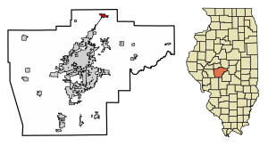 Location of Williamsville in Sangamon County, Illinois. | |
.svg.png) Location of Illinois in the United States | |
| Coordinates: 39°57′3″N 89°33′3″W | |
| Country | United States |
| State | Illinois |
| County | Sangamon |
| Area | |
| • Total | 1.26 sq mi (3.27 km2) |
| • Land | 1.26 sq mi (3.27 km2) |
| • Water | 0.00 sq mi (0.00 km2) |
| Elevation | 598 ft (182 m) |
| Population (2010) | |
| • Total | 1,476 |
| • Estimate (2018)[2] | 1,491 |
| • Density | 1,183.98/sq mi (457.24/km2) |
| Time zone | UTC-6 (CST) |
| • Summer (DST) | UTC-5 (CDT) |
| ZIP Code(s) | 62693 |
| Area code(s) | 217 |
| FIPS code | 17-81854 |
| Website | williamsville |
Geography
Williamsville is located at 39°57′3″N 89°33′3″W (39.950942, -89.550745).[3]
According to the 2010 census, Williamsville has a total area of 1.26 square miles (3.26 km2), all land.[4]
Schools
The Williamsville-Sherman CUSD15 office is located at 800 S. Walnut St., Williamsville, IL 62693
http://www.wcusd15.org/index.php
Demographics
| Historical population | |||
|---|---|---|---|
| Census | Pop. | %± | |
| 1880 | 457 | — | |
| 1890 | 444 | −2.8% | |
| 1900 | 573 | 29.1% | |
| 1910 | 600 | 4.7% | |
| 1920 | 652 | 8.7% | |
| 1930 | 661 | 1.4% | |
| 1940 | 649 | −1.8% | |
| 1950 | 656 | 1.1% | |
| 1960 | 735 | 12.0% | |
| 1970 | 923 | 25.6% | |
| 1980 | 996 | 7.9% | |
| 1990 | 1,140 | 14.5% | |
| 2000 | 1,439 | 26.2% | |
| 2010 | 1,476 | 2.6% | |
| Est. 2018 | 1,491 | [2] | 1.0% |
| U.S. Decennial Census[5] | |||
At the 2000 census there were 1,439 people in 531 households, including 417 families, in the village. The population density was 1,159.0 people per square mile (448.1/km²). There were 555 housing units at an average density of 447.0 per square mile (172.8/km²). The racial makeup of the village was 98.12% White, 0.56% African American, 0.49% Native American, 0.14% Asian, 0.28% from other races, and 0.42% from two or more races. Hispanic or Latino of any race were 0.83%.[6]
Of the 531 households 42.4% had children under the age of 18 living with them, 69.5% were married couples living together, 7.2% had a female householder with no husband present, and 21.3% were non-families. 19.4% of households were one person and 9.0% were one person aged 65 or older. The average household size was 2.71 and the average family size was 3.12.
The age distribution was 29.3% under the age of 18, 7.2% from 18 to 24, 31.1% from 25 to 44, 19.0% from 45 to 64, and 13.5% 65 or older. The median age was 36 years. For every 100 females, there were 89.8 males. For every 100 females age 18 and over, there were 89.9 males.
The median household income was $50,238 and the median family income was $56,012. Males had a median income of $41,169 versus $30,870 for females. The per capita income for the village was $20,201. About 1.8% of families and 3.1% of the population were below the poverty line, including 2.0% of those under age 18 and 4.3% of those age 65 or over.
References
- "2016 U.S. Gazetteer Files". United States Census Bureau. Retrieved Jun 30, 2017.
- "Population and Housing Unit Estimates". Retrieved January 19, 2020.
- "US Gazetteer files: 2010, 2000, and 1990". United States Census Bureau. 2011-02-12. Retrieved 2011-04-23.
- "G001 - Geographic Identifiers - 2010 Census Summary File 1". United States Census Bureau. Archived from the original on 2020-02-13. Retrieved 2015-12-25.
- "Census of Population and Housing". Census.gov. Retrieved June 4, 2015.
- "U.S. Census website". United States Census Bureau. Retrieved 2008-01-31.
Municipalities and communities of Sangamon County, Illinois, United States | ||
|---|---|---|
| Cities | Map of Illinois highlighting Sangamon County | |
| Villages | ||
| Townships | ||
| Unincorporated communities | ||
| Footnotes | ‡This city also has portions in adjacent county or counties | |