Huntington, New York
The Town of Huntington is one of ten towns in Suffolk County, New York, United States. Founded in 1653,[1] it is located on the north shore of Long Island in northwestern Suffolk County, with Long Island Sound to its north and Nassau County adjacent to the west. Huntington is part of the New York metropolitan area. As of the United States 2010 Census, the town population was 203,264.
Huntington, New York | |
|---|---|
Town | |
| Town of Huntington | |
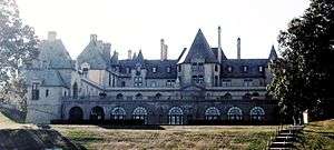 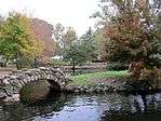 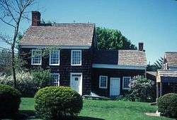 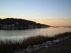 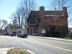 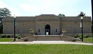 Oheka Castle, Heckscher Park, Walt Whitman's Birthplace, sunset at Centerport Harbor, the historic former Huntington Sewing & Trade School, the Heckscher Museum of Art. | |
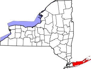
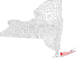 Location of Huntington in Suffolk County, New York | |
| Coordinates: 40°51′36″N 73°21′8″W | |
| Country | United States |
| State | New York |
| County | Suffolk |
| Government | |
| • Town Supervisor | Chad A. Lupinacci (R) |
| Area | |
| • Total | 137.1 sq mi (355 km2) |
| • Land | 94.0 sq mi (243 km2) |
| • Water | 43.1 sq mi (112 km2) |
| Elevation | 135 ft (41 m) |
| Population (2010) | |
| • Total | 203,264 |
| • Density | 2,162/sq mi (835/km2) |
| Time zone | UTC−5 (EST) |
| • Summer (DST) | UTC−4 (EDT) |
| ZIP codes | 11721, 11724, 11731, 11740, 11743, 11746, 11747, 11750, 11768 |
| Area code(s) | 631 |
| FIPS code | 36-68000 |
| GNIS feature ID | 0979498 |
| Website | huntingtonny |
Huntington is the only township in the United States to ban self-service gas stations at the town level. Along with New Jersey and Oregon, they are the only three places in the country where full-service gas stations are compulsory.[2]
History
In 1653, three men from Oyster Bay, Richard Holbrook, Robert Williams and Daniel Whitehead, purchased a parcel of land from the Matinecock tribe. This parcel has since come to be known as the "First Purchase" and included land bordered by Cold Spring Harbor on the west, Northport Harbor on the east, what is now known as Old Country Road to the south and Long Island Sound to the north. The three men immediately turned the land over to the settlers who had already been living there.[3]
._Street%2C_Huntington%2C_Long_Island%2C_May_1907..jpg)
._Street%2C_Huntington%2C_Long_Island%2C_ca._1872-1887..jpg)
From that initial settlement, Huntington grew over subsequent years to include all of the land presently comprising the modern Towns of Huntington and Babylon. The southern part of the town was formally separated to create Babylon in 1872.[3]
Because Huntington was populated largely by English settlers, unlike the rest of the New Amsterdam colony, the town voted in 1660 to become part of the Connecticut colony rather than remain under the authority of New Amsterdam. It was not until the British gained control of New Amsterdam in 1664 (renaming it New York) that Huntington was formally restored to the jurisdiction of New York.[3]
Following the Battle of Long Island during the American Revolutionary War, British troops used Huntington as their headquarters, and remained encamped there until the end of the war.[3]
The arrival of the Long Island Rail Road in 1867 transformed the economy of Huntington from primarily agriculture and shipping (based on its well protected harbor) to tourism and commuting. Cold Spring Harbor became a popular summer resort.[3]
The end of World War II brought about an explosive growth of population in Huntington, as in the rest of the region. Farms and resorts gave way to homes, and Huntington has transformed into a major bedroom community for nearby New York City.[3]
Demographics
| Historical population | |||
|---|---|---|---|
| Census | Pop. | %± | |
| 1790 | 3,260 | — | |
| 1800 | 3,894 | 19.4% | |
| 1810 | 4,424 | 13.6% | |
| 1820 | 4,935 | 11.6% | |
| 1830 | 5,582 | 13.1% | |
| 1840 | 6,562 | 17.6% | |
| 1850 | 7,481 | 14.0% | |
| 1860 | 8,924 | 19.3% | |
| 1870 | 10,704 | 19.9% | |
| 1880 | 8,098 | −24.3% | |
| 1890 | 8,277 | 2.2% | |
| 1900 | 9,483 | 14.6% | |
| 1910 | 12,004 | 26.6% | |
| 1920 | 13,893 | 15.7% | |
| 1930 | 25,582 | 84.1% | |
| 1940 | 31,768 | 24.2% | |
| 1950 | 47,506 | 49.5% | |
| 1960 | 126,221 | 165.7% | |
| 1970 | 200,172 | 58.6% | |
| 1980 | 201,512 | 0.7% | |
| 1990 | 191,474 | −5.0% | |
| 2000 | 195,289 | 2.0% | |
| 2010 | 203,264 | 4.1% | |
| Est. 2016 | 203,236 | [4] | 0.0% |
| U.S. Decennial Census[5] | |||
| Data source | Population | White | Black | Asian | Native Americans | Pacific Islanders | Hispanic/Latino | Other | Two or more races |
|---|---|---|---|---|---|---|---|---|---|
| 2000 Census | 195,289 | 88.31% | 4.22% | 3.50% | 0.13% | 0.02% | 6.58% | 2.27% | 1.55% |
| 2010 Census | 203,264 | 84.15% | 4.68% | 4.96% | 0.20% | 0.02% | 11.00% | 3.89% | 2.10% |
As of the census[6] of 2000, there were 195,289 people, 65,917 households, and 52,338 families residing in the town. The population density was 2,078.4 people per square mile (802.5/km²). There were 67,708 housing units at an average density of 720.6 per square mile (278.2/km²). The racial makeup of the town in 2000 was 88.31% White, 4.22% Black or African American, 0.13% Native American, 3.50% Asian, 0.02% Pacific Islander, 2.27% from other races, and 1.55% from two or more races. Hispanic or Latino of any race were 6.58% of the population. As of the census of 2010, the racial makeup of the town was 84.15% White, 4.68% Black or African American, 0.20% Native American, 4.96% Asian, 0.02% Pacific Islander, 3.89% from other races, and 2.10% from two or more races. Hispanic or Latino of any race were 11.00% of the population.
There were 65,917 households out of which 37.1% had children under the age of 18 living with them, 67.4% were married couples living together, 8.9% had a female householder with no husband present, and 20.6% were non-families. 16.2% of all households were made up of individuals and 6.7% had someone living alone who was 65 years of age or older. The average household size was 2.91 and the average family size was 3.26.
In the town, the population was spread out with 25.5% under the age of 18, 5.8% from 18 to 24, 30.2% from 25 to 44, 25.5% from 45 to 64, and 13.1% who were 65 years of age or older. The median age was 39 years. For every 100 females, there were 96.2 males. For every 100 females age 18 and over, there were 93.4 males.
According to a 2007 estimate, the median income for a household in the town was $102,865, and the median income for a family was $113,119.[7] Males had a median income of $61,748 versus $40,825 for females. The per capita income for the town was $36,390. About 2.9% of families and 4.6% of the population were below the poverty line, including 5.1% of those under age 18 and 4.6% of those age 65 or over.
Government and politics
The town government consists of a town council with four members, all of whom are elected at large. The town supervisor is elected by the entire town. Other elected positions are the Town Clerk, Highway Superintendent, and Receiver of Taxes.[8] A referendum to move to a ward district system on December 22, 2009 failed 81% to 18%.
Economy
Sbarro's headquarters were located in Melville in the Town of Huntington until 2015.[9]
Around 2002, Swiss International Air Lines's North American headquarters moved from Melville to Uniondale, Town of Hempstead. The facility, the former Swissair North American headquarter site, was completed in 1995. Swissair intended to own, instead of lease, its headquarters site. It enlisted architect Richard Meier to design the Melville facility.[10][11]
In 1997, Aer Lingus announced that it was moving its North American headquarters from Manhattan to Melville; James Lyndon, a spokesperson for the airline, said that the company moved to Long Island in an effort to reduce costs, as leasing costs are lower in Long Island than in Manhattan. The move would transfer 75 employees, including administrative personnel, marketing personnel, sales personnel, and telephone reservation agents. The airline planned to move on June 15, 1997. The airline had also considered sites in Boston and in Westchester, New York.[12]
Top employers
According to Huntington's 2016 Comprehensive Annual Financial Report,[13] the top employers in the town are:
| # | Employer | # of Employees |
|---|---|---|
| 1 | Huntington Hospital | 2,000 |
| 2 | Northport Veterans Affairs Medical Center | 2,000 |
| 3 | Canon | 1,800 |
| 4 | Estée Lauder | 1,500 |
| 5 | Henry Schein | 1,400 |
| 6 | Western Suffolk BOCES | 1,317 |
| 7 | Newsday | 1,228 |
| 8 | Marchon Eyewear | 1,055 |
| 9 | Town of Huntington | 702 |
| 10 | BAE Systems Inc. | 650 |
Education
Colleges and universities
Huntington is home to two colleges and universities, including:
- Five Towns College in Dix Hills
- Seminary of the Immaculate Conception
Elementary and high schools
- Cold Spring Harbor Central School District
- Cold Spring Harbor Jr./Sr. High School
- Goosehill Primary School
- Lloyd Harbor School
- Commack School District
- Commack High School
- Commack Middle School
- Burr Intermediate School
- Sawmill Intermediate School
- Rolling Hills Primary School
- North Ridge Primary School
- Note: Some schools in the Commack School District are located in the Town of Smithtown.
- Elwood Union Free School District
- John Glenn High School
- Elwood Middle School
- James H. Boyd Intermediate School
- Harley Avenue Primary School
- Half Hollow Hills Central School District
- Half Hollow Hills High School East
- Half Hollow Hills High School West
- West Hollow Middle School
- Candlewood Middle School
- Otsego Elementary School
- Paumanok Elementary School
- Signal Hill Elementary School
- Sunquam Elementary School
- Vanderbilt Elementary School
- Harborfields Central School District
- Harborfields High School
- Oldfield Middle School
- Thomas J. Lahey Elementary School
- Washington Drive Primary School
- Huntington Union Free School District
- Huntington High School
- J. Taylor Finley Middle School
- Woodhull Intermediate School
- Jack Abrams Intermediate School
- Flower Hill Primary School
- Jefferson Primary School
- Southdown Primary School
- Washington Primary School
- Northport-East Northport Union Free School District
- Northport High School
- East Northport Middle School
- Northport Middle School
- 5th Avenue Elementary School
- Pulaski Rd Elementary School
- Bellerose Elementary School
- Dickinson Elementary School
- Norwood Elementary School
- Ocean Ave Elementary School
- South Huntington Union Free School District
- Walt Whitman High School
- Henry L. Stimson Middle School (with 6th grade at Silas Wood Center)
- Birchwood Intermediate School
- Maplewood Intermediate School
- Countrywood Primary School
- Oakwood Primary School
- Private schools
- St. Patrick's School
- St. Anthony's High School
- Upper Room Christian School
Local media
Several weekly newspapers cover local news exclusively, including The Long-Islander, since 1838 as well as The Times of Huntington by TBR News Media. The Village Connection Magazine, published by Jim Savalli, is a lifestyle and entertainment magazine dedicated to the town of Huntington. Additionally, Patch, an online-only news website owned by AOL, and the Huntington Buzz, an online-only news website that is independently owned, covers hyper-local news on issues, people and events in Huntington.
In popular culture
- Huntington is the setting of the long-running comic strip The Lockhorns.
- Huntington is the basis for the television series The Wonder Years.
- Huntington is the town in which the American sitcom Growing Pains supposedly takes place.[14] However, Robin Hood Lane, the street address of the Seaver family's home, is fictional.[15] The show's creator, Neal Marlens, grew up in Huntington.[16]
- The Village of Northport was mentioned in episode 6 of the 2012 NBC drama series Smash.[17]
- The Jon Megaris hair salon in Huntington was used as a filming location for the 2015 film Sisters starring Tina Fey and Amy Poehler.
- Several episodes of the USA television series Royal Pains were filmed at West Neck Beach in Huntington.[18][19]
Notable people
- Jason Alexander, actor
- Wendy Andreiev (Wendy Wild), lead vocalist in the 1980s for several New York–based bands
- Al Arbour, lived in Cold Spring Harbor during his coaching career with the New York Islanders; moved in 1999, some years after his retirement
- Ian Matthias Bavitz (Aesop Rock), hip-hop, rap artist
- Joe Bendik, professional goalkeeper for Orlando City.
- Robert Bendiner, journalist, editor, and author
- Brian Bloom, actor who previously lived in Dix Hills
- Bob Bourne, former New York Islanders player
- Stephen Bowen, Dallas Cowboys defensive end; lived in Dix Hills through high school
- Christie Brinkley, model[20]
- Brendan B. Brown, lead vocalist for the band Wheatus
- Anthony G. Brown, U.S. House member and former Lieutenant Governor of Maryland
- Edwin G. Burrows, won 1999 Pulitzer Prize for History for the book Gotham: A History of New York City to 1898[21]
- Greg Buttle, former NFL football player for the New York Jets
- Peter Calandra, Broadway, movie, and television pianist/composer[22]
- Mariah Carey, singer-songwriter, born and raised in Centerport, New York, she graduated from Harborfields High School in 1987.
- Harry Chapin, singer-songwriter and humanitarian
- John Coltrane, famed jazz saxophonist and composer, who lived in Dix Hills during the last years of his life
- Gerry Cooney, former heavyweight boxer
- Bob Costas, sportscaster
- Anthony Cumia, former co-host of XM Satellite Radio program Opie and Anthony, current host of The Anthony Cumia Show
- Cornelius H. DeLamater, industrialist, and owner of Eaton's Neck
- Alice G. Dewey, anthropologist
- Marlene Dietrich, actress and singer[23]
- James L. Dolan, Cablevision CEO; graduated in 1974 from Cold Spring Harbor High School
- Harry E. Donnell, noted architect, and Eaton's Neck estate owner
- Arthur Dove, artist
- Adam Ebbin, Virginia House of Delegates member
- Edie Falco, Broadway, movie, and television actress best known for her role as Carmela Soprano on The Sopranos
- Alison Fanelli, actress best known for the role on the television series The Adventures of Pete & Pete[24]
- Greg Fox, nationally syndicated comic strip artist/writer (His comic Kyle's Bed & Breakfast takes place in Northport)
- Mark Gastineau, defensive end for the New York Jets; lived in Huntington Bay in the 1980s
- Andrew Geller, architect[25][26][27]
- Adam Gertler, Food Network chef
- Clark Gillies, former New York Islanders hockey player
- Jackie Gleason, comedian who spent many summers in Asharoken
- Rube Goldberg, cartoonist
- Don Goldstein, All American and Pan American champion basketball player
- George Grosz, artist[28]
- Leroy Grumman
- Tom Gugliotta, former NBA player
- Julie Halston, actress and comedian
- Jupiter Hammon
- Sean Hannity, talk show and Fox News host
- John L. Hennessy, president of Stanford University[29]
- Pete Harnisch, Major League pitcher
- Mel Harris, actress
- Tobias Harris, NBA player
- Melissa Joan Hart, actress, writer, director, producer, singer, and businesswoman
- Joseph Jeffrey Hazelwood, the ship's master of the Exxon Valdez at the time of the Exxon Valdez oil spill in the Prince William Sound, Alaska, on March 24, 1989
- Elizabeth Hendrickson, television actress best known for her role as twin sisters Frankie and Maggie Stone on All My Children.[30]
- Ron Hextall, former NHL goalie
- John Sloss Hobart, owner of Eaton's Neck, and U.S. Senator; namesake of the Town's "Hobart Beach" in Eaton's Neck
- Bill and Bunny Hoest, co-creators of The Lockhorns
- Chris Hogan, NFL wide receiver two-time Super Bowl Champion with the New England Patriots.[31]
- Gregg (Opie) Hughes
- "Cousin" Sal Iacono, comedian and writer
- Kasper Idland, Norwegian resistance fighter and SOE agent
- Amy Ignatow, author and illustrator, The Popularity Papers
- Steve Israel, U.S. Representative (D-N.Y.)
- Curtis Jackson (50 Cent), used to live in Dix Hills[32][33]
- Billy Joel, singer[34]
- Jenny Kallur, Swedish World Championships finalist in 100-meter hurdles; born in Huntington
- Susanna Kallur, Swedish World Indoor record holder in the 60-meter hurdles; born in Huntington
- Darius Kasparaitis, former NHL ice hockey player for the New York Islanders, Pittsburgh Penguins, Colorado Avalanche and the New York Rangers.[35]
- Ricky Kasso, murderer
- Jack Kerouac, novelist and writer commonly credited as a major catalyst for the 1960s counterculture movement.[36]
- Pat LaFontaine, professional hockey player
- Fiorello La Guardia, famed former mayor of New York City
- Charles Lindbergh, aviator[20]
- Lindsay Lohan, spent a portion of her childhood and teen years in Cold Spring Harbor. She attended Cold Spring Harbor High School until her Sophomore year of high school
- Mark LoMonaco, wrestler who grew up in Dix Hills
- Allie Long, professional soccer player
- Carey Lowell, actor; James Bond film Licence to Kill; Law & Order character Jamie Ross, 1996–2001
- Charles Ludlam, actor, playwright and founder of the Theater of the Ridiculous in New York City, grew up in Greenlawn and graduated from Harborfields High School.
- Patti Lupone, Tony Award-winning broadway and television actress, best known for her role as Eva Peron in Evita;[37] raised in Northport
- John Macaluso, drummer
- Ralph Macchio, actor (The Karate Kid); raised in Dix Hills
- Ashley Massaro, former World Wrestling Entertainment (WWE) Diva
- Eddie McGee, Big Brother winner
- Chris Messina, television actor, best known for his role as Ted Fairwell on Six Feet Under[38][39][40]
- Dina Meyer, actress
- Dan Milano, television writer and voice actor best known as the co-creator of the show Greg the Bunny[41][42]
- Paul Steven Miller, commissioner, U.S. Equal Employment Opportunity Commission (1994–2004); Henry M. Jackson Professor of Law at the University of Washington School of Law (2004–present); Special Assistant to President Obama (2009)
- Richard P. Mills Lt. General (ret), USMC 1975–2015[43]
- Eric Milnes (born 1959), harpsichordist, organist and conductor
- Bruce Morrison, former U.S. Congressman from Connecticut; grew up in Northport and attended Northport High School[44]
- Jim Neu (1943–2010), playwright[45]
- Daniel O'Donnell, New York State Assembly member
- Rosie O'Donnell, former talk show host and LGBT rights activist, raised in Commack
- Eugene O'Neill, playwright, in 1931
- Steve Park, NASCAR driver
- Laura Pergolizzi
- Todd Phillips, filmmaker known for The Hangover
- Mary Pickford, actress
- Gretchen Rau, Academy Award-winning motion picture set decorator
- Sarah Reinertsen, leg amputee and athlete who set many world records
- Alia Sabur, youngest professor in history[46]
- Antoine de Saint-Exupéry, author of The Little Prince, written at Delamater-Bevin Mansion in Asharoken in 1942
- Paul Scheer, actor and podcast host
- John Scurti, television actor best known for his role as Kenny Shea on Rescue Me[47]
- Craig Ricci Shaynak, television character actor[48]
- Cindy Sherman, photographer
- David F. Schmitz, history professor at Whitman College
- Dee Snider, front man for rock band Twisted Sister
- David Spergel, theoretical astrophysicist and MacArthur Fellow; presently a professor at Princeton University known for his work on the WMAP mission and chair of the Astrophysics Subcommittee of the NASA Advisory Council
- Henry L. Stimson, Secretary of State under Herbert Hoover, Secretary of War under William Howard Taft and again for Franklin D. Roosevelt throughout World War II[49]
- Brandon Sutter, NHL player for the Vancouver Canucks
- Ruth Ann Swenson, opera singer
- Wally Szczerbiak, NBA basketball player for the Cleveland Cavaliers; attended Cold Spring Harbor High School
- Evan Thomas, journalist; editor and author; grew up in Cold Spring Harbor
- Randall Tolson, craftsman and clockmaker; known for a series of highly collectible memorial clocks; lived in Cold Spring Harbor until he died in 1954
- Richard D. Veltri, mechanical engineer and Connecticut state legislator; was born in Huntington
- Ryan Vesce, player for the San Jose Sharks in the NHL, grew up in Lloyd Harbor, adjacent to Cold Spring Harbor, and attended Cold Spring Harbor High School
- Wesley Walker, former Jets wide receiver
- James D. Watson, Nobel Prize winner, co-discoverer of the structure of DNA, and former Chancellor of the Cold Spring Harbor Laboratory
- Jim Wetherbee (born 1952), astronaut[50]
- Meg Whitman, CEO of eBay and 2010 California gubernatorial candidate; grew up in Lloyd Harbor, adjacent to Cold Spring Harbor, and attended Cold Spring Harbor High School, graduating in 1973
- Walt Whitman, poet
- Judd Winick, writer/artist from MTV's The Real World San Francisco (former)
Communities and locations
Villages (incorporated)
Hamlets (unincorporated)
- Centerport
- Cold Spring Harbor
- Commack (partly, with the Town of Smithtown)
- Dix Hills
- East Northport
- Eatons Neck
- Elwood (CDP only)
- Fort Salonga (partly, with the Town of Smithtown)
- Greenlawn
- Halesite
- Huntington (hamlet)
- Huntington Station
- Melville
- South Huntington
- Vernon Valley
- West Hills
- Wincoma
Transportation
Railroad lines
The Long Island Rail Road's Port Jefferson Branch serves the town's vicinity, and uses stations between Cold Spring Harbor through Northport. Huntington is the eastern terminus of electrification along the Port Jefferson Branch.
Bus service
The Town of Huntington is served primarily by Huntington Area Rapid Transit bus routes, though some routes from Suffolk County Transit also serve the town.
Major roads


- Old Country Road, an extension of a principal west–east thoroughfare in Central Nassau County. It enters Suffolk County in a hidden overlap with Round Swamp Road at Exit 48 on I-495, then branches off to the northeast as it passes through West Hills, Melville, Dix Hills and South Huntington. Unlike in Nassau County, the road has no designation.


See also
- 1946 Town of Huntington planning map from Wikimedia Commons
- National Register of Historic Places listings in Huntington, New York
- Heckscher Museum of Art
References
- Woods, Silas (1898). Silas Wood's sketch of the town of Huntington, L. I., from its first settlement to the end of the American revolution. F. P. Harper. p. 16.
- Smith, Noah (January 8, 2018). "The future of pumping gas and other make-work jobs". Chicago Tribune. Retrieved May 13, 2019.
- "History of Huntington". Town of Huntington. Archived from the original on March 24, 2013. Retrieved April 7, 2016.
- "Cities and Towns (Incorporated Places and Minor Civil Divisions) Annual Estimates: April 1, 2010 to July 1, 2016" (CSV). Retrieved January 9, 2018.
- "Census of Population and Housing". Census.gov. Retrieved June 4, 2015.
- "U.S. Census website". United States Census Bureau. Retrieved January 31, 2008.
- "Fact Sheet". American Community Survey. U.S. Census Bureau. 2007. Archived from the original on February 12, 2020. Retrieved November 28, 2007.
- "Elected Officials". huntingtonny.gov. Town of Huntington. Archived from the original on January 17, 2012. Retrieved August 10, 2009.
- "Contact Us." Sbarro. Retrieved March 5, 2010.
- "Contact Us SWISS USA." Swiss International Air Lines. Retrieved January 20, 2009.
- Anastasi, Nick. "SwissAir USA HQ heads to market.(Swiss International Airlines moves to Uniondale)." Long Island Business News. June 7, 2002. Retrieved January 25, 2009.
- Wax, Alan J. "Aer Lingus moving offices to LI." Newsday.
- "Comprehensive Annual Financial Report Year Ended December 31, 2016" (PDF). Town of Huntington. May 2017. Retrieved October 4, 2017.
- "Jason & Maggie Seaver". TV Character Bios. TV Acres. Archived from the original on September 13, 2012. Retrieved January 28, 2009.
- Adam, McDowell (January 7, 2008). "From the Cutting Room Floor: Alan Thicke". National Post. The Ampersand. Canada. Retrieved January 28, 2009.
Everything's OK on Robin Hood Lane, which was the name of our street.
- Blum, David (February 27, 1989). "Where Were You in '68?". New York Magazine. News America. p. 118. Retrieved January 28, 2009.
- Rose, Josée (March 13, 2012). "'Smash,' Season 1, Episode 6, 'Chemistry': TV Recap". Wall Street Journal. Retrieved June 26, 2012.
- Altherr, Stacey (September 6, 2013). "'Royal Pains' stars reveal their favorite Long Island shooting locales". Newsday. Retrieved February 15, 2017.
WEST NECK BEACH, LLOYD HARBOR On June 17, 2010, the cast and crew shot here depicting a private beach scene.
- Bonelli, Winnie. "'Royal Pains' Comes to an End". Family Choice Awards. Retrieved February 15, 2017.
several beach scenes were filmed at West Neck Beach in Huntington
- "Joseph Lloyd Manor House, Page 2". Longisland.about.com. June 22, 2013. Archived from the original on May 13, 2013. Retrieved June 26, 2013.
- DeWan, George (April 24, 2000). "LONG ISLAND OUR PAST / LI to NY: Hey, You Owe Us". Newsday. Retrieved October 22, 2009.
- "Peter Calandra / Composer". Archived from the original on August 20, 2007. Retrieved November 11, 2007.
- Little, Bob. "Avenue of Stars". Archived from the original on September 5, 2006. Retrieved June 2, 2006.
- "Alison Fanelli". IMDb. Retrieved January 21, 2010.
- "Leisureama homes". History Detectives. Season 3. Episode 10. 2005.
- "Episode 10, 2005: Leisurama (transcript)" (PDF). History Detectives. PBS. Retrieved September 22, 2009.
- Gorst, Jake. "Andrew M Geller Biography". Retrieved September 22, 2009.
- "George Grosz at The Heckscher Museum of Art".
- Auletta, Ken (April 30, 2012). "Get Rich U." The New Yorker. Archived from the original on March 25, 2013. Retrieved April 6, 2013.
Hennessy grew up in Huntington, Long Island.
- "Elizabeth Hendrickson". IMDb. Retrieved January 21, 2010.
- "Tom Rock". Newsday. Retrieved March 11, 2019.
- "Home of 50 Cent destroyed by fire". WABC-TV. May 30, 2008. Archived from the original on December 29, 2013. Retrieved December 28, 2013.
- Kellogg, Valerie (March 1, 2010). "50 Cent trying to sell Dix Hills property". Newsday. Cablevision. Archived from the original on December 29, 2013. Retrieved December 28, 2013.
- "Long Island Luxury Homes, Long Island real estate, Long Island Homes for sale". Lloydharborluxuryhomes.com. Retrieved June 26, 2013.
- Diamos, Jason (November 18, 1996). "Islanders Trade Kasparaitis for Smolinski". New York Times. Retrieved May 31, 2008.
- Asher, Levi (September 19, 2001). "Jack Kerouac". Literary Kicks. Retrieved November 2, 2007.
- "Patti Lupone". IMDb. Retrieved January 21, 2010.
- "Rozie Bacchi Publicity Stills & Production Photos". Rozie Bacchi. Retrieved November 12, 2007.
- "Biography for Joe Roseto". IMDb. Retrieved November 12, 2007.
- "Chris Messina". IMDb. Retrieved November 12, 2007.
- "Dan Milano". IMDb. Retrieved January 21, 2010.
- Open Seas 1990 (Northport High School Yearbook), 11, Marceline, Missouri: Walsworth Publishing Company, 1990, p. 169
- Robinson, Pam (March 18, 2011). "Marine General Recalls His Whitman Roots". Patch. Retrieved April 22, 2020.
He has long been away from Huntington
- "MORRISON, Bruce Andrew, (1944, )". Biography Directory of the U.S. Congress. Retrieved July 27, 2008.
- Weber, Bruce. "Jim Neu, Creator of Wry Plays, Is Dead at 66", The New York Times, July 21, 2010. Retrieved July 21, 2010.
- "Guinness names Northport teen world's youngest professor". Newsday. Archived from the original on April 26, 2008. Retrieved April 22, 2008.
- "John Scurti". IMDb. Retrieved January 21, 2010.
- "Craig Ricci Shaynak". IMDb. Retrieved January 21, 2010.
- "Henry L. Stimson, 83, Dies on LI, Served Nation in Four Cabinets". Newsday. October 21, 1950. p. 2.
- Kerr, Kathleen. "They Began Here: Around the country, leading thinkers in health and science can trace their roots to Long Island" Archived December 14, 2008, at the Wayback Machine, Newsday, July 16, 2008. Retrieved September 17, 2008.
External links
| Wikimedia Commons has media related to Town of Huntington, New York. |
- Official website
- Huntington Historical Society
- Chisholm, Hugh, ed. (1911). . Encyclopædia Britannica (11th ed.). Cambridge University Press.
| Authority control |
|
|---|