Coram, New York
Coram is a hamlet (and census-designated place) in Suffolk County, New York, in the United States. As of the 2010 census, the CDP population was 39,113.[1]
Coram, New York | |
|---|---|
Hamlet and census-designated place | |
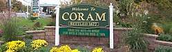 Welcome sign at the east corner of NY 25 and 112. | |
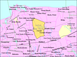 U.S. Census map | |
 Coram, New York Location within the state of New York | |
| Coordinates: 40°53′26″N 73°0′38″W | |
| Country | United States |
| State | New York |
| County | Suffolk |
| Area | |
| • Total | 13.8 sq mi (35.7 km2) |
| • Land | 13.8 sq mi (35.7 km2) |
| • Water | 0.0 sq mi (0.0 km2) |
| Elevation | 95 ft (29 m) |
| Population (2010) | |
| • Total | 39,113 |
| • Density | 2,800/sq mi (1,100/km2) |
| Time zone | UTC-5 (Eastern (EST)) |
| • Summer (DST) | UTC-4 (EDT) |
| ZIP code | 11727 |
| Area code(s) | 631 934 |
| FIPS code | 36-18157 |
| GNIS feature ID | 0947423 |
Coram is a community in the town of Brookhaven on Long Island and is served by the Longwood Central School District and the Middle Country Central School District.
History
Coram is the oldest settlement in the central part of the town of Brookhaven. Its early name was "Wincoram", perhaps the name of a Native American who lived in the area as late as 1703. The first European settler in the area was likely William Satterly, who sought permission to open a tavern to cater to travelers in 1677.[2]
During the American Revolutionary War, Benjamin Tallmadge's Culper Ring captured and burned 300 tons of British hay at what later became the corner of New York State Route 25 and New York State Route 112.[3]
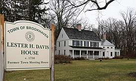
From 1784 to 1885, Coram served as the meeting place for the Town of Brookhaven government, using the Davis Town Meeting House for much of that period.[4] The Davis House, built in the 1750s, was placed on the National Register of Historic Places in 2001 and is the oldest existing structure in Coram.
A small airport existed in Coram until 1984.[5]
The area is served by SCPD 6th Pct. and the Coram Fire District.
Notable people
- George J. Hochbrueckner Former Congressman and resident of Coram while he was in office.[6]
Geography
The CDP has a total area of 13.8 square miles (36 km2), all land.[7]
Demographics for the CDP
| Historical population | |||
|---|---|---|---|
| Census | Pop. | %± | |
| 1980 | 24,752 | — | |
| 1990 | 30,111 | 21.7% | |
| 2000 | 34,923 | 16.0% | |
| 2010 | 39,113 | 12.0% | |
As of the 2000 census,[7] 34,923 people, 12,530 households, and 9,121 families resided in the CDP. The population density was 2,532.1 per square mile (977.8/km²). There were 12,880 housing units at an average density of 933.9/sq mi (360.6/km²). The racial makeup of the CDP was 89.5% White, 1.7% African American, 0.3% Native American, 3.1% Asian, 0.0% Pacific Islander, 3.1% from other races, and 2.3% from two or more races. Hispanic or Latino of any race were 9.5% of the population.
There were 12,530 households out of which 35.3% had children under the age of 18 living with them, 57.9% were married couples living together, 11.4% had a female householder with no husband present, and 27.2% were non-families. 21.3% of all households were made up of individuals and 6.1% had someone living alone who was 65 years of age or older. The average household size was 2.75 and the average family size was 3.22.
In the CDP, the population was spread out with 25.1% under the age of 18, 7.9% from 18 to 24, 33.5% from 25 to 44, 24.1% from 45 to 64, and 9.3% who were 65 years of age or older. The median age was 35 years. For every 100 females, there were 93.1 males. For every 100 females age 18 and over, there were 89.2 males.
The median income for a household in the CDP was $61,309, and the median income for a family was $70,769. Males had a median income of $46,905 versus $34,545 for females. The per capita income for the CDP was $24,597. About 4.1% of families and 5.6% of the population were below the poverty line, including 5.5% of those under age 18 and 7.2% of those age 65 or over.
Schools
- Longwood Central School District
- Middle Country Central School District
- Riverhead Charter School
References
- "Geographic Identifiers: 2010 Demographic Profile Data (G001): Coram CDP, New York". U.S. Census Bureau, American Factfinder. Archived from the original on 2020-02-12. Retrieved 2012-12-26.
- History of Coram Archived 2011-06-15 at the Wayback Machine, by Osborn Shaw, Brookhaven Town Historian (1947), Longwood's Journey website, Retrieved 2009-10-22
- Burning of the Hay (Longwood Public Library)
- The Lester Davis Home (Longwood Public Library) Archived 2009-06-03 at the Wayback Machine, Retrieved 2009-10-22
- Coram Airport Site (WikiMapia)
- Barone, Michael; Ujifusa, Grant (1987). The Almanac of American Politics 1988. National Journal. p. 797.
- "U.S. Census website". United States Census Bureau. Retrieved 2008-01-31.
External links
| Wikimedia Commons has media related to Coram, New York. |
- Coram's page at the Longwood School District website
| Authority control |
|
|---|