Henry Lawson Drive
The Henry Lawson Drive is a 20-kilometre (12 mi)[1] major urban sealed road, located in Sydney, New South Wales, Australia. The road's northwestern terminus is located at the Meccano Set in Villawood, with its southeastern terminus located at the road's junction with Forest Road, located in Peakhurst. The road is named in honour of Henry Lawson, one of Australia's foremost poets.
Henry Lawson Drive | |
|---|---|
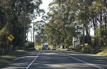 | |
Henry Lawson Drive at Georges Hall | |
| General information | |
| Type | Road |
| Length | 20 km (12 mi)[1] |
| Major junctions | |
| NW end |
|
| |
| SE end |
|
| Location(s) | |
| Major suburbs | Georges Hall, Milperra, East Hills, Padstow Heights |
It is designated as Main Road 508 for administrative purposes. In 1964, on its completion, it was signposted as part of ring road 5, replaced by state route 55 in 1974. The maximum elevation of the road is 60.9 metres (200 ft) AMSL and at its lowest point it is 1.65 metres (5 ft 5 in) AMSL.[2] Other than at its eastern end from Alfords Point Road to Forest Road it is constructed as a single two-lane carriageway. As of September 2015, the road had high congestion levels[3] and the City of Canterbury-Bankstown has been trying to overcome this.[4]
History
Henry Lawson Drive was conceived of as a scenic drive to follow the north bank of the Georges River. Most of it was constructed as an unemployment relief project during the 1930s, with some sections in Georges Hall, Milperra, East Hills and Picnic Point utilising pre-existing roads. In 1963, following the closure of the Morgans Creek landfill waste disposal site at the southern end of The River Road, Henry Lawson Drive was extended to Padstow Heights with the completion of the 53-metre-long (174 ft) bridge over Little Salt Pan Creek. In September 1964 the final section was completed with the opening of the 183-metre-long (600 ft) bridge over Salt Pan Creek, connecting the road via what had formerly been Hymen Street to Forest Road in Peakhurst. In 1975 the former T-junction with Forest Road at the eastern terminus was reconfigured so that the route from Henry Lawson Drive to Forest Road northbound became the through route. Widening of the section from Alfords Point Road to Forest Road occurred incrementally, initially by reconfiguring pavement markings and construction of a westbound overtaking lane. It was later widened to four lanes in places and then six lanes. This work was completed in conjunction with the duplication of the Salt Pan Creek Bridge.
See also
References
- Henry Lawson Dr, Villawood NSW 2163 to Henry Lawson Dr, Peakhurst NSW 2210 (Map). Google Maps. 2017. Retrieved 11 January 2017.
- "Map of Henry Lawson Drive, NSW". Bonzle Digital Atlas of Australia. Retrieved 11 January 2017.
- Beech, James (10 September 2015). "Demand for Henry Lawson Drive widening before major developments like Moorebank Intermodal increase congestion". Daily Telegraph. Australia. Retrieved 11 January 2017.
- "Calls to improve Henry Lawson Drive". Bankstown City Council. Archived from the original on 20 March 2011.