Quetame
Quetame is a municipality and town of Colombia in the Eastern Province, part of the department of Cundinamarca. The urban centre of Quetame is located at 62 kilometres (39 mi) from the capital Bogotá at an altitude of 1,496 metres (4,908 ft). The municipality borders Fómeque in the north, Fosca and Cáqueza in the west, the department of Meta in the east and in the south with Guayabetal.[1]
Quetame | |
|---|---|
Municipality and town | |
 Flag  Seal | |
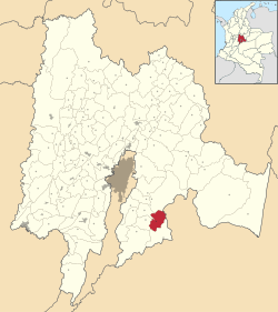 Location of the municipality and town inside Cundinamarca Department of Colombia | |
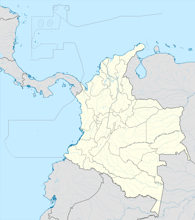 Quetame Location in Colombia | |
| Coordinates: 4°19′49″N 73°51′46″W | |
| Country | |
| Department | |
| Province | Eastern Province |
| Founded | 26 June 1826 |
| Founded by | Josè Joaquin Guarín |
| Government | |
| • Mayor | Wilder Enrique Moreno Hernández (2016-2019) |
| Area | |
| • Municipality and town | 138.47 km2 (53.46 sq mi) |
| • Urban | 0.29 km2 (0.11 sq mi) |
| Elevation | 1,496 m (4,908 ft) |
| Population (2015) | |
| • Municipality and town | 7,141 |
| • Density | 52/km2 (130/sq mi) |
| • Urban | 1,609 |
| Time zone | UTC-5 (Colombia Standard Time) |
| Website | Official website |
History
In the times before the Spanish conquest, Quetame was inhabited by the Muisca. Quetame was loyal to the cacique of Ubaque.[1]
Modern Quetame was founded on June 26, 1826 by Josè Joaquin Guarín.[1]
Economy
Main economical activity of Quetame is agriculture with products beans, sagú, maize, peas, arracacha and others.[1]
Earthquake
On May 24, 2008, there was a magnitude 5.5 earthquake with its epicentre in Quetame that caused at least 3 deaths and destroyed 40% of the buildings in the village. The tremor was also felt in Bogotá and Villavicencio.[2][3]
References
- (in Spanish) Official website Quetame
- USGS data earthquake 2008 Archived May 26, 2008, at the Wayback Machine
- (in Spanish) A 15 ascienden los muertos que dejó temblor del sábado en el centro del país Archived 2008-08-21 at the Wayback Machine - El Tiempo