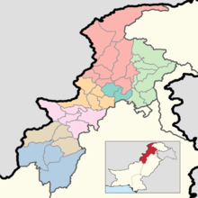
Districts of Khyber Pakhtunkhwa
The province of Khyber Pakhtunkhwa, the third-largest province of Pakistan by population and the smallest province by area, is divided into 35 districts and seven divisions. Below, you will find an overview of the recent history of districts in Khyber Pakhtunkhwa, a map showing each district, the divisions of Khyber Pakhtunkhwa and their districts, and a list showing each district's name, the division the district belongs to, the district's area, the location of the district's headquarters, the district's population and population density (in 2017), the average annual population growth rate of each district (between 1998 and 2017), and a map showing each district's location.
| Districts of Khyber Pakhtunkhwa | |
|---|---|
 | |
| Location | Khyber Pakhtunkhwa, Pakistan |
| Number | 35 (as of June 15, 2020) |
| Populations | 169,240 (Upper Chitral District) – 4,333,770 (Peshawar District) |
| Areas | 467 square kilometres (180 sq mi) (Torghar District) – 9,044 square kilometres (3,492 sq mi) (Dera Ismail Khan District) |
| Government | District Government City District Government Zilla Council |
| Subdivisions | Tehsils |
Recent History
During the 1998 Census of Pakistan, Khyber Pakhtunkhwa had 24 districts.[1] No changes occurred to this setup for over a decade, until 2011, when Kala Dhaka Tehsil was separated from Mansehra District to become Torghar District,[2] the 25th district of Khyber Pakhtunkhwa. These 25 districts (the 24 districts dating to 1998 and Torghar) were the only districts recorded as a part of Khyber Pakhtunkhwa during the 2017 Census.[3] Kohistan District was bifurcated into Upper Kohistan District and Lower Kohistan District in 2014,[4] but tensions on the bifurcation[5] did not resolve until 2017, when Kolai-Palas District was formed as well.[6] Chitral District, formerly the largest district in the province by area, was also bifurcated in 2018 into Upper Chitral District, from Mastuj Tehsil, and Lower Chitral District, from Chitral Tehsil.[7]
Current Map
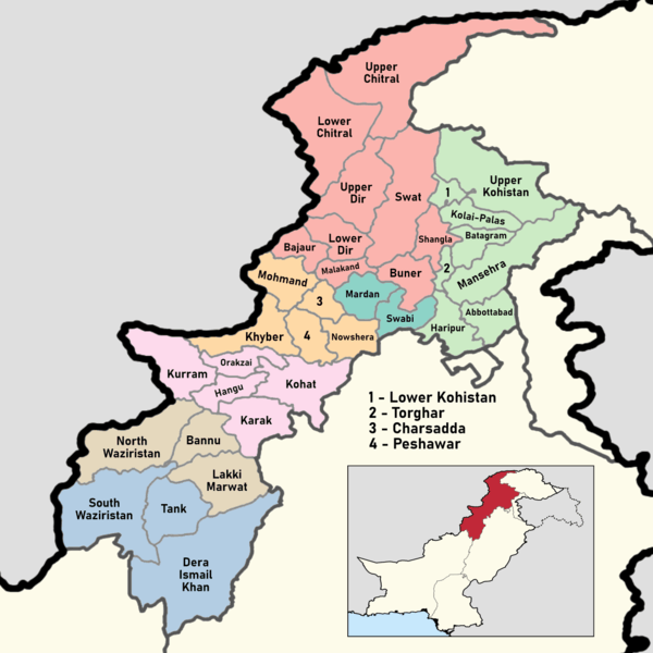
Divisions of Khyber Pakhtunkhwa and their districts
In Pakistan, the division is the administrative unit which is higher in hierarchy than a district, but lower in hierarchy than a province. There are seven divisions in Khyber Pakhtunkhwa, each of which have anywhere between two and nine districts. They are separated by color on the map above, and you can find a list of them below.
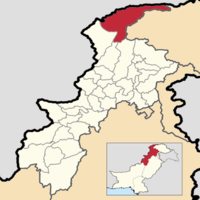
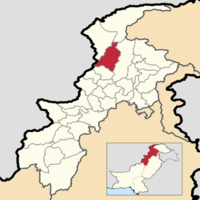
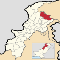
| Division [8] | Districts[8][9] | Population (2017)[8] | Land Area[10] | Population Density (2017) | Map |
|---|---|---|---|---|---|
| Bannu Division |
|
2,656,801 | 10,266 km2 (3,964 sq mi) | 258.80/km2 (670.3/sq mi) | 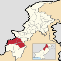 |
| Dera Ismail Khan Division |
|
2,798,027 | 18,096 km2 (6,987 sq mi) | 154.62/km2 (400.5/sq mi) | 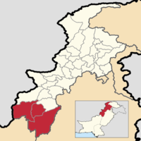 |
| Hazara Division |
|
5,325,121 | 17,448 km2 (6,737 sq mi) | 305.20/km2 (790.5/sq mi) |  |
| Kohat Division |
|
3,211,458 | 12,241 km2 (4,726 sq mi) | 262.35/km2 (679.5/sq mi) | 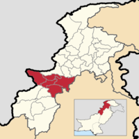 |
| Malakand Division |
|
8,608,378 | 30,897 km2 (11,929 sq mi) | 278.62/km2 (721.6/sq mi) | 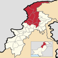 |
| Mardan Division | 3,997,677 | 3,120 km2 (1,200 sq mi) | 1,281.31/km2 (3,318.6/sq mi) | 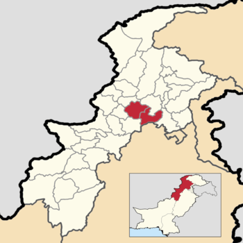 | |
| Peshawar Division | 8,922,465 | 9,255 km2 (3,573 sq mi) | 964.07/km2 (2,496.9/sq mi) | 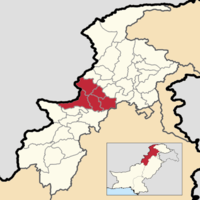 |
List of Districts
Below you will find a sortable list of all 35 districts in the province of Khyber Pakhtunkhwa, along with the division it belongs to, the area of the district, the population and population density of the district, the average annual population growth rate of each district (between 1998 and 2017), and a map showing its location. The districts are initially listed in alphabetical order.
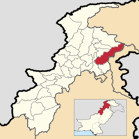
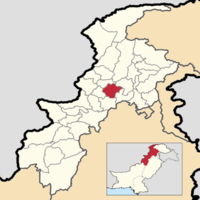
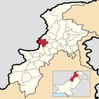
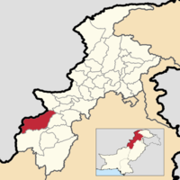
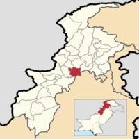
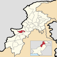
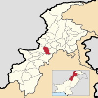
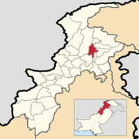
| Name | Division[8][9] | Population (2017)[8] | Area[10] | Population Density (2017) | Average Annual Population Growth Rate (1998 - 2017)[8][10] | Map |
|---|---|---|---|---|---|---|
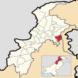
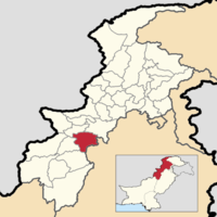
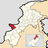
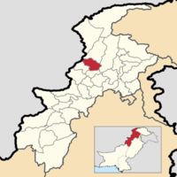
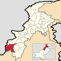
| Abbottabad District | Hazara Division | 1,332,912 | 1,756 km2 (678 sq mi) | 759.06/km2 (1,966.0/sq mi) | 2.20% |
 |
| Bajaur District | Malakand Division | 1,093,684 A | 1,359 km2 (525 sq mi) | 804.77/km2 (2,084.3/sq mi) | 3.25% |
 |
| Bannu District | Bannu Division | 1,211,006 B | 2,004 km2 (774 sq mi) | 604.29/km2 (1,565.1/sq mi) | 2.96% |
 |
| Batagram District | Hazara Division | 476,612 | 1,356 km2 (524 sq mi) | 351.48/km2 (910.3/sq mi) | 2.33% |
 |
| Buner District | Malakand Division | 897,319 | 1,735 km2 (670 sq mi) | 804.77/km2 (2,084.3/sq mi) | 3.05% |
 |
| Charsadda District | Peshawar Division | 1,616,198 | 991 km2 (383 sq mi) | 1,630.88/km2 (4,224.0/sq mi) | 2.43% |
 |
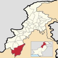
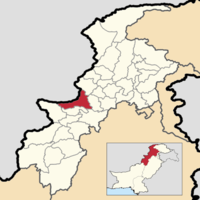
| Dera Ismail Khan District | Dera Ismail Khan Division | 1,695,688 C | 9,044 km2 (3,492 sq mi) | 187.49/km2 (485.6/sq mi) | 3.43% |
 |
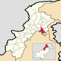
| Hangu District | Kohat Division | 518,798 | 1,380 km2 (530 sq mi) | 375.94/km2 (973.7/sq mi) | 2.66% |
 |
| Haripur District | Hazara Division | 1,003,031 | 1,927 km2 (744 sq mi) | 520.51/km2 (1,348.1/sq mi) | 1.97% |
 |
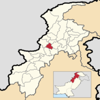
| Karak District | Kohat Division | 706,299 | 2,653 km2 (1,024 sq mi) | 266.23/km2 (689.5/sq mi) | 2.63% |
 |
| Khyber District | Peshawar Division | 986,973 D | 2,743 km2 (1,059 sq mi) | 359.82/km2 (931.9/sq mi) | 3.15% |
 |
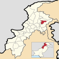
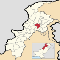
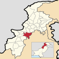
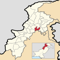
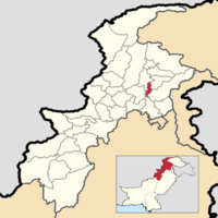
| Kohat District | Kohat Division | 1,112,452 E | 3,443 km2 (1,329 sq mi) | 323.11/km2 (836.9/sq mi) | 2.85% |
 |
| Kolai-Palas District | Hazara Division | 275,003 F | 1,410 km2 (540 sq mi) | 195.04/km2 (505.2/sq mi) | 2.71% |
 |
| Kurram District | Kohat Division | 448,310 G | 3,389 km2 (1,309 sq mi) | 132.28/km2 (342.6/sq mi) | 1.71% |
 |
| Lakki Marwat District | Bannu Division | 902,541 H | 3,368 km2 (1,300 sq mi) | 267.98/km2 (694.1/sq mi) | 3.18% |
 |
| Lower Chitral District | Malakand Division | 278,122 I | 5,910 km2 (2,280 sq mi) | 47.06/km2 (121.9/sq mi) | 2.17% |
 |
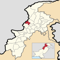
| Lower Dir District | Malakand Division | 1,435,917 | 1,758 km2 (679 sq mi) | 816.79/km2 (2,115.5/sq mi) | 3.71% |
 |
| Lower Kohistan District | Hazara Division | 202,913 J | 642 km2 (248 sq mi) | 316.06/km2 (818.6/sq mi) | 2.70% |
 |
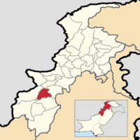
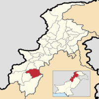
| Malakand District | Malakand Division | 720,295 | 948 km2 (366 sq mi) | 759.80/km2 (1,967.9/sq mi) | 2.47% |
 |
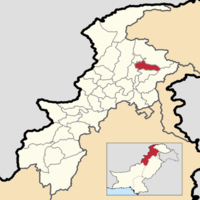
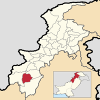
| Mansehra District | Hazara Division | 1,556,460 | 4,287 km2 (1,655 sq mi) | 363.07/km2 (940.3/sq mi) | 2.47% |
 |
| Mardan District | Mardan Division | 2,373,061 | 1,639 km2 (633 sq mi) | 1,447.87/km2 (3,750.0/sq mi) | 2.58% |
 |
| Mohmand District | Peshawar Division | 466,984 K | 2,258 km2 (872 sq mi) | 206.81/km2 (535.6/sq mi) | 1.77% |
 |
| North Waziristan District | Bannu Division | 543,254 L | 4,894 km2 (1,890 sq mi) | 111.00/km2 (287.5/sq mi) | 2.17% |
 |
| Nowshera District | Peshawar Division | 1,518,540 | 1,746 km2 (674 sq mi) | 869.73/km2 (2,252.6/sq mi) | 2.94% |
 |
| Orakzai District | Kohat Division | 254,356 M | 1,376 km2 (531 sq mi) | 184.85/km2 (478.8/sq mi) | 0.64% |
 |
| Peshawar District | Peshawar Division | 4,333,770 N | 1,517 km2 (586 sq mi) | 2,856.80/km2 (7,399.1/sq mi) | 3.93% |
 |
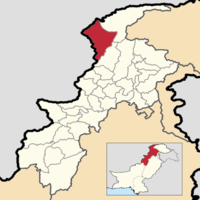
| Shangla District | Malakand Division | 757,810 | 1,389 km2 (536 sq mi) | 545.58/km2 (1,413.0/sq mi) | 2.96% |
 |
| South Waziristan District | Dera Ismail Khan Division | 674,065 O | 6,231 km2 (2,406 sq mi) | 108.18/km2 (280.2/sq mi) | 2.39% |
 |
| Swabi District | Mardan Division | 1,624,616 | 1,481 km2 (572 sq mi) | 1,096.97/km2 (2,841.1/sq mi) | 2.44% |
 |
| Swat District | Malakand Division | 2,309,570 | 5,367 km2 (2,072 sq mi) | 430.33/km2 (1,114.5/sq mi) | 3.24% |
 |
| Tank District | Dera Ismail Khan Division | 428,274 P | 2,821 km2 (1,089 sq mi) | 151.82/km2 (393.2/sq mi) | 2.54% |
 |
| Tor Ghar District | Hazara Division | 171,395 | 467 km2 (180 sq mi) | 367.01/km2 (950.6/sq mi) | -0.10% |
 |
| Upper Chitral District | Malakand Division | 169,240 Q | 8,845 km2 (3,415 sq mi) | 19.13/km2 (49.5/sq mi) | 1.24% |
 |
| Upper Dir District | Malakand Division | 946,421 | 3,586 km2 (1,385 sq mi) | 263.92/km2 (683.5/sq mi) | 2.64% |
 |
| Upper Kohistan District | Hazara Division | 306,337 R | 5,603 km2 (2,163 sq mi) | 54.67/km2 (141.6/sq mi) | 2.69% |
 |
See also
- Districts of Pakistan
- Districts of Punjab (Pakistan)
- Districts of Sindh
- Districts of Balochistan (Pakistan)
- Districts of Azad Kashmir
- Districts of Gilgit-Baltistan
- Divisions of Pakistan
| History | |
|---|---|
| Government | |
| Culture and places |
|
| Geography |
|
| Education & Health | |
| Sport |
|
| |
Notes
- A. ^ In 2017 Bajaur District was not a district of Khyber Pakhtunkhwa, but was an agency in FATA.
- B. ^ In 2017 Bannu District was split into both the "Frontier Region Bannu" (a part of FATA) and "Bannu District".
- C. ^ In 2017 Dera Ismail Khan District was split into both the "Frontier Region Dera Ismail Khan" (a part of FATA) and "Dera Ismail Khan District".
- D. ^ In 2017 Khyber District was not a district of Khyber Pakhtunkhwa, but was an agency in FATA.
- E. ^ In 2017 Kohat District was split into both the "Frontier Region Kohat" (a part of FATA) and "Kohat District".
- F. ^ In 2017 Kolai-Palas District was not a district, but a part of the erstwhile Kohistan District. Today it occupies the area the Palas Tehsil used to occupy.
- G. ^ In 2017 Kurram District was not a district of Khyber Pakhtunkhwa, but was an agency in FATA.
- H. ^ In 2017 Lakki Marwat District was split into both the "Frontier Region Lakki Marwat" (a part of FATA) and "Lakki Marwat District".
- I. ^ In 2017 Lower Chitral District was not a district, but a part of the erstwhile Chitral District. Today it occupies the area the Chitral Tehsil used to occupy.
- J. ^ In 2017 Lower Kohistan District was not a district, but a part of the erstwhile Kohistan District. Today it occupies the area the Pattan Tehsil used to occupy.
- K. ^ In 2017 Mohmand District was not a district of Khyber Pakhtunkhwa, but was an agency in FATA.
- L. ^ In 2017 North Waziristan District was not a district of Khyber Pakhtunkhwa, but was an agency in FATA.
- M. ^ In 2017 Orakzai District was not a district of Khyber Pakhtunkhwa, but was an agency in FATA.
- N. ^ In 2017 Peshawar District was split into both the "Frontier Region Peshawar" (a part of FATA) and "Peshawar District".
- O. ^ In 2017 South Waziristan District was not a district of Khyber Pakhtunkhwa, but was an agency in FATA.
- P. ^ In 2017 Tank District was split into both the "Frontier Region Tank" (a part of FATA) and "Tank District".
- Q. ^ In 2017 Upper Chitral District was not a district, but a part of the erstwhile Chitral District. Today it occupies the area the Mastuj Tehsil used to occupy.
- R. ^ In 2017 Upper Kohistan District was not a district, but a part of the erstwhile Kohistan District. Today it occupies the area the Dassu and Kandia Tehsils used to occupy.
References
- "Khyber Pakhtunkhwa". Khyber Pakhtunkhwa | Pakistan Bureau of Statistics. Pakistan Bureau of Statistics. Archived from the original on June 15, 2020. Retrieved 15 June 2020.
- "Tor Ghar: Kala Dhaka becomes 25th K-P District". Tor Ghar: Kala Dhaka becomes 25th K-P District - The Express Tribune. The Express Tribune. 28 January 2011. Archived from the original on 5 July 2017. Retrieved 15 June 2020.
- "TABLE - 1: PROVISIONAL PROVINCE WISE POPULATION BY SEX AND RURAL/URBAN CENSUS - 2017 PAKISTAN" (PDF). DISTRICT_WISE_CENSUS_RESULTS_CENSUS_2017.pdf. Pakistan Bureau of Statistics. Archived from the original (PDF) on June 15, 2020. Retrieved 15 June 2020.
- "Kohistan bifurcated in lower and upper districts". Kohistan bifurcated in lower and upper districts. The News International. 16 January 2014. Archived from the original on 15 June 2020. Retrieved 15 June 2020.
- Nisar Ahmad Khan (24 January 2017). "People of Pales to seek review of SC's Kohistan bifurcation verdict". People of Pales to seek review of SC’s Kohistan bifurcation verdict - Newspaper - DAWN.COM. Dawn. Archived from the original on 15 June 2020. Retrieved 15 June 2020.
- "Kolai-Palas notified as new district". Kolai-Palas notified as new district. The News International. 26 August 2017. Archived from the original on 15 June 2020. Retrieved 15 June 2020.
- "Chitral bifurcated into two districts". Chitral bifurcated into two districts - Chitral Today. Chitral Today. Retrieved 15 June 2020.
- "PROVINCE WISE PROVISIONAL RESULTS OF CENSUS - 2017" (PDF). PAKISTAN TEHSIL WISE FOR WEB CENSUS_2017.pdf. Pakistan Bureau of Statistics. Archived from the original (PDF) on 16 June 2020. Retrieved 16 June 2020.
- Health Department Government of Khyber Pakhtunkhwa (16 June 2020). "Khyber Pakhtunkhwa Corona Virus COVID19 Daily Update: 16 June 2020". Eaojo0wXQAIG4_k (471x680). Health Department Government of Khyber Pakhtunkhwa. Archived from the original on 16 June 2020. Retrieved 16 June 2020.
- "PAKISTAN: Tehsils and Talukas". Pakistan: Tehsils and Talukas (Districts and Subdistricts) - Population Statistics, Charts, and Map. citypopulation.de. 19 January 2018. Archived from the original on 16 June 2020. Retrieved 16 June 2020.