Copper Coast Highway
The Copper Coast Highway (route ![]()
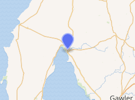
Copper Coast Highway | |
|---|---|
| |
 southeast end northwest end | |
| Coordinates |
|
| General information | |
| Type | Highway |
| Length | 58 km (36 mi)[1] |
| Route number(s) | |
| Major junctions | |
| southeast end | Augusta Highway (Port Wakefield) |
| |
| northwest end | Spencer Highway (Wallaroo) |
| Location(s) | |
| Major settlements | |
| Highway system | |
Improvements
In 2016, the state government proposed to restructure the intersection on the Copper Coast Highway at the north end of the Yorke Highway to provide a large roundabout instead of Yorke Highway terminating at a tee-junction.[2] The roundabout is intended to reduce delays at the end of holiday periods when lots of people try to drive back towards Adelaide at the same time, and will permit road trains to operate between Port Wakefield and Ardrossan which had previously not been permitted due to limitations of that intersection. Subsidiary works improved the Yorke Highway north of Ardrossan with a widened bridge, sealed shoulders and overtaking lanes.[3] Road trains up to 36.5 metres (120 ft) were previously permitted to operate on the Augusta Highway through Port Wakefield north towards Port Pirie and beyond, and from Ardrossan south to Port Giles, but were not permitted to operate north of Ardrossan to the Augusta Highway,[4] limiting the capacity to transport grain or minerals. Work commenced on the roundabout in October 2017 and it was completed in January 2018.[5]
A proposal by the Liberal Party of Australia before the 2018 state election was that if it was elected it would build a single lane overpass at the Augusta Highway end of the Copper Coast Highway to reduce traffic conflicts.[6] The party won the election and upgraded the planning to completely grade-separate the intersection.[7]
The contract for detailed design and construction of duplication of Port Wakefield Road through Port Wakefield and grade-separate the intersection with the Copper Coast Highway was let in March 2020 to the Port Wakefield to Port Augusta Alliance, a consortium of CPB Contractors, Aurecon and GHD Group. This consortium is also responsible for the duplication of Joy Baluch AM Bridge in Port Augusta. Both projects are expected to be completed in 2022.[8]
Major intersections and towns
| LGA | Location[9] | km[1] | mi | Destinations | Notes |
|---|---|---|---|---|---|
| Wakefield | 2km north of Port Wakefield | 0 | 0.0 | ||
| 6 | 3.7 | Road-train capable roundabout | |||
| Barunga West | Kulpara | 17 | 11 | Upper Yorke Road – southwest to Maitland, north to Bute | |
| Copper Coast | Paskeville | 30 | 19 | ||
| 34 | 21 | northeast to Lochiel | |||
| 35 | 22 | west to Moonta | |||
| Kadina | 49 | 30 |
| ||
| Wallaroo | 58 | 36 | Spencer Highway – northeast to Port Broughton, south to Moonta |
References
- Google (15 September 2014). "Copper Coast highway" (Map). Google Maps. Google. Retrieved 15 September 2014.
- Copper Coast Highway Intersection with Yorke Highway - for illustrative purposes only (PDF) (Map). Government of South Australia. August 2016. Retrieved 24 August 2016.
- Peter Malinauskas (10 August 2016). "New roundabout to help ease holiday traffic on Yorke Peninsula". News release - Peter Malinauskas (Press release). Government of South Australia.
- RAVNet (Map). Government of South Australia. Retrieved 24 August 2016.
- Mayfield, Greg (9 January 2018). "Traffic fix sends mayors round the twist". The Northern Argus. Retrieved 27 March 2018.
- "Cutting out crash corner at Port Wakefield". Liberal Party of Australia (South Australian Division). 29 January 2018. Retrieved 27 March 2018.
- "Port Wakefield Overpass and Highway Duplication". Department of Planning, Transport and Infrastructure. Retrieved 9 May 2020.
- McCormack, Michael (1 March 2020). "PORT WAKEFIELD AND JOY BALUCH UPGRADES ARE SIGNED, SEALED AND SOON TO BE DELIVERED" (PDF) (Press release). Retrieved 9 May 2020 – via Department of Planning, Transport and Infrastructure.
- "Naming of State Rural Roads - Mid North" (PDF). Government of South Australia. 16 December 2013. Retrieved 15 September 2014.
Road infrastructure in South Australia | ||
|---|---|---|
| Freeways |
| |
| Interstate highways | ||
| State highways | ||
| Arterial roads |
| |
| Outback tracks | ||