District Council of Barunga West
The Barunga West Council is a local government area in the Yorke and Mid North region of South Australia.[3] The council seat is at Port Broughton, with a sub-office at Bute.[6]
| Barunga West Council South Australia | |||||||||||||||
|---|---|---|---|---|---|---|---|---|---|---|---|---|---|---|---|
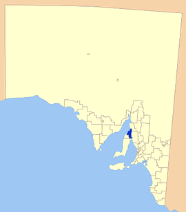 Location of the Barunga West Council | |||||||||||||||
| Population | 2,544 (2016 census)[1] | ||||||||||||||
| • Density | 1.6649/km2 (4.3121/sq mi) | ||||||||||||||
| Area | 1,528 km2 (590.0 sq mi) | ||||||||||||||
| Mayor | Leonie Kerley [2] | ||||||||||||||
| Council seat | Port Broughton | ||||||||||||||
| Region | Yorke and Mid North[3] | ||||||||||||||
| State electorate(s) | Frome[4] Goyder[5] | ||||||||||||||
| Federal Division(s) | Grey | ||||||||||||||
| Website | Barunga West Council | ||||||||||||||
| |||||||||||||||
Description
The council takes its name from the Barunga Range in the eastern part of the council area.[7] The council covers an area in the Mid North and bordering the top of the Yorke Peninsula which includes the towns and localities of Alford, Bute, Clements Gap, Fisherman Bay, Kulpara, Melton, Ninnes, Port Broughton, Thomas Plain and Ward Hill, and parts of Mundoora, Paskeville, South Hummocks, Tickera and Willamulka.[8] The main industries are tourism and growing grain.
History
It was formed in 1997 from the amalgamation of the District Council of Bute and the District Council of Port Broughton.[9] The council boundaries closely follow the boundaries of the six cadastral hundreds of the County of Daly which formed the original local governing bodies in the area in the late 1800s, namely the hundreds of Mundoora and Wokurna (District Council of Mundoora), and the hundreds of Ninnes, Wiltunga, Tickera and Kulpara (District Council of Ninnes).
Councillors
| Ward | Councillor | Notes | |
|---|---|---|---|
| Unsubdivided [2] | |||
| Leonie Kerley | Mayor | ||
| Grant Rowlands | |||
| Dave Eason | |||
| Peter Button | Deputy Mayor | ||
| Rob Locke | |||
| Rebecca Hewett | |||
| Margaret McDonald | |||
| Georgie Simmons | |||
| Brian Lockyer | |||
Mayors
- unknown (1997-????)
- Dean Dolling (2011-2013?)
- Cynthia Axford (2014–2018)
References
- Australian Bureau of Statistics (27 June 2017). "Barunga West (DC)". 2016 Census QuickStats. Retrieved 10 April 2018.

- "Elected Members". Retrieved 31 March 2016.
- "Yorke and Mid North SA Government region" (PDF). The Government of South Australia. Retrieved 10 October 2014.
- "District of Frome Background Profile". ELECTORAL COMMISSION SA. Retrieved 3 November 2014.
- "District of Goyder Background Profile". ELECTORAL COMMISSION SA. Retrieved 3 November 2014.
- "Council". District Council of Barunga West. Retrieved 31 March 2016.
- "Explanatory Statement and Analysis" (PDF). District Council of Barunga West. Retrieved 31 March 2016.
- "Location SA Map Viewer". Government of South Australia. Retrieved 31 March 2016.
- "Mid North locals honoured". The Flinders News. 26 January 2016. Retrieved 31 March 2016.
External links
| Major Townships | |||||||
|---|---|---|---|---|---|---|---|
| Minor Townships | |||||||
| Governance |
| ||||||
| Coastal features | |||||||
| Protected areas |
| ||||||
| Adjacent islands | |||||||
| Related and uncategorised | |||||||
| |||||||