Bulanık
Bulanık, formerly Gop or Kop (Armenian: Կոփ, Kurdish: Kop[3]), is a town and district of Muş Province in the Eastern Anatolia region of Turkey.
Bulanık | |
|---|---|
 Bulanık | |
| Coordinates: 39°5′42″N 42°16′0″E | |
| Country | |
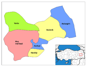
| Province | Muş |
| Government | |
| • Mayor | Adnan Topçu (HDP) |
| • District Governor | Mehmet İidi |
| Area | |
| • District | 1,688.51 km2 (651.94 sq mi) |
| Elevation | 1,480 m (4,860 ft) |
| Population (2012)[2] | |
| • Urban | 24,354 |
| • District | 85,114 |
| • District density | 50/km2 (130/sq mi) |
| Post code | 49500 |
| Website | www.bulanik.bel.tr |
History
In the 19th century Bulanık was the name of the kaza. Its capital, today's Bulanık town, was called Gop, also rendered as Kop. At the end of the 19th century Gop was described as a large village with about 400 houses, all but 50 of them inhabited by Armenians. Although the soil was amongst the most fertile in the region, the inhabitants were almost destitute due to the region's insecurity and the impossibility of exporting their crops. Two miles south of the village was an Armenian monastery named Surb Daniel which contained the relics of a saint of that name.[4]
The district was formerly called Hark' and was part of Historical Armenia's Turuberan province. The earliest record of Kop is found in the 995 encyclical from Vandir monastery under the name Koghb, which was later distorted.
Bulanık means "blurred" in Turkish which is a cite for Murat River.
After the Battle of Manzikert in 1071, Turkmen tribes (such as Bayat, Eymür and Bayındır) settled in Bulanık. Today, Kurds are the majority. Before the Armenian genocide, there was an Armenian majority, which was later replaced by Turks (in addition to local Turkmens, Bulanık took a lot of Turkic emigrants such as Meskhetians and Qarapapaq Turks. These Muhacirs' first came with the Russo-Turkish War and continued to come during the Republic era).
The town's current mayor is Adnan Topçu of the Peoples' Democratic Party (HDP).[5] Mehmet İlidi was appointed as the current district governor.[6]
References
- "Area of regions (including lakes), km²". Regional Statistics Database. Turkish Statistical Institute. 2002. Retrieved 2013-03-05.
- "Population of province/district centers and towns/villages by districts - 2012". Address Based Population Registration System (ABPRS) Database. Turkish Statistical Institute. Retrieved 2013-02-27.
- Adem Avcıkıran (2009). Kürtçe Anamnez Anamneza bi Kurmancî (PDF) (in Turkish and Kurdish). p. 56. Retrieved 17 December 2019.
- Lynch, H.F.B., "Armenia: Travels and Studies. Volume II: The Turkish Provinces", pp. 344–345, London, 1901.
- Şafak, Yeni (2019-11-23). "Muş Bulanık Seçim Sonuçları – Bulanık Yerel Seçim Sonuçları". Yeni Şafak (in Turkish). Retrieved 2019-11-23.
- "Mehmet İLİDİ Kaymakam". www.bulanik.gov.tr. Retrieved 2019-11-23.
- Prothero, W.G. (1920). Armenia and Kurdistan. London: H.M. Stationery Office. p. 60.
- Prothero, W.G. (1920). Armenia and Kurdistan. London: H.M. Stationery Office. p. 74.