Barrington, Quebec
Barrington is a hamlet in the Township of Hemmingford, located at the junction of Rte 219 and Fisher Road. It was previously called Johnson's Corners. Barrington was Mr. Johnson's middle name.[4]
Barrington | |
|---|---|
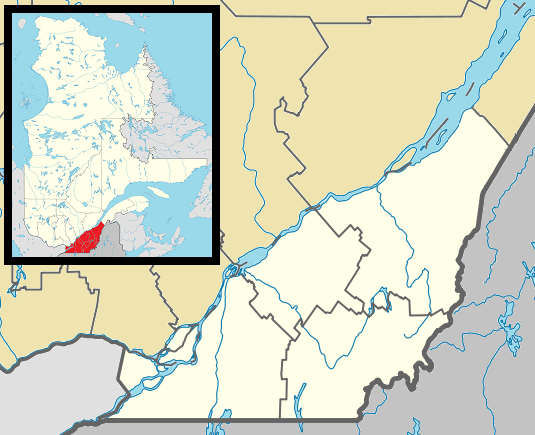 Barrington Location in southern Quebec. | |
| Coordinates: 45°6′39.599″N 73°34′22.799″W[1] | |
| Country | |
| Province | |
| Region | Montérégie |
| RCM | Les Jardins-de-Napierville |
| Constituted | July 1, 1855 |
| Government | |
| • Mayor | Paul Viau |
| • Federal riding | Beauharnois—Salaberry |
| • Prov. riding | Huntingdon |
| Time zone | UTC−5 (EST) |
| • Summer (DST) | UTC−4 (EDT) |
| Postal code(s) | J0L 1H0 |
| Area code(s) | 450 and 579 |
| Highways | |
| Website | www |
The Barrington Post Office operated from a store at Barrington from 1861 until 1969. It was previously called Johnson's Corners Post Office.
A railway station used to be located about 1 km (0.6 mi)(45.121N/73.573W) north of Barrington at the junction of the Canada Atlantic Railway line to Cantic and the Grand Trunk Railway line to Hemmingford (both now abandoned).[4] On current Google Maps the same spot is called 'The Crutch' - meaning unknown. Barrington Station was also known as Johnson's Station. A recreation of the station with original sign is located at Canadian Railway Museum in Delson, Quebec.[5]
Canada Atlantic - Ottawa to Vermont | |||||||||||||||||||||||||||||||||||||||||||||||||||||||||||||||||||||||||||||||||||||||||||||||||||||||||||||||||||||||||||||||||||||||||||||||||||||||||||||||||||||||||||||||||||||||||||||||||||||||||||||||||||||||||||||||||||||||||||||||||||||||||||||||||||||||||||||||||||||||||||||||
|---|---|---|---|---|---|---|---|---|---|---|---|---|---|---|---|---|---|---|---|---|---|---|---|---|---|---|---|---|---|---|---|---|---|---|---|---|---|---|---|---|---|---|---|---|---|---|---|---|---|---|---|---|---|---|---|---|---|---|---|---|---|---|---|---|---|---|---|---|---|---|---|---|---|---|---|---|---|---|---|---|---|---|---|---|---|---|---|---|---|---|---|---|---|---|---|---|---|---|---|---|---|---|---|---|---|---|---|---|---|---|---|---|---|---|---|---|---|---|---|---|---|---|---|---|---|---|---|---|---|---|---|---|---|---|---|---|---|---|---|---|---|---|---|---|---|---|---|---|---|---|---|---|---|---|---|---|---|---|---|---|---|---|---|---|---|---|---|---|---|---|---|---|---|---|---|---|---|---|---|---|---|---|---|---|---|---|---|---|---|---|---|---|---|---|---|---|---|---|---|---|---|---|---|---|---|---|---|---|---|---|---|---|---|---|---|---|---|---|---|---|---|---|---|---|---|---|---|---|---|---|---|---|---|---|---|---|---|---|---|---|---|---|---|---|---|---|---|---|---|---|---|---|---|---|---|---|---|---|---|---|---|---|---|---|---|---|---|---|---|---|---|---|---|---|---|---|---|---|---|---|---|---|---|---|---|---|---|
| |||||||||||||||||||||||||||||||||||||||||||||||||||||||||||||||||||||||||||||||||||||||||||||||||||||||||||||||||||||||||||||||||||||||||||||||||||||||||||||||||||||||||||||||||||||||||||||||||||||||||||||||||||||||||||||||||||||||||||||||||||||||||||||||||||||||||||||||||||||||||||||||
| (* - miles from Depot Harbour) | |||||||||||||||||||||||||||||||||||||||||||||||||||||||||||||||||||||||||||||||||||||||||||||||||||||||||||||||||||||||||||||||||||||||||||||||||||||||||||||||||||||||||||||||||||||||||||||||||||||||||||||||||||||||||||||||||||||||||||||||||||||||||||||||||||||||||||||||||||||||||||||||
References
- Reference number 28436 of the Commission de toponymie du Québec (in French)
- "Ministère des Affaires municipales, des Régions et de l'Occupation du territoire: Hemmingford (township)". Archived from the original on 2014-11-29. Retrieved 2014-11-18.
- Riding history for Beauharnois—Salaberry, Quebec from the Library of Parliament
- http://www.rootsweb.ancestry.com/~qchuntin/location/b.htm
- https://www.google.com/search?q=barrington+station+exporail&source=lnms&tbm=isch&sa=X&ei=b7pqVImzCoHesASev4HAAQ&ved=0CAoQ_AUoAw&biw=1280&bih=896
Adjacent Municipal Subdivisions | ||||||||||
|---|---|---|---|---|---|---|---|---|---|---|
| ||||||||||
| Cities | |
|---|---|
| Municipalities | |
| Parishes | |
| Townships | |
| Villages | |
| |